Monitoring and managing regional water quality
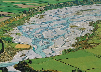
The quality of New Zealand’s fresh water and concerns about the impact of changing land use on water are increasingly at the forefront of New Zealanders’ thinking.
Regional councils are responsible for managing the cumulative effects of land use on water quality. In a collaborative project with Environment Canterbury, Landcare Research staff have developed more effective mechanisms for managing land use (and associated nitrate leaching) to meet water quality limits for the region.
We’ve been doing this work at farm, catchment and regional scales.
At the farm-scale, in a simulation study, we showed that current methods and technology for measuring leachate under grazed pasture are inadequate. Impractical numbers of measuring devices are needed to gain an accurate estimate of average leaching from a field and this is critically important given these data are used by researchers to develop and evaluate farm-scale leaching models. Also, some regional councils are hoping to ensure compliance with nutrient discharge limits through such measurements.
Meanwhile, the spatial model AquiferSim (developed with Lincoln Ventures) assesses the impact of potential land intensification options on water quality in aquifers and spring-fed streams and takes only minutes rather than weeks as with more complex models. It can be used where there is limited geo-hydrological data (good information is only available for a few aquifers in New Zealand).
Researcher Linda Lilburne says AquiferSim was tested in the Central Canterbury Plains (where good data are plentiful) and in the Hurunui River area (where data are few). The modelling work contributed to Environment Canterbury’s Land Use and Water Quality Project, a collaborative process with stakeholders that resulted in the Hurunui and Waiau River Regional Plan. We are now working with Environment Southland to apply AquiferSim to the mid-Mataura River basin.
Our new spatial model of contamination risk at the regional scale draws on data in S-map and relevant research on contaminant pathways. This helps land managers determine where mitigation practices are needed, and enables regional councils to apply more appropriate consenting rules for effluent disposal and septic tank discharge fields.
We used an updated regional nitrate-leaching map to provide statistics on the impact of nitrate thresholds being considered for the draft Canterbury Land and Water Regional Plan. We also developed a new method for allocating a catchment-scale nutrient limit between farms. This focuses on more intensive mitigation practices for land where there is a nitrate contamination problem, i.e. intensive land use on leaky soils in catchments known to have poor water quality.