Assessing economic, environmental, and social vulnerability in regional New Zealand
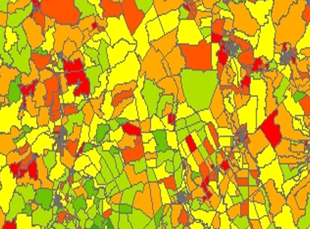
Environmental issues and policies are often treated in isolation from local economic and social factors, which can influence a community’s ability to respond to environmental stressors and natural hazards. The new Economic Social Vulnerability Index (ESVI) is a spatially explicit tool for representing economic and social vulnerability in a straightforward index, designed to be relevant for environmental considerations.
The Economic and Social Vulnerability Index (ESVI) measures economic and social vulnerability, with an emphasis on environmental factors. It is spatially explicit at the meshblock level and can be estimated using either national or region-specific data.
The issue: Spatially heterogeneous environmental problems are often approached without considering spatially explicit economic and social vulnerabilities. For instance, a policy might improve overall air quality while the most vulnerable populations remain near emissions sources. Linking economic, social, and environmental considerations at a useful scale across the landscape is a challenge for policy and operational decision-making.

The tool: The ESVI is designed to complement tools already used by regional councils, such as the NZ Deprivation Index. It draws on international models such as the Social Vulnerability Index (USA), which is largely used to explore interactions between social vulnerability and natural disasters. The construction of the ESVI begins with a large set of economic and social variables that can indicate vulnerability. Our analysis draws on publicly available data from the New Zealand Census (2013). As the analysis is concerned with comparative vulnerability, the full set of national meshblocks is used to calibrate the analysis for the main ESVI. However, it is also possible to estimate a region-specific ESVI, so that vulnerability is measured against other areas in the region instead of nationally. The construction of the index also allows the user to identify the source of vulnerability, highlighting the most relevant Census variables.
There are 32 Census variables used to construct the index. Those variables were selected due to theoretical considerations, past literature, their importance in local economies, and their relevance for environmental factors. For instance, we include indicators of several age groups that are more vulnerable to environmental contaminants and pollutants, such as the percent of the meshblock under 4 years of age, those from 5 to 9 years old, and those 65 years and older. We also add additional indicators of environmental vulnerability, such as home-heating types.
The value of the ESVI is its ability to detect local variation in important factors related to vulnerability. The index has been compared to other New Zealand-based composite indices and is a useful complement. As the ESVI draws on existing data, it can be deployed quickly and cost-effectively. Contact Patrick Walsh for more information or to explore how the ESVI could be applied in your region or district.
