Technique
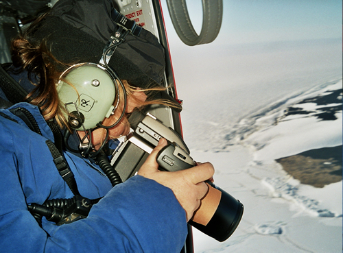
Adélie penguin colony being photographed from a helicopter. Image - Phil Lyver
Adélie colonies are photographed from the air, the images processed and the number of birds nesting at each colony counted from the images.
Colonies on Ross Island are photographed from helicopter flying at >2500' agl to prevent disturbing the birds. The colonies along the Victoria Land coastline are photographed through the open paratroop doors of a C-130 Hercules (flying at approximately 2000' agl).
The protocols used for the aerial photography and counting have been adopted by CCAMLR as a standard method (CCAMLR Standard Method A3B).
Due to logistic constraints it is not possible to photograph all colonies in the Ross Sea region each year. Ross Island colonies are photographed each year and indicator colonies along the Victoria Land coast, selected because of their size, topography and locality, are photographed every 2–3 years to maintain a continuous database.
Timing
The aerial census is carried out in late November or early December to coincide with the incubation phase of breeding. At this stage in the cycle, one bird is incubating while its mate is at sea feeding. As there are few non-incubating birds ashore, an accurate count of breeding birds can be obtained.
For more information:
Taylor RH, Wilson PR, Thomas BW 1990. Status and trends of Adelie penguin populations in the Ross Sea region. Polar Record 26(159): 293–304.