Rangitāiki catchment
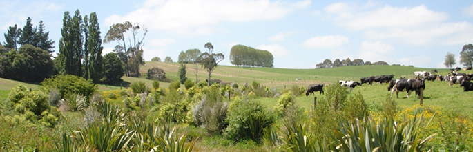
The Rangitāiki catchment (in the Bay of Plenty, New Zealand) has a variety of landscapes and uses, from spectacular Whirinaki Forest, to Kaingaroa pine plantations, to dairy farming on the Galatea Plains, to the hydropower stations along the Rangitāiki River to the reclaimed Rangitāiki Plain. These landscapes are connected, and the relationships between them are complex. Because of the interconnected nature of the landscapes, the decisions people make about their land often have unforeseen impacts both within and beyond their property boundaries.
Rangitāiki Landscape Scenarios Participatory Process
In the Rangitāiki catchment we are piloting the BEST assessment framework. For this participatory process, we have invited a small group of local people (who have an interest in and/or make decisions about how land is being managed in the catchment) to explore future options for the landscapes of the Rangitāiki catchment. This process recognises people within the local community are best positioned to make robust, practical, and enduring decisions about the future of the landscapes in which they live. It also recognises the work of the Rangitāiki River Forum, which, through a co-governance process, has developed the Pathways of the Rangitāiki plan.
We have developed a seven-workshop process as part of the BEST assessment framework being piloted in the Rangitāiki catchment:
- Introduction: Share knowledge and build a common understanding in the group around the Rangitāiki catchment resources and the ecosystem services approach
- Field Trip: Further extend collective knowledge and understanding of the catchment and the ecosystem services it provides
- Prioritise: Identify the local natural resources, current uses and associated services critical for delivery of the groups objectives
- Future Scenarios: Identify future drivers, translate these drivers into possible alternative future land use and management scenarios for the catchment
- Future forecast: Discuss scenario findings based on modelling
- Future forecast continued: Discuss scenario findings based on modelling
- Strategize: Identify decisions/options/strategies for future actions
This seven-meeting process has involved:
- asking members of the working group to consider the Rangitāiki landscape in terms of what benefits the different areas of the catchment provide for them, e.g. recreational opportunities, agricultural production, stable land, as well as how it influences their sense of identity and feeling of being home. This information is used to identify which ecosystem services are of greatest relevance in the catchment and to stimulate thinking about how land-use and land-management choices may affect what the catchment provides
- creating landscape modelling scenarios to determine how different land use/covers impact the flow of ecosystem services for the Rangitāiki catchment. These scenarios will be defined by the working group and assessed using the ARLUNZ model.