Use of soil databases in hydrological modelling
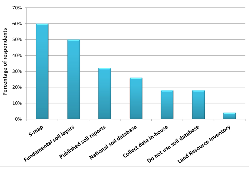
S-map and the Fundamental Soil Layers are the most widely used soil databases (Figure 11).
These databases are used by 60% of participants, while 32% obtain their soil data from published reports, and only a small percentage of users collect their data on-site. Eighteen percent of participants do not use soil information in their hydrological models.
These results highlight the need to:
- determine how S-map data can be made more useful;
- investigate if data collected in-house by other parties can be incorporated into S-map.
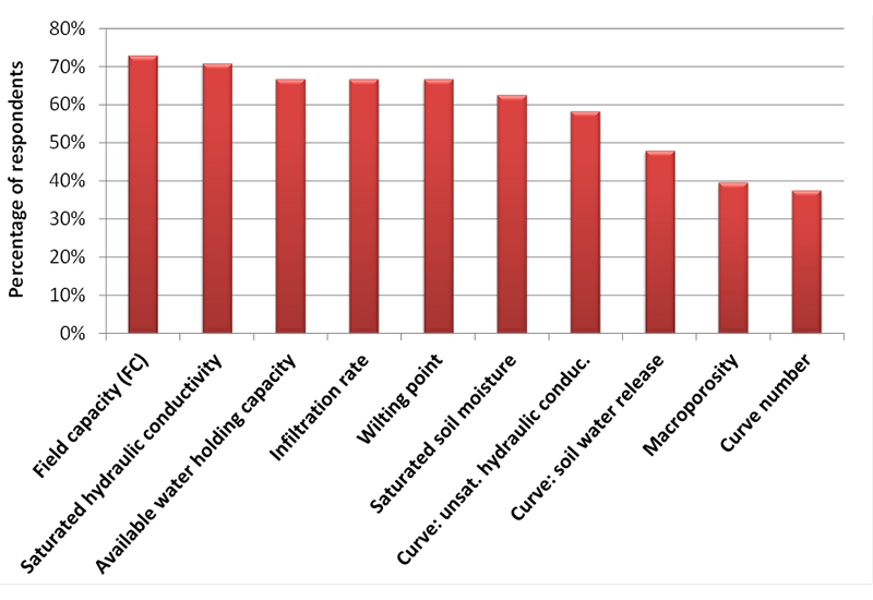
Participants are interested in being provided with all the major hydrological parameters, especially field capacity and saturated hydraulic conductivity (Figure 12), although macroporosity (preferential flow) was not identified as an important parameter. This may be due to the difficulties in obtaining measurements of macroporosity. Nevertheless, macroporosity is an important parameter necessary to accurately compute drainage and nitrate leaching, especially in stony soils. Participants were least interested in the curve number method, since it is understood that 2D fully spatial hydrological models can provide them with more accurate partitioning between infiltration and runoff.
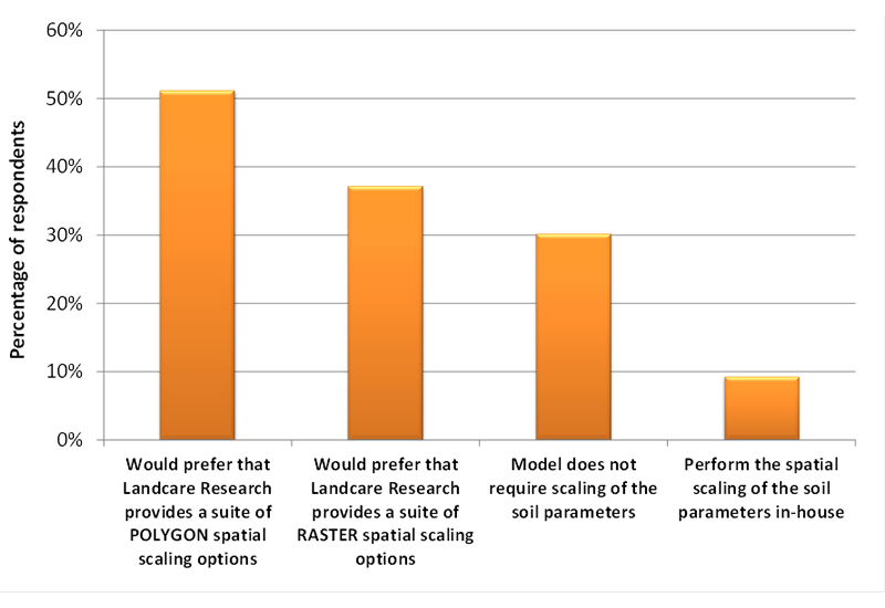
Soils information is useful for hydrological models only if effective soil parameters can be derived at the scale of interest. Scaling soil parameters is a difficult task requiring a good understanding of soil morphology. Figure 13 shows that only 10% of participants perform spatial scaling in-house and there is a large demand (50%) for effective parameters at the scale of interest in the format of POLYGON and secondly as RASTER.

Figure 11 . Soil databases currently used in hydrological modelling (multiple choices accepted).
Figure 12 . Demand for soil parameters derived from soil databases (multiple choices accepted).
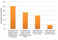
Figure 13 . Methods of performing spatial scaling of soil parameters (multiple choices accepted).