Soil Quality - Delivery and Visualisation
Using a number of extant data sources, IDA created a well-documented, nationally meaningful soil quality dataset of clear provenance. We undertook a major data validation exercise manually checking each data entry, cross-checking with lab sheet information, and dealing with legacy data collection and management issues such as inconsistent coding of properties across records. These data were added to Manaaki Whenua's National Soil Data Repository (NSDR). However, because of data privacy and ownership issues we are unable to make most of these data publicly available.
IDA staff led an Open Geospatial Consortium (OGC) interoperabilty experiment, the Soil Data Interoperability Experiment (SoilIE) researching the development and testing of a global Soil Markup Language by which data can be shared between soil information systems. This was achieved by harmonizing and advancing existing standards initiatives such as ISO28258 SoilML, the EU-INSPIRE soil data specification, eSoterML, ANZSoilML, and others. The SoilIE set the stage for an OGC candidate soil data model and encoding standard. A soil-encoding standard is required for the exchange of soil feature data, including data about soil bodies, profiles, horizons, and related entities. A standard is also required as a reference for soil observations, as these features typically host the properties that are observed. This work impacted on the work of Pillar 4 (Global Soil Information System) and Pillar 5 (Harmonization) of the FAO Global Soil Partnership.

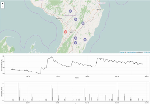
Demonstration of provision of soil sensor data as TimeSeriesML - from OGC SoilIE
As part of the work done to develop a proof of concept, a multi-indicator environmental data infrastructure, a Soil Quality Assessment Tool, was implemented using R Shiny technology to provide information on soil health in New Zealand. Using OGC standards, this tool sources data from different web services, providing useful examples of how to utilize geospatial data and eventually turn these retrieved data into knowledge that matters to the user.
