Learn about New Zealand’s Environments – new online mapping web site
Following on from the successful launch earlier this year of the S–Map Online web mapping web site, researchers from Landcare Research have today unveiled a new and free online mapping tool which will make it easier for businesses, government, researchers and the public to better understand the natural environments that underpin New Zealand’s economy and society.
Wednesday 07 Dec 2011
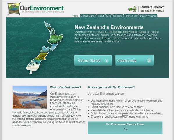
OurEnvironment screenshot
Following on from the successful launch earlier this year of the S–Map Online web mapping web site, researchers from Landcare Research have today unveiled a new and free online mapping tool which will make it easier for businesses, government, researchers and the public to better understand the natural environments that underpin New Zealand’s economy and society.
Nnatural environments that underpin New Zealand’s economy and society.
Our Environment (http://ourenvironment.scinfo.org.nz) is a new web mapping tool which provides easy access to information on New Zealand’s land environments and land resources. Based on “Google Maps” style navigation the mapping tool makes it easy to search, view and query environmental information. Using Our Environment users can
- Use interactive maps to learn about their local environment and regional variations.
- Select particular data themes such as vegetation, land suitability or surface rock type to view as maps.
- View detailed information from a particular data theme.
- Obtain further details about a particular theme (metadata).
- Create high quality, custom PDF maps for printing.
Our Environment uses data from nationally significant databases such as the Land Resource Inventory System (LRIS), the Land Cover Database (LCDB) and other national datasets and is designed to support applications at local, regional and national scales. Further data themes and features will be added as time goes by.
Landcare Research’s Informatics Team Manager David Medyckyj-Scott says there are plans to further develop Our Environment in the next 12 months.
“One example is a facility that combines different data to provide an environmental summary of an area; an environmental data mash-up! We want users to be able to use Our Environment to expand their environmental knowledge about specific locations within New Zealand”.
Our Environment has been designed to compliment S-map Online (http://smap.landcareresearch.co.nz) which provides easy access to information on the soils and is aimed at the more specialist user. Our Environment has a more thematic-question based focus and has been designed to be usable by non-specialists, although experts should find it of value too.
Alison Collins, Director of the soon to be established ‘National Land Resource Centre’ says Our Environment is an exciting application developed in response to an overwhelming demand for information about the world around us.
“Our Environment will be one of a suite of information resources and tools that will be incorporated within the National Land Resource Centre, due to be launched next year to enable businesses, government, researchers and the public to understand and therefore effectively use and enhance New Zealand’s land resources”.
Our Environment is built using a new geospatial-portal-software platform for visualising geospatial data and for querying datasets. Designed and written by the Informatics team at Landcare Research and based on open standards and open source software, the platform will be used to roll out other web applications with rich data visualisations capabilities over the next few years.