Land Resources
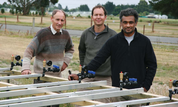
Researchers Trevor Webb, Sam Carrick and Jagath Ekanayake - the team behind channel lysimeters.
Outcome: Sustainable use of land resources and their ecosystem services across catchments and sectors
The fate of nutrients in soils
We have three complementary projects focused on understanding the fate of nutrients in the soil. Understanding and quantifying of leachates are essential to managing runoff and reducing the nutrients reaching groundwater, waterways and lakes.
We have some appreciation of how different soils transmit the microbial load in dairy shed effluent applied to the soil’s surface. Landcare Research produced a general map for all of New Zealand showing where soils are either ‘leaky’ to or retain microbes within their structure, but this map revealed a lack of knowledge about what happens in stony soils, many of which are being converted to dairying.
Standard lysimeters to measure the fate of effluent on stony soils
Standard lysimeters – hand-carved cores of undisturbed soil in purpose-built barrels – have been collected from the Mackenzie Basin. In the laboratory, these have been irrigated with dairy effluent and artificial rainfall, and the leachate analysed for bacterial indicators.
Large scale in situ lysimeter array near Lake Taupo
This is a more direct approach quantifying the impacts of land-use practices and amelioration treatments, such as use of biochar, on reducing nutrients entering Lake Taupo. Water in the lake is deteriorating due to nitrogen, of which 30–40% comes from pastoral farmland. Waikato Regional Council has a target of reducing manageable nitrogen entering the lake by 20%, and is exploring nitrogen trading markets as a mechanism to help achieve this.
Researcher Malcolm McLeod says cut-and-carry lucerne may be an economically viable, low-nitrogen-loss option but its effectiveness needs to be quantified. To provide these data, a specially designed and manufactured lysimeter array has been installed on the western side of Lake Taupo. Each of the 12 lysimeters contain an undisturbed 1-m-diameter soil core 1.5 m high, which weighs about 1.2 tonnes, with the surface of each planted and treated in four different combinations of lucerne, industry standard fertilisers, biochar, and ryegrass/clover. Leachate is analysed for nitrate, ammonium and phosphate. Rainfall, air temperature, soil temperature and level of leachate in the tanks are being telemetered hourly back to Landcare Research at Hamilton. The research will extend for at least three years.
Channel lysimeters
These are another innovative in situ design with the potential to provide direct feedback to farmers enabling them to modify irrigation schedules, optimising water use and minimising water leaching down into groundwater. Channel lysimeters are inserted horizontally into soil about 1.5 m below the ground surface and just above the water table.
Following a prototype developed and tested at Lincoln, four channel lysimeters have recently been installed, with Otago Regional Council support, on two dairy farms with stony soils in Central Otago. Researcher Sam Carrick says irrigation efficiency, both in terms of water and effluent application and impact on leachates, will be monitored through summer. The lysimeters and soil moisture sensors are connected to a wireless sensor network supplying real-time data over the Internet, which will enable farmers to tune the efficiency of their irrigation systems. The data will also aid Otago Regional Council in developing policy and resource consenting, and add to research knowledge about the fate of effluent in stony soils.
S-map Online
Researchers recently unveiled a new online tool to make it easier and more effective for land managers, business, scientists and the public to better understand the soils that underpin New Zealand’s economy, land use and ecology.
S-map Online is a web browser service that provides easy access to information on the soils likely to be found at a location of interest. It is based on ‘Google Earth’ style navigation to make it easy to search, view and query, and allows users to:
- Explore interactive maps of soil properties such as soil drainage and available water
- Learn about the soil in their backyard or paddock
- View detailed information about soil classes or attributes
- Create custom PDF soil maps for printing
- Download soil factsheets that provide more detailed knowledge of soil properties for specifi c locations and information relevant to a variety of potential uses.
S-map Online is a digital system for providing soil spatial information. It is being populated with data to provide consistent and comprehensive national soil data layers, to support applications at local, regional and national scales. It improves on previous soil mapping, fills gaps with new mapping, and upgrades the associated soil property information to meet a new national standard.
As well as giving access to detailed soils information, the S-map Online web service has excellent, high quality base maps, including maps based on LINZ topographic data. These not only allow the user to locate an area of interest with a high degree of accuracy but also provide a geographic context for the soils data.
S-map coverage is not yet complete and work is underway to extend S-map to the Environment Waikato and Canterbury territorial areas, the soft-rock hill country in the central North Island, and parts of Northland, Gisborne, Hawke’s Bay, Manawatu, Wairarapa, Golden Bay and the West Coast.
‘We also have plans to further develop S-map Online so users can increase their soil knowledge and ultimately make better informed and more reliable land use decisions and we’ll keep users informed of these developments,’ Informatics Team Manager Dr Medyckyj-Scott says.