Planting to protect our waterways
With dairy farmers well on the way to ensuring stock are excluded from waterways by the government’s deadline of July next year, attention is turning to the industry’s next efforts to improve water quality – riparian planting. Industry body, DairyNZ, and Landcare Research have created a web-based tool to make this next step easier for farmers.
There is more to protecting New Zealand’s waterways from the environmental impacts of dairy farming than just fencing off stock, says Nick Spencer of Landcare Research.
“Fencing is probably the most significant thing that can be done, and as dairy companies have achieved stock exclusion on nearly all of their accord waterways, their next target is to plan planting and other actions along their waterway margins.”
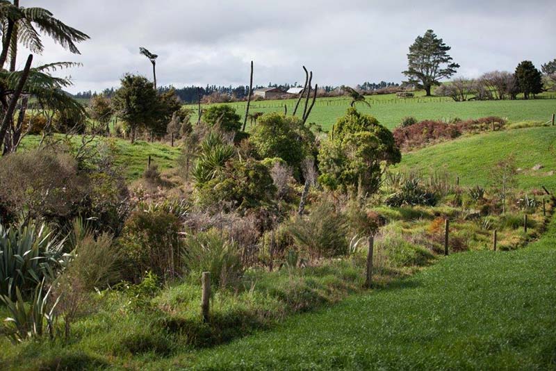
Maintaining vegetated margins along waterways is beneficial. Grass and sedges (grasslike plants) help filter water running off the land and planting shrubs and trees will stabilize the stream bank and cool the water by providing shade. Lower water temperatures can benefit aquatic insect and fish communities, he said.
Setting and implementing riparian plans is one of the key environmental targets set out in the Sustainable Dairying Water Accord – a voluntary commitment from the dairy industry to improve water quality. Other key targets include stock exclusion from waterways, stock crossings, water use efficiency, as well as nutrient and effluent management.
Making it easy
To help farmers meet this deadline, DairyNZ contracted Landcare Research to develop the Riparian Planner, a web-based tool which takes the guesswork out of building a riparian management plan. It was launched late March and is already getting good reviews.
Spencer, who led the project, said combining DairyNZ's practical and scientific knowledge of on-farm riparian solutions and Landcare Research's experience in creating automated guidance tools led to a flexible, user-driven and comprehensive tool that automates and regionalises riparian plans.
He said the Riparian Planner was an easy-to-use “interactive web-mapping tool, like Google Earth”. His Landcare Research colleague, Margaret Watts, was the lead developer of the tool.
Farmers simply enter in their milk supply number to locate their farm on the map and then highlight their property boundary, Spencer said.
“They can then use the tool to draw the various waterways (including streams, drains, ponds, wetlands, and critical sources areas) they want to work on such as existing vegetation cover, presence of weeds, whether stock are excluded, or erosion status.
“The tool also estimates the cost and provides guidance and recommended actions about some of the things they might like to do or need to do. For example, they might like to do some weed control before they begin planting.”
The tool provides a regionally specific planting list. DairyNZ developed these planting lists in conjunction with regional councils and other experts so users know they are getting the right plants in the right places. Over time, the plants could also benefit biodiversity, pollinators and erosion, he said.
“It allows farmers to build up a picture of the total task ahead and to spread their efforts and budgets over a number of years."
“The aim is to match what is ideal for water quality benefits to a timescale that is economical for dairy farmers,” he said.
Reporting
Farmers can also use the tool to present the cost and details of their riparian management from start to finish. By recording completed actions over time they can report progress toward meeting their on-farm water accord goals, Spencer said.
“In the future, with farmer permission we envisage the tool will allow farmers to submit updates directly to their milk supply companies. This will ensure they have up-to-date information to help with compliance across the board.”
Feedback
DairyNZ senior developer Matt Highway said while it was early days he had already received some great feedback from farmers about the tool.
“Farmers tell me they really appreciate the tool’s simplicity and accuracy, and being able to work within their budget.”
On average, developing a riparian management plan using the Riparian Planner takes less than an hour, depending on its complexity, he said.
“Once completed, the plan includes costs, actions and a timeline, a plant list, a map and details on how much fencing to buy, where to plant, site preparation and pest control.”
He said having a plan helped farmers reduce the risk of planting in the wrong place, at the wrong time, or overcommitting financially.
“Using the right plants and techniques will help maximise the success of riparian planting and ensure you are getting value for money by getting it right first time.”
Farmers’ thoughts
Tokoroa dairy farmers Wendy and Keith Lambeth said the tool simplified the process “dramatically”.
“I think it brings it all into one easy access spot. Without the tool we would’ve had to spend a bit of time with a ruler and a calculator,” Keith said.
“With the water accord that the dairy industry is committed to, the plan will help farmers get a step-by-step process of what they need to go through to actually get to that end point,” Wendy said.
Duncan Smeaton, a dairy farmer in Waihi, said the tool made the process “reasonably painless”. “It seemed quite logical and intuitive,” he said.
While Waikuku dairy farmer Stu Muir said it set farmers up to succeed by providing all the necessary information “at the click of a button”. He also believed it would help farmers meet the 2020 deadline by realising the “magnitude” of the task at hand.
This project was funded by dairy farmers (through their levy to DairyNZ), Landcare Research and the Ministry for Primary Industries (as part of the Transforming the Dairy Value Chain Primary Growth Partnership programme). The Riparian Planner was developed with input from The New Zealand Association of Resource Managers, regional councils and key environmental experts. Using DairyNZ’s riparian management expertise and feedback from rural professionals and farmers, the tool was able to be developed to meet water quality objectives as well as meet on farm priorities and constraints.
Gallery

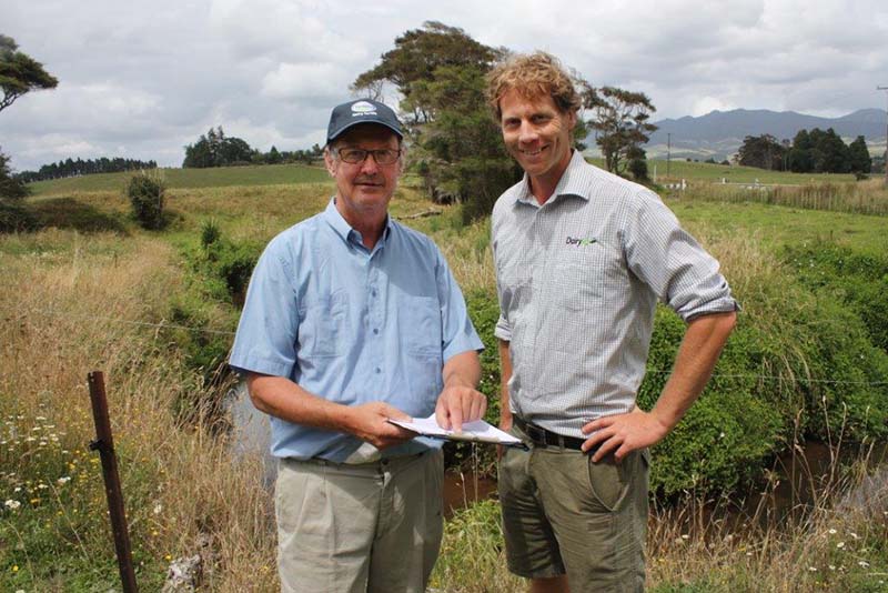
DairyNZ's Matt Highway, right, with Waikato farmer John Bluett trialling the Riparian Planner. Photo credit: DairyNZ
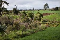
Riparian plans are part of the Sustainable Dairying Water Accord. Photo credit: DairyNZ

The Riparian Planner. Photo credit: DairyNZ
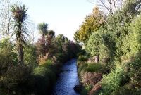
Riparian planting helps filter out sediment and nutrients before they enter waterways. Photo credit: DairyNZ
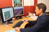
Nick Spencer testing the Riparian Planner.


You may also like
Comments
Please note - these comments are moderated