Issue 2, May 2010
In this issue:
|
Editorial
Dramatic numbers certainly hit home the stark reality of serious environmental issues.
Gully erosion in North Island hill country is one of those serious issues that we have been working with you to address for a number of years. And the numbers are certainly dramatic.
To think that in the Gisborne District alone, 100 square kilometres of hill country land has been or is being affected by gully erosion. About half of the abnormally high sediment yield in the district’s river catchments comes from the 800 actively eroding gullies. These gullies typically account for just 1-2% of the catchment surface area.
The particularly alarming statistic is that if nothing further is done to avert future gully erosion, the sediment yield in catchments like the Waiapu will more than double by 2050.
In this edition of our newsletter we touch on the seriousness of the erosion problem, as our scientists recently explained to the Gisborne District Council, in a meeting jointly organised with your East Coast Forestry Project staff.
Credible data provide the evidence to underpin effective decision making. Our innovative research to understand the nitrogen leaching from lucerne on farmland near Lake Taupo will provide the evidence necessary for the adoption of low nitrogen-loss farming practices.
Above ground one of the big challenges we are helping to address is the spread of weeds. We have 500 recognised weeds in this country, and biocontrol presents the only viable long-term control options for many of these invasive species. So we are delighted to have opened the new $1.6m David Miller Invertebrate Containment Building to undertake our weed biocontrol research.
You’ll find news about these developments and more in this edition of our newsletter. I hope you find it interesting, and I would welcome your feedback.
Best wishes,
Phil Hart
Land & Water
Fundamental approach for land-water management
 Integrated Catchment Management (ICM) is now seen as a fundamental approach for resolving high profile land and water issues in New Zealand, according to Andrew Fenemor of Landcare Research, leader of the ICM programme on the Motueka River.
The FRST-funded programme, which ends later this year, celebrated 10 years of collaborative research recently with a three-day public workshop: ‘ICM - Connecting Research and Practice’. The workshop attracted over 135 participants including the Parliamentary Commissioner for the Environment, Dr Jan Wright.
The programme has delivered some big 'take-home' research findings, according to Mr Fenemor.
- ICM is about whole community engagement with the science of land-water management, so the community almost instinctively sees themselves within a wider environment rather than just seeing their own property or sector.
- Catchments extend offshore (in the case of the Motueka about 400km2) - increased interest in coastal values and aquaculture demands conjunctive management of catchments and coastal zones. Researchers were able to demonstrate how catchment activities impacted on the local scallop fishery, and identified pathogens 6km offshore traced from cattle sources up-catchment, for example.
- Long-term sediment yields from agriculture are often larger than from forestry.
- Long duration floods in spring were the main cause of the 1990’s 70% decline in Motueka trout numbers.
- Building iwi capacity and respect for kaitiakitanga principles can do wonders for collaborative catchment management.
The inter-disciplinary ICM research team, which included Landcare Research, Cawthron, Tasman District Council, NIWA, GNS, Scion, iwi, Landcare Trust and social science researchers, saw ICM as based on three integrative principles:
- Resource management that considers land as being connected with water and with the coast (geographical integration)
- An adaptive management process driven by the big issues in a catchment
- A way of operating that links biophysical knowledge (our traditional science) with engagement processes (what we’ve loosely termed community resilience).
“We’ve found that by researching together in this way, the outcomes and spin-offs from different disciplines working together are multiplied,” says Mr Fenemor.
“ICM water quality and riparian research with farmers in the Sherry River catchment, for example, has led to a 50% improvement in water quality. It also led to stock-crossing recommendations in the Clean Streams Accord but, just as importantly, motivated the community in that catchment to commit voluntarily to ongoing changes in land management via Landowner Environmental Plans to achieve an 80% improvement and make their river swimmable.”
Presentations from the Nelson workshop are available on the ICM website at http://icm.landcareresearch.co.nz.
Further information:
Andrew Fenemor
Planting to avert erosion
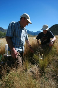
Further afforestation of gullies in the Gisborne region will be critical to saving vast areas of productive hill country and reducing catchment sediment yields, a group of Landcare Research scientists recently told the Gisborne District Council.
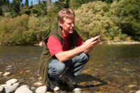
“More than 800 actively eroding gullies in the region are contributing about half of the abnormally high sediment yield of local rivers says Dr Mike Marden, a local Landcare Research scientist who along with colleagues Drs Chris Phillips and Alexander Herzig presented findings from recent erosion-related projects.
Dr Alexander Herzig’s modelling predictions for sediment yield under different afforestation scenarios showed that sediment derived from gullies will more than double in the next 40 years if nothing more is done to stabilise them. Dr Chris Phillips says a ‘mosaic’ of planting would be the best option for stemming erosion. “What’s required is not all trees or all grass but a mixture of close-planted forests, pastured areas, and space-planted trees.”
Topics covered in the council presentation included the history of gully erosion and its contribution to sediment yield, predicting sediment yields from gullies under different afforestation scenarios, bank erosion measurement and erosion mitigation by vegetation.
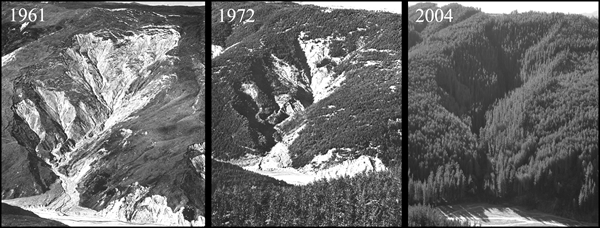 |
| The effectiveness of gully reforestation is evident in these three photos of the same gully, taken between 1961 and 2004. |
Gully erosion
Despite good gully erosion control now being achieved through reforestation of 135,000 hectares of exotic forest since 1960, the wider Gisborne region has still suffered a 27% overall increase in area effected by gully erosion, a 2007 study found.
This is because gullies present on farmland 40 years ago, but never planted, have increased in size, and new gullies have formed over this period as well.
Dr Marden’s work has shown that reforestation of gullies successfully closes down all but the largest features. However the early targeting of gullies could have prevented the loss of significant productive hill country. Gullies, both treated and untreated combined, have affected a staggering 100 square kilometres of hill country in this region.
Dr Marden says gullies are the single largest source of sediment and until sediment production from them is halted, suspended sediment yields in the East Coast river systems will remain abnormally high for many decades to come.
For the period 1957-1997, gullies contributed the equivalent of 43%, 49% and 54% of the average annual suspended sediment yield of the Waipaoa, Waiapu and Uawa rivers, respectively. This sediment came from just 0.8%, 2.4% and 1.7% of hill country areas in these respective catchments.
He warns that the remaining untreated gullies will inevitably increase in size and add significantly to the sediment load.
The region has more than 800 actively eroding gullies (excluding those in indigenous forest) that require treatment. The longer treatment is delayed, the higher the costs of restoration in the future and the greater the on-site and off-site consequences, particularly to the region’s infrastructure.
Gully modelling
Landcare Research’s gully modelling has shown that past afforestation was effective in reducing current sediment yield compared to not having afforested at all. The Waiapu catchment sediment yield is 17% lower and the Waipaoa reduction is 33%.
The models show that of the two afforestation plans for the region, MAF Target Land plan would be more effective at reducing sediment yield than the Gisborne District Council’s Land Overlay 3A area. However, the most effective way to reduce future sediment yield is to afforest all gullies (and sub-catchments) irrespective of size and if this were done for all existing and every newly initiated gully in the Waiapu catchment by 2020, then the sediment yield will halve by 2050 from 22 million tonnes to 11 million tonnes per year.
The modelling also shows that if there is no more afforestation of the present and newly initiating gullies in the Waiapu catchment then the sediment yield will more than double by 2050 from 22 million tonnes to over 45 million tonnes of sediment per year.
Bank erosion
Bank erosion contributes to river sediment loads; in fact it can be a major contributor. Measurements from cross-sectional surveys of the banks of the Waipaoa River following Cyclone Bola indicated that bank collapses of more than 20m in width, and in some cases 65m wide, were common during this single, albeit massive storm.
There have been very few New Zealand studies quantifying bank erosion and evaluating its contribution to sediment loads and budgets, and impaired water quality.
Dr Ron De Rose of Landcare Research is developing models of bank erosion to incorporate into water quality models, and has set up trial sites along two reaches of the much-studied Waipaoa River.
The sites were selected because of the extensive existing research into the geology, hydrology, land use and erosion processes in this region, and because of the availability of a LIDAR (Light Detection and Ranging) survey captured in 2005. LIDAR is an optical remote sensing system used to collect topographic data. Aircraft-mounted lasers record elevation measurements with a vertical precision of 5 centimetres.
Previous research experience in the area and historical aerial photographs from the 1950s in conjunction with LIDAR enabled the researchers to plot the previous location and elevation of river banks.
The analyses showed that the mass of sediment produced from cliff erosion in the gorge area is seven times that coming from alluvial banks. The combined contribution from bank and cliff erosion is not large in percentage terms (<1.5%) because very extensive gully erosion dominates the sediment budget of this catchment.
Nevertheless, the research has significant potential application to rivers elsewhere in New Zealand.
Erosion mitigation using vegetation
Vegetation mitigates erosion in two ways: by changing the hydrological regime and through tree roots reinforcing soils, thereby increasing the soil’s shear strength.
We know that close planted slopes have fewer landslides than grassed slopes – trees prevent erosion. Close planted trees can control gullies if they are treated early and earthflows can be slowed.
The long-term solution to erosion prevention in places like the East Coast is to have a mosaic of land use across the landscape, i.e. not all trees or all grass but a mixture of close-planted forests, pastured areas, and space-planted trees.
Native plants do develop good root systems but they are not as fast growing as some exotic species.
Root studies of native plants indicate that there is significant variation in below ground appearance – in much the same way that native trees look different in their above-ground appearance.
For bank erosion control, non-woody species such as flax, carex and toe toe have many more roots and are likely to be more effective in the short term.
Further information:
Mike Marden
Chris Phillips
New research to give certainty to nitrogen market
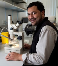
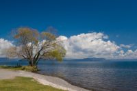 Nitrogen leaching losses under lucerne crops will be measured in a sophisticated new project being undertaken by Landcare Research soil scientists near Tihoi, on the western side of Lake Taupo.
Water quality in the lake is deteriorating due to increasing nitrogen levels. About 1250 tonnes of nitrogen per year is entering the lake, about 30-40% coming from pastoral farmland.
Waikato Regional Council has set a challenging target of reducing manageable nitrogen entering the lake by 20%. Farmers are now looking for economically viable, low nitrogen-loss options for land use. One alternative may be cut-and-carry lucerne.
However, current predictions of nitrogen leaching losses for cut-and-carry lucerne range between 5–26 kg/N/ha/y. Because of this huge variation, farmers cannot participate effectively in the nitrogen trading market. Accurate, quantifiable data is required before farmers who change to low nitrogen-loss farming practices can receive the correct credit from the Lake Taupo Protection Trust (LTPT).
So LTPT let a competitive tender to Landcare Research to improve the understanding of nitrogen leaching from lucerne and any associated microbial/soil quality changes. Over the next three years a rigorous field trial on nitrogen-leaching under cut-and-carry lucerne will take place on a Taupo Lake Care (TLC) member’s Tihoi farm.
The researchers will study three different treatments: lucerne and industry fertiliser, lucerne and biochar, and lucerne and organic fertiliser. The nitrogen leaching results will also be provided to upgrade the Overseer® model, which is widely used to predict nitrogen leaching on a farm-scale basis.
Research leader, Malcolm McLeod, says the project will provide valuable insights about nitrogen leaching. “The Overseer® model needs certainty about what is actually leaching from lucerne and that is what our research will provide.”
This research will use 16 large (1m diameter x 1.5m deep), undisturbed soil wick-activated barrel lysimeters to directly measure the amount of nitrogen leaching. The specially manufactured 18-mm wall thickness polyethylene barrel lysimeters will be hand-carved into the soil to maintain the physical integrity of the soil profile. The base of the barrel lysimeters, now filled with undisturbed soil, will have tubing leading to 200 litre leachate collection vessels in a nearby underground room.
At the Tihoi farm site, we will log rainfall, air and soil temperatures and leachate volume on a 3-hourly basis. This data will be automatically downloaded daily and delivered to a website for public viewing. Every 2 weeks the leachate will be collected and analysed for total nitrogen, nitrate-nitrogen ammonicial-nitrogen, and organic nitrogen. The experiment will collect data for a minimum of 5 years; however, a longer time period has been recommended to account for variability in weather events.
Soil chemistry will be determined by standard analyses, while soil storage of total nitrogen, organic and inorganic nitrogen will be determined by intensive depth-wise soil sampling at trial set-up and completion. Herbage nitrogen will also be determined at the harvesting cycles by 10% flowering or local knowledge.
To assess overall soil health, organic matter and microbial diversity will be analysed before and after planting lucerne. The analyses will be used to characterise the changes in the community structure and activity of certain microbial groups (i.e. fungi, gram-positive bacteria, gram-negative bacteria and bacteria in general) to estimate microbial community adaptation to the new carbon source (biochar).
In addition, microbial biomass carbon measurement (soil health indicator) will be performed for each treatment to assess organic matter changes. Nitrogen mineralisation will be measured as an indication of labile nitrogen and basal respiration as a measurement of labile carbon (labile meaning the carbon that leaches easily through soil into ground water).
Further information:
Malcolm McLeod
New guide to wetland restoration
 New Zealand’s notoriety as a world leader in the destruction of wetlands is now being matched by leading expertise in the restoration of these critical ecosystems.
Over the last 150 years we have lost a staggering 90% of our wetlands, and many remnant wetlands continue to be under pressure from land-use intensification and urban growth.
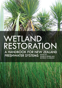
Fortunately attitudes are changing and a new book, ‘Wetland restoration: a handbook for New Zealand freshwater systems’, co-edited by Dr Bev Clarkson of Landcare Research, is an authoritative guide for forward-thinking landowners, community groups, schools, agency land managers and non-government organisations who are now restoring wetlands.
“The handbook brings together expertise from specialists and groups actively engaged in restoring wetlands throughout the country,” says Dr Clarkson. “It provides a detailed, comprehensive ecosystem approach toward understanding, protecting and enhancing our remaining wetlands. It is targeted at those who plan to, and those who already are making a difference to improving wetlands, and is written in a way that can easily be understood and importantly, acted on.”
The problem
Most of our major cities are built on wetlands. Coastal and inland wetlands were drained, reclaimed, destroyed, and built-over to support a growing, land-hungry population. That loss continues today. The majority of wetland remnants are highly degraded and the unique biota dependent on these ecosystems is under threat. Land-use intensification has both increased the demand for fertile land and nitrogen-rich runoff has exacerbated eutrophication processes affecting wetland biodiversity and ecosystem functioning.
The response
Thankfully many people are now recognising that wetlands are not a waste of space. Wetlands are nature’s tools for maintaining water tables, filtering and recycling waste, pollutants, nutrients and sediment washed from the land. Changing attitudes and land-use practices developed over several generations can be challenging, particularly if there is no clear path to the outcome desired or examples to follow.
But change is occurring. Wetlands are being restored to capitalise on their natural attributes and more sustainable land use practices are being applied. Objectives vary widely between projects but the overall goal is clear: to return degraded wetlands back to what they once were - healthy, living ecosystems. Restoring wetlands instead of destroying them inevitably requires new skills, knowledge, and time to learn and apply that knowledge.
The new handbook is timely for guiding new projects as well as providing additional useful information for projects already under way. It focuses on restoring ecosystem function in naturally occurring wetlands for long-term sustainable outcomes.
The Handbook is divided into three sections to highlight the key phases of restoring a wetland. Individual chapters in each section cover key aspects of restoration from planning, to implementing, to monitoring and protecting the restored wetland. Case studies provide practical examples of the main principles covered in each of the chapters. References and further reading, along with useful websites are included at the end of each chapter. A CD inside the back cover contains a PDF of all text references and web links used within the Handbook.
‘Wetland restoration: a handbook for New Zealand freshwater systems’ is available from: www.mwpress.co.nz/store/viewItem.asp?idProduct=908
Further information:
Bev Clarkson
Carbon storage
Soil carbon research heats up
 Globally, soil respiration releases ten times more carbon dioxide into the atmosphere than the burning of fossil fuels. So small changes in the amount of carbon lost from soil organic matter with a warming climate could have major effects on climate change.
To get a better understanding of the effect of soil warming, a team of Landcare Research, University of Canterbury and Macaulay Land Use Research Institute (Scotland) scientists are using state-of-the-art equipment to simulate and measure the effects of increased soil warming on carbon dioxide release from soils in tussock grassland in the Canterbury high country.
Electrical cables buried in replicated plots are heating the soil 3 degrees centigrade above the temperature in the control plots. Scientists are using a tuneable diode laser to measure sources of carbon dioxide released from the soil by analysing subtle changes in the isotopic composition. This world leading technique was perfected by Landcare Research and collaborating scientists at Lincoln.
This research is expected to provide new insights that will improve models of global carbon cycling and climate change, according to Landcare Research Global Change Processes Team Leader, Dr David Whitehead.
“When most people think of the carbon stored in a terrestrial ecosystem they think of the above-ground biomass – the trunks, branches and leaves of trees and shrubs,” says David. “But soil has by far the largest pool of terrestrial carbon. Soil respiration – carbon dioxide released by everything living in the soil – has a major impact on atmospheric carbon dioxide concentration.
“Hence small shifts in the amount of carbon lost from soil organic matter as a consequence of a warming climate could have major feedback effects on climate change. With much of New Zealand’s surface area covered in tussock grassland, the research in this location is particularly relevant.
The research is funded by the Foundation for Research, Science and Technology.
Further information:
David Whitehead
Environmental markets for New Zealand: barriers & opportunities
Environmental markets could help address environmental issues in New Zealand, according to Research Leader Dr Suzie Greenhalgh and ecologist Dr Susan Walker, although they caution that markets would be more feasible for some commodities than others.
“Greenhouse gases, water quality and water quantity markets are likely to be the most straightforward to establish in New Zealand, but nevertheless face numerous legal, resource and information constraints. Biodiversity is more complex, and the barriers to a successful market are much higher, so we suggest biodiversity markets are probably not feasible at present” says Dr Greenhalgh, the lead author of a report that assesses the issues.
Environmental markets are among an array of intervention options available to policy makers to reduce environmental degradation or improve environmental quality. While markets are not always an appropriate policy response, they are often promoted as a more palatable and cost-effective option for achieving an environmental goal than stand-alone regulation, especially by those regulated. This is because markets can allow greater flexibility to those causing environmental harm in how they meet their regulatory obligations, which may result in cost-savings.
How environmental markets work
With an environmental market a regulated source of environmental harm can comply by making the necessary internal actions to reduce their environmental impact, or they can purchase improvements in environmental quality from other sources that can make these improvements at lower cost.
The development of markets in the last decades has also been encouraged by the need to involve a greater variety of sources of environmental degradation to achieve an environmental goal, especially where it is not politically or economically palatable to apply stand-alone regulation. For example, although agriculture is the largest source of nutrient pollution in many US catchments, there is political reticence to regulate agricultural sources. Establishment of an environmental market for nutrient pollutants can make such regulation more palatable, by allowing agricultural sources to financially benefit from low-cost reductions in their pollution.
Achieving success
The questions many are now asking about environmental markets are whether they are truly successful, and what is needed to establish a successful environmental market.
To answer these questions we must first define success. Dr Greenhalgh and her co-authors define a successful environmental market as one that meets its environmental goal as well as lowers the compliance costs for the regulated participants, provides regulated participants with incentives to innovate and lowers regulator costs (administration, monitoring and enforcement).
To be successful environmental markets require particular conditions and characteristics. These include:
- Precise legislation or rules comprising unambiguous environmental goals and quantitatively defined caps adequate to meet the goal;
- An environmental commodity that can be quantified in an appropriate currency that is "capable of capturing what we care about" as well as a reliable, well-tested measurement and estimation methodology;
- Trading restrictions to prohibit exchanges that would cause negative overall outcomes;
- Sufficient numbers of buyers and sellers (market participants);
- Sufficient technical or management options to reduce environmental damage (e.g., alternative options to reduce emissions, or water use) and/or possible sites to trade;
- Inclusive stakeholder consultation that enables buy-in from the range of interest groups;
- Rigorous and credible enforcement;
- Robust market design with: sound governance, and effective mechanisms for coordination between the different levels of government involved; independent market oversight and review; certainty for participants (e.g., adequate liability arrangements); appropriate capability and resources, and adequate mechanisms for quality control within the administering agency; and appropriate infrastructure to minimise transaction costs.
Barriers in New Zealand
There are a number of barriers to the development of robust and efficient environmental markets in New Zealand. Our primary environmental legislation (the Resource Management Act 1991, or RMA) is enabling in principle, but makes market establishment challenging in practice. A key problem is the ambiguity of ‘sustainable development’, which provides a poor basis for defining environmental goals.
There is also inadequate direction on allocation of property rights and the setting of caps, and limited transferability of consents and permits. Further, the RMA provides no guidance on who has authority to establish and operate markets, and has weak accountability for administrative bodies.
Devolution of most environmental decision-making to regional and district councils under the RMA means varied, and often limited, capacity to assess the need for an environmental market and then to design, establish, operate, monitor and enforce it successfully. Capability problems are compounded by deficiencies in co-operation and co-ordination among central, regional and local government.
Devolution of New Zealand’s environmental governance also increases the likelihood of regulatory capture by local economic interests, and makes it more difficult for dispersed stakeholder interests (like environmental non-government organisations) to engage; a further hindrance to the establishment of successful environmental markets.
The latter point is tied to a second major barrier to successful environmental markets, which is their political viability. Typically, those affected to the underpinning regulation will resist it, affecting subsequent market design, often leading to weak environmental goals and less efficient overall market design.
Cost and lack of environmental data are further hindrances to the establishment of environmental markets in New Zealand, and to subsequent compliance monitoring. Legal constraints on access to private land for inventory and monitoring purposes are likely to be especially problematic for some markets. Finally, New Zealand’s small size may limit potential markets participants (limiting market efficiency) and the number of third party providers for verifying or certifying transaction details and their level of independence (which will compromise quality control).
Overcoming the barriers
To facilitate the development of successful environmental markets for New Zealand, we suggest that various actions are needed to address these barriers. These actions fall into:
- Supporting guidance including:
- Developing guidance to assist government and other relevant stakeholders determine if environmental markets are an appropriate policy response to an environmental problem.
- Developing overarching national market policy and guidance on market design to promote consistency between markets and reduce the cost of establishing markets, and identifying an array of mechanisms that market administrators can legally apply to enforce compliance.
- Amending the RMA to:
-
- clarify the meaning of ‘sustainable development’
- enable councils to formulate precautionary rules and regulations
- overcome limitations on the transferability of consents and permits
- require the Minister for the Environment or territorial authorities/regional councils to specify measurable environmental goals or promulgate new legislation for market operation
- create better means for revoking permits for lack of compliance
- Establishing an independent oversight committee or ombudsman to act as grievance body for public oversight concerns with markets, and requiring market administrators to submit annual reports on market performance to that body.
- Requiring that environmental markets be subject to regular independent audits.
- Legislative amendments including:
- Developing market infrastructure, such as a national marketplace and registry for all environmental markets.
"In summary, environmental markets are not suitable for all commodities and all situations, and require particular conditions to work well. In New Zealand, markets could be successful for some commodities and in some regions, but our environmental law, administration and data arrangements don’t make their establishment easy. Our report looks at the barriers and the work needed to do to create the right conditions," says Dr Walker.
Further information:
Suzie Greenhalgh
Susan Walker
Native forest management
Deadly kauri fungus continues to spread
 Landcare Research is striving to improve understanding of the kauri–killing fungus PTA (Phytophthora taxon Agathis), which was recently found infecting a kauri tree just 500 metres from Tane Mahuta.
This is the first time the pathogen has been confirmed in the world-renowned Waipoua Forest and puts the iconic kauri Tane Mahuta and other nearby giants at risk of being attacked by the pathogen. Previously, the nearest PTA had been found to Waipoua was at Trounson Kauri Park, one kilometre south of the Waipoua Forest boundary, where it had been recovered from the soil in 2005.
Landcare Research scientist Stan Bellgard believes that increased efforts are required to ensure Tane Mahuta does not fall victim to the pathogen.
Dr Bellgard and his team were guided into Waipoua Forest by Te Roroa kaumatua Davy Paniora and Stephen King of the Waipoua Forest Trust who were able to show scientists trees in the forest that exhibited classic PTA dieback symptoms. As well as finding PTA close to Tane Mahuta, the team found some other concerning discoveries.
Many of the infected trees discovered to date on Great Barrier Island and near Auckland have been rickers - young regenerating trees up to about 200 years old. However, at Trounson Kauri Park PTA was recovered from a 2m diameter large tree, at least 600 years old. Team member Dr Nick Waipara from the Auckland Regional Council said that they had discovered a similar-sized infected tree in a survey at the Cascades Park near Auckland. The fact that such large trees are becoming infected confirms the possibility that the iconic giants are at risk.
Symptoms of the disease caused by PTA include yellowing of foliage, canopy thinning, girdling of the lower branches and the eventual death of the tree. However, its most distinctive symptom is the excessive bleeding of gum from lesions in the bark near the base of the tree trunk Dr Bellgard says.
“We were shown some trees near Tane Mahuta with suspicious symptoms and detailed work has confirmed that one tree with characteristic 'pus-like gummosis' was infected with PTA. This is of particular concern because the tree is so close to Tane Mahuta.”
Landcare Research scientists have been working with colleagues in Scion, Plant & Food Research and the Auckland Regional Council to investigate the threat posed by PTA since it was discovered on the mainland in 2006. Project leader Dr Ross Beever says there is still a lot to find out about PTA.
“It is a bit of a sleeper. It was first recognised on Great Barrier Island in 1972 but was undoubtedly more widespread even then. While it is highly pathogenic to kauri, we know very little about how it spreads and infects trees in the wild. We suspect it is exotic, and are investigating it relationships with strains from overseas, especially South East Asia and Queensland.
Present evidence suggests PTA is a soil-borne disease with long-lived resistant spores that can spread by soil movement, and short-lived swimming spores that can be moved in water flow in soil as well as spreading tree to tree through close contact of the roots. Soil containing the long-lived spores is likely to be transported around on human footwear and by animals such as pigs.
Further information:
Stan Bellgard
Weed and pest management
Weed biocontrol research to benefit from new facility
 Weed and insect pests are a serious and expensive problem in New Zealand but the opening of a new state of the art containment facility will assist in the fight against these unwanted invaders.
Conservation Minister Hon. Kate Wilkinson opened Landcare Research’s new $1.6m Invertebrate Containment Facility at Lincoln, which will assist with efforts to take on the enormous challenge of tackling weeds and pests.
Of the more than 2000 plants that have naturalised in New Zealand so far, 500 are already recognised as weeds, and the estimated 25000 species in cultivation provide a large reservoir from which future weeds will emerge. On average every 39 days a species escapes cultivation and establishes in the wild and a quarter of those have traditionally gone on to become weeds.
The new facility, named in honour of Dr David Miller (1890-1973) who is widely regarded as one of the founders of professional entomology in New Zealand, will strengthen New Zealand’s ability to develop biocontrol for key weed species.
While chemical and mechanical control of weeds and pests is feasible in high-value production systems, it is too expensive and often unacceptable on a landscape scale. Consumer demand for nil or low residue synthetic chemical control of weed is growing quickly. Therefore, biocontrol, especially for widespread weeds in sensitive natural environments is the only option. Currently biocontrol is available in New Zealand for less than 20 weeds but land managers are increasingly turning to biocontrol to supplement or replace other control options.
“Weeds are a nationally significant issue and the annual cost of controlling them continues to grow,” says Landcare Research chief executive Warren Parker.
It is estimated that $40m is spent every year preventing the introduction and spread of weeds and that $60m per annum is lost in agricultural and forestry production.
“Landcare Research is a world leader in weed biocontrol research and this invertebrate containment facility is essential to our strategy of increasing the rate of release of new and effective biocontrol agents to stem the expansion of weeds and lower the cost of their control,” says Dr Parker.
The David Miller invertebrate containment facility will enable other insect work to be undertaken, such as a $1m project to release dung beetles, as well as responding to biosecurity incursions which often require urgent research and considerable quarantine space.
The facility is designed to accommodate such surges in demand and builds Landcare Research’s New Zealand and international credibility and strength in one of its core area of science: the control of invasive weeds, pests and diseases.
Further information:
Hugh Gourlay