Issue 4, July 2011
In this issue:
|
|
Editorial
Winter weather and a good dose of Auckland rain greeted us as we gathered with other environmental researchers and members of the Auckland Council science and policy teams for the long awaited Regional Science Road show at the end of May.
A day of presentations and discussions kept us all warm and busy, and it was great to see the expanded council team together and “joining the dots” in their new region.
Over the last few months you will probably have heard about the re-focussing of CRI’s into core science areas, and just this week Landcare Research’s Statement of Core Intent was published. We have been working with stakeholders including many regional councils to ensure alignment of our priorities with their research needs, and we will talk more about this in future editions.
This edition provides you with insights into a range of really interesting recent and current projects at Land care Research. Do feel free to contact us if you would like more detail or want to get involved.
Best wishes,
Christine Harper
Water
Innovative tools for water management
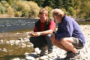 An innovative new tool – the WaterWheel – will be an important component in a new project recently funded by the Ministry of Science and Innovation. The Waterwheel project is a partnership between Aqualinc, Landcare Research, AgResearch and Tipa Associates which aims to capitalise on the power of collaborative approaches for managing water allocation and protecting water quality.
Regional and unitary councils are increasingly setting limits on river flows, bulk water allocation and water quality at the scales of catchment, sub-catchment and water management zone. The Waterwheel project examines how to set and implement such limits collaboratively with water users and stakeholders, and how to sheet home the responsibility to individual water and land users, while achieving acceptable cultural, economic and social outcomes.
The WaterWheel itself is a single, visual representation of the ‘health’ of a catchment or water management zone with each spoke of the wheel representing an indicator of environmental, social, cultural or economic variables. The idea is a visual tool which can be used by water users at a sub catchment level, community groups at a catchment scale, industry bodies such as energy companies, and agribusiness and policy agents at the catchment, region and national scale.
Landcare Research scientist Andrew Fenemor says at present there is no real means for water users at a sub catchment scale to understand, and therefore actively manage, the impacts of their decisions on both flow and quality states.
“The cumulative impact of many users requires both individual and collective responsibility for actions. At present there are few examples of collective institutions in place at nested scales to deliver agreed catchment outcomes. Most decisions around water use will still be taken to optimise an economic output with little understanding of the flow-on consequences of these actions for environmental as well as social and cultural outcomes,” he says.
This programme aligns with Land and Water Forum recommendations, SWIM and MfE targets, and addresses Ground Water Forum critical issues by designing improved institutional arrangements. It fills a research gap by developing a tool and process for setting limits which balance the values of communities, and improve water use and quality at a variety of scales.
The programme was developed through an equally innovative initiative, the ‘Freshwater Sandpit’ research planning process last March and imported from Europe. The ‘sandpit’ was an intensive, week-long brainstorming session to develop creative research projects.
As the proposal notes “The distinguishing feature of this research is that we are aligning and integrating institutional behaviour to our understanding of the physical dynamics of water movement through the medium of a tool and process that will allow feedback between collective actions and the meeting of environmental, social, cultural and economic states.” Matauranga Maori is integral to the institutional design and the development of the tool. The research will be informed by literature, analysis of existing case studies and workshops, and a proof of concept will be tested in two sub catchments (yet to be determined).
The outputs will be unique and innovative because they are the product of an interdisciplinary research approach integrating social science with economics, political governance, collective learning and environmental science. A new collaborative governance design will be developed to manage water and land to meet acceptable standards in line with environmental, social, economic values.”
The Waterwheel research team includes John Bright (Aqualinc), Andrew Fenemor (Landcare Research), Liz Wedderburn (AgResearch) and Gail Tipa, plus international input from scientists from Europe who attended the Sandpit. The programme builds on research completed in integrated catchment management (ICM), the Pastoral 21 environment programme and various regional council catchment projects.
As Andrew Fenemor notes “We’d like to get to the point where catchment landowners think about doing their Waterwheel accounts when they do their GST reconciliations every 1-2 months”.
Further information:
Andrew Fenemor
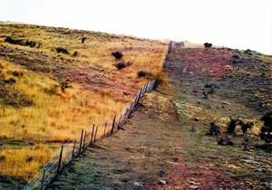
Soil conservation reduces sediment yield in rivers
Many rivers in the Manawatu-Wanganui region are silt-laden because of hill-country erosion. Sediment is deposited on river channels, reducing flood capacity and spoiling aquatic habitat. Sediment is also a major source and carrier of phosphorus that degrades water quality. The Horizons Regional Council are encouraging soil conservation through the Sustainable Land Use Inititiative (SLUI). Farm plans are being developed for farms on highly erodible land and farmers are subsidised for erosion control works, such as forestry, retirements, and soil-conservation tree planting. SLUI will spend up to $80 million in the Manawatu-Wanganui region.
To help plan and assess progress in SLUI, John Dymond (Palmerston North), Daniel Rutledge (Hamilton) and Suzie Greenhalgh (Auckland) of the Ecosystem Services Program for Multiple Outcomes are providing a model for assessing the impacts of farm plans on sediment yield. The model integrates the soil-conservation effects of farm plans over water management zones throughout the region. Sediment yields are estimated for present day, for 2020, and for target (i.e. all farm plans implemented and fully mature). Results showed that many of the silt-laden rivers have a target reduction of about 50% in sediment yield, such as the Turakina, Middle Whanganui, Lower and Middle Whangaehu, Akitio, and Owhanga. By 2020, about half of the target reduction would have been realised.
The water management zones of the Manawatu River generally have lower targets of about 25% reduction, with the exception of the Tiraumea tributary that has a target of about 50%. These data are being used by the Integrated Freshwater Solutions program (MSI funded) in their mediation of stakeholders in the Manawatu river accord. In future, the model will be further improved using more comprehensive measurements of erosion and sediment transport in the Clean Water Productive Land research program (MSI funded).
Further information:
John Dymond
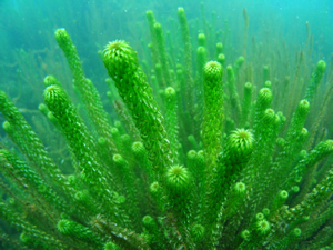
Biocontrol prospects for targeting aquatic weeds
 Biocontrol appears to be underutilised as a method of controlling aquatic weeds in New Zealand, but has great potential.
To date, only one aquatic weed here, alligator weed (Alternanthera philoxeroides), has been targeted in this way with some success. The use of biocontrol for aquatic weeds warrants further investigation not just because herbicide application in freshwater habitats is expensive and becoming increasingly unacceptable to many, but also because it has proven to be highly successful overseas. While recently investigating what kinds of weeds make the best targets, we found that aquatic species do seem to be more susceptible to biocontrol than terrestrial weeds.
There are rather a lot of exotic aquatic weeds in New Zealand that need to be controlled. Fifty-two aquatic species have naturalised and become weeds so far and this is not including wetland species that are normally flooded for only part of their life cycle. We have previously developed a scoring system to improve prioritisation of targets for weed biocontrol, and have now applied this to aquatic species. The system uses measures of the weed’s impacts (its importance), amenability to biocontrol (how feasible it is to target) and the likely effort (or cost) required to implement a biocontrol programme, to come up with scores.
Paul Champion from NIWA was extremely helpful, providing us with a list of aquatic weeds and scores from NIWA’s Aquatic Weed Risk Assessment Model (AWRAM). The model scores a weed’s potential impact in New Zealand and was developed by NIWA to improve border control for potential aquatic weeds. Many aquatic weeds currently have limited distributions in New Zealand, and biocontrol is often most suitable against weeds that are too widespread or too difficult to be controlled using conventional measures. For this reason, species that are targets for eradication on a national level, for example, National Interests Pest Response (NIPR) species and those included in Regional Pest Management Strategies (RPMS), were discounted as suitable targets for biocontrol. This left 38 species to be assessed.
The calculated biocontrol impact scores indicate that most aquatic weed species in New Zealand are likely to be good targets for biocontrol. Some are already the focus of biocontrol programmes elsewhere.
“Of the 38 species under consideration, biocontrol agents have been released against seven worldwide and their impact has often been substantial,” said Quentin Paynter, who wrote the report.
Surveys looking for potential biocontrol agents in the weed’s native range have been conducted for oxygen weed (Egeria densa), lagarosiphon (Lagarosiphon major), water purslane (Ludwigia peploides subsp. montevidensis), and common reed (Phragmites australis). The surveys indicate that promising agents exist for all four species.
The final ranking scores indicate that purple loosestrife (Lythrum salicaria) is ranked first despite having a relatively low weed importance score. Its ranking is raised due to the successful biocontrol programme in Canada and the United States where plant biomass was reduced by 81%. This gave purple loosestrife a maximum biocontrol impact score combined with a very low effort score, because native range surveys and host-range testing have already been performed.
Lagarosiphon got the second highest ranking – it has a high AWRAM score, promising agents have been identified in its native range, and the biocontrol impact is predicted to be high.
Oxygen weed is ranked third, above parrot’s feather (Myriophyllum aquaticum), even though the latter has been successfully controlled by a beetle (Lysathia sp.) in South Africa. Parrot’s feather is ranked lower than might be expected due to the risk of non-target attack as there are five indigenous Myriophyllum species in New Zealand. Hornwort (Ceratophyllum demersum) was ranked fifth, despite being the second most important weed by AWRAM score. “The difference is due to the lack of previous research into biocontrol of hornwort, meaning that a programme would have to start from scratch, thus increasing costs and the uncertainty of success,” said Quentin.
Having identified the best targets for biocontrol, the next step is to check with those working on aquatic weed control that the most important weeds have been identified and scored correctly. “We excluded weeds that are eradication targets. While purple loosestrife is believed to be beyond eradication, I think it may be ranked too high because its distribution is currently quite limited,” warned Quentin.
Lagarosiphon also has the potential to change rank depending on the values of interested parties. This is because the weed has some uses: it provides habitat for aquatic fauna, large patches increase sedimentation (which is helpful in some areas), it can coexist with native aquatic plants in some areas, and it is one of the few plants that can withstand the conditions in some fresh waters, so its removal would further degrade the habitat. Biocontrol agents released against lagarosiphon may spread to areas where it is valued for these reasons which would need to be taken into account.
We also need to ensure we understand the effects of removing an aquatic weed. There are examples of terrestrial weeds being removed only to be replaced by another weed species and this may happen in the aquatic environment too. Although, the slower rate of removal by biocontrol, than mechanical or chemical control methods, gives less aggressive plants more of a chance to get established.
Another thing to consider is the best kind of agents to use on aquatic weeds. In Europe, leaf beetles and weevils have been the most successful agents. Fungal pathogens have not been used much, but they might be suitable to attack emergent species, and the use of indigenous pathogens as mycoherbicides shows some promise. In New Zealand most aquatic weeds spread vegetatively so biocontrol agents that attack flowers or fruit are unlikely to have a significant impact. However, biocontrol agents that attack stems and/or roots also have the potential to increase stem fragmentation, which may in turn facilitate weed spread, as well as cause problems for clogging intakes for power generation.
Keeping these things in mind, biocontrol of aquatic weeds in New Zealand has the potential to be very successful. The prospects for the biocontrol of lagarosiphon and oxygen weed, look very promising. Hornwort, arguably our most serious aquatic weed, is also a promising target, although initiating a biocontrol programme against it will be more expensive since it would be starting from scratch. Other targets look quite achievable, but might require a greater investment to yield results. We plan to organise a workshop later this year to share our findings with those who manage aquatic pests and float [pun entirely intentional!] the idea of activating an aquatic biocontrol programme for New Zealand.
Further information:
Quentin Paynter
Biosecurity
Rabbits on the rise
 It’s almost 15 years since the release of the rabbit haemorrhagic disease (RHD) which decimated rabbit numbers over large areas of New Zealand. However, in the intervening years rabbits have developed increasing immunity to the RHD virus and their numbers have started to recover.
Increased rabbit densities have led to resurgence in the use of conventional control tools, including baiting with either 1080 or pindone. Landowners are required to control rabbits when numbers exceed specified population levels and some landowners are again incurring high rabbit control costs.
Due to growing concern about the numbers of rabbits infesting our drylands, for the first time in more than 10 years Landcare Research scientists, led by Bruce Warburton, have received funding from the Crown to extend recent research on possum control to the control of rabbits.
The research has three main strands: (1) reducing the cost and amount of toxic bait used in aerial baiting, (2) identifying cost-effective strategies currently used by farmers for secondary control, and (3) understanding the toxicology of pindone poisoning in order to reduce the cost of application and its potential impacts on non-target species.
As a first step, published papers and reports from previous relevant research were catalogued within a searchable web-accessible bibliography (http://rabbits.landcareresearch.co.nz). The catalogue helped identify key research that could be used to update current best practice for controlling rabbits with aerially sown 1080-carrot bait. Such control typically involves sequential sowings of 20–40 kg each of prefeed (non-toxic) and toxic bait per hectare, depending on rabbit density, and costs up to $100 per hectare. Based on research into baiting for possums, Bruce believes that current bait sowing rates and associated control costs for rabbits can be significantly reduced.
To test this hypothesis, Bruce and his team are working with Otago Regional Council staff to develop and run a series of trials this winter to test a range of different bait sowing rates and applications that could reduce costs by as much as 50% and the sowing rate of bait by 66%.
Some farmers undertake secondary control of rabbits to slow or halt population recovery. To determine how control is currently being carried out, farmers are being interviewed to identify the control methods they use based on variations in habitat, percentage cover, farming practices, and the density of rabbits on their property. Preliminary results show that investment in rabbit control varies greatly; some farmers have long-standing control programmes costing tens of thousands of dollars per year, whereas others invest very little, instead relying on the RHD virus and the even the efforts of meat shooters to suppress rabbit numbers.
Farmers and rabbiters engaged in control use a wide range of tools to limit rabbit populations. Shooting is the most common control method used, though its application varies. For example, in areas where access by 4WD or motorbike is possible, night shooting is effective when rabbit densities are low. On steeper, less accessible country, rabbits are shot from helicopters. Other complementary methods include fumigation of burrows and patch-poisoning with pindone.
Pindone (a first-generation anticoagulant toxin) is used by some farmers and contractors to control rabbits because of the regulatory and stock-withholding-period requirements when using 1080. However, as with other pesticide uses, baiting with pindone raises concerns over toxin residues and risk to non-target species, but far less is known about these aspects of pindone use in comparison to 1080 use. Landcare Research toxicologist Penny Fisher has been assessing the residue concentrations of pindone in tissues from caged rabbits after they have eaten a lethal amount of pindone and has found relatively high levels of the toxin in rabbit liver and fat. Tissue testing is ongoing, and the final results will be used to review assessments of risk to non-target species that prey on or scavenge rabbits and to help optimize the application of pindone baits to both minimize costs and secondary poison risks.
Further information:
Bruce Warburton
This article originally appeared in the latest edition of Landcare Research’s vertebrate pest research newsletter, Kararehe Kino.
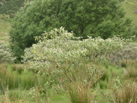
First biocontrol for woolly nightshade
 The first biocontrol agent for woolly nightshade (Solanum mauritianum) has now been released in New Zealand.
The woolly nightshade lace bug (Gargaphia decoris) was released in a forestry block in Tauranga by Environment Bay of Plenty who had made the first application to ERMA to release the lace bugs.
Since then releases have been made in Waikato, Taranaki, Northland, Manawatu-Wanganui, and at other sites in the Bay of Plenty. More widespread releases are planned.
We are looking forward to the lace bugs settling in and feeding on woolly nightshade. Having seen the potential for serious damage they have demonstrated in South Africa (the only other place where they have been released for biocontrol) and knowing that there will be less pressure from predators here, we are expecting positive results.The next step in the biocontrol programme will be to work towards releasing a second agent, which is likely to be a tiny weevil (Anthonomus santacruzi), which feeds on the flower buds.
Woolly nightshade is a major pest in the Waikato region because it invades open areas such as pastoral land, native forest margins and urban areas.
It grows quickly and produces large amounts of seed. For example, a single plant can produce up to 10,000 seeds. The seeds are spread by birds, and can remain alive ‘viable’ in the soil for 20 to 30 years before germinating.
Woolly nightshade can quickly establish large groups (or stands) of plants. It takes over an area by ‘crowding out’ other plants and stopping them from growing.
If you come across woolly nightshade:
- Don’t eat the berries - they are moderately toxic to people, especially children.
- Don’t touch the leaves - they shed fine hairs when touched, which irritate the skin, eyes, nose and throat.
- Keep stock away - berries may also be toxic to livestock.
Further information:
Chris Winks
Land Environments
Clever visualisation tool improves access to land resource information
 A new land visualisation tool has been developed to provide convenient access to extensive information about Māori land.
The tool has been designed and developed specifically for Māori land owners and land managers searching for their land blocks, and then wanting to know about the land resource characteristics and potential.
The tool, (http://whenuaviz.landcareresearch.co.nz) is available to everyone who has an interest in Māori land. It combines updated block (property and legal) data from the Ministry of Justice (Māori land online: http://www.maorilandonline.govt.nz/gis/) with environmental and land resource data from Landcare Research.
The tool can create a customised report of the environmental characteristics for any Māori land block in New Zealand, with land located by using either an interactive map or by searching for a block name or place name.
The tool generates a series of resource maps, statistics, and descriptive information detailing land resources and presents this information to the user as an interactive webpage. The data is displayed over topographic maps, satellite imagery and aerial photographs.
“This will provide landowners with an idea of the potential of their land blocks, including a ‘first cut’ land assessment showing areas at national scale suitable for horticulture, cropping, pastoral farming, forestry and areas needing long-term protection,” says Landcare Research scientist, Garth Harmsworth.
“There has been huge interest in the tool when we have demonstrated it at conferences and workshops around the country, especially from Māori land owners and Māori organisations such as trusts and incorporations, and many government departments.
“Māori have been waiting a long time to gain better and easier access to land resource and environmental data of their blocks.
“In future Māori land data can be linked to relevant data from many other sources. Already we have linked the tool to the National Library’s Digital NZ records, giving a wealth of historical and archival information for each Māori land block.”
Development of the tool was funded by Te Puni Kōkiri (Ministry of Māori Development).
Further information:
Garth Harmsworth
Sustainable Development
Magnetic South
 Landcare Research and the Christchurch City Council teamed up to organise an innovative public-driven online ‘game’ that discussed how the city could look in the future. The same ‘game’ could also be used by other regional and unitary councils to help tackle other difficult problems.
The Magnetic South event used an online tool developed in Silicon Valley, California, by The Institute for the Future and ran for almost 30 hours.
Magnetic South allowed participants to explore the future together by drawing on the collected knowledge of the crowd. As well as spotlighting unexpected challenges, it helped reveal new ideas and solutions to keep Christchurch vibrant and thriving in the next few decades.
It posed the question “In 2021, when talent and investment are in even shorter supply than clean energy, what will you do to attract them to Christchurch?”
Project Director Bob Frame says it was a critical question that captured the fast-changing world in which the future Christchurch must be a destination of choice for the talented, if it is to be the success it so dearly desires.
“The event encouraged people to think about life in the future. A lot of the ideas bouncing around at the moment are based on people’s current lifestyles and preferences – naturally. But many of the redevelopment decisions about to be made in Christchurch will impact people for generations to come, so it is useful to think about the longer-term.”
And, the answers came in thick and fast - almost 900 participants in 16 countries took part generating more than 9,000 ideas.
“That’s an average of six a minute, though at times it was many more. It highlights a genuine community commitment to engage in the exciting opportunity to rebuild the city in a way that will continue to attract talent and investment,” says Bob. Some ideas spanned as many as ten secondary ideas and one conversation went on for more than 25 exchanges.
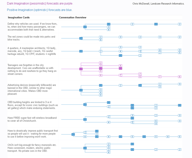
All the data is freely available online at http://blog.magneticsouth.net.nz/ and can be analysed by anyone. A unique visualisation created by Landcare Research’s Chris McDowall enables every conversation to be examined in depth.
 |
|
Magnetic South Micro-Forecast Chain Reactions |
Bob Frame says that consensus-based decision making has become increasingly popular over the last ten years, especially in areas where polarised views mean that competing priorities are difficult to meet. It is difficult because it often requires lengthy and expensive face-to-face meetings (and often lots of these if there are large numbers of stakeholders involved).
“Online participatory exercises can bring lots of people together at much lower cost (including time costs) than getting everyone physically assembled in the same room, and experiences around the globe are demonstrating how well these exercises can work.”
Christchurch Mayor Bob Parker, who was supporting the event, said Magnetic South was a great addition to the City Council’s successful ‘Share an Idea’ website and community expo initiatives.
“What makes Magnetic South different is we’re looking at the city from a future perspective. The decisions our forebears made in the 1800s, creating Hagley Park and the grid layout of our streets for example, continue to impact us today, and it’s important the decisions we make in redeveloping Christchurch also stand the test of time,” Mr Parker says.
This unique event – only one of a handful tried in the world - utilised new technology, and its limitations were exposed. Two hours before the event was meant to end, the US-based system crashed due to very heavy interest following an interview about the event on Kim Hill’s “Saturday Morning” radio show on Radio New Zealand.
“While the event was forced to end a little earlier than expected it still generated almost 9,000 ‘ideas’ on how to shape the city following several devastating earthquakes in the past nine months. This is an exceptional result that highlights a genuine community commitment to rebuild the city in a way that the community wants and in a way that will continue to attract talent and investment.”
Support for similar events has already been voiced by authorities leading the earthquake recovery as well as from other councils throughout New Zealand who are grappling with other challenging issues.
“Future events of interest to Landcare Research include more boutique crowd-sourcing events with perhaps no more than 500 people on quite specific issues in more focused environments. We will be discussing this with Christchurch City Council and the Christchurch Earthquake Recovery Authority,” Bob Frame says.
Further information:
Bob Frame
Climate Change
Igniting social knowledge about climate change
 Climate change and sustainability need to be ‘re-framed and re-imagined’ as locally understood and relevant issues before most New Zealanders will embrace low-carbon lifestyles, according to a leading group of social scientists.
A new report,
‘Degrees of Possibility: Igniting Social Knowledge around Climate Change’, says climate change has been framed as a singular, global and temporally distant problem, removed from people’s immediate concerns and everyday lives.
Landcare Research social scientist, Alison Greenaway, one of the report authors, says that in replacing the doomsday discourse of climate change with an imaginative and aspirational one we need a uniquely New Zealand perspective.
“Climate change needs to be connected to our sense of identity. We need to understand what a changing climate will mean for our lifestyles and cultures, what we value, for our agricultural and biological economies, and we need to collectively find our own ways to adapt.”
Alison teamed up with counterparts, Brendon Doody of GNS Science and Karen Cronin of ESR, together with the New Zealand Climate Change Centre to produce the ‘Degrees of Possibility’ report.
“The report presents a unique New Zealand take on the current state of social knowledge around climate change, highlights key questions that need to be addressed and potential processes for future engagement and interdisciplinary collaboration.”
The report followed a December 2010 workshop with the same title, attended by 110 people. The aim of the workshop was to facilitate dialogue within the social science community, and between social scientists and biophysical scientists, around climate change.
“We believe there are four important ways that social science is contributing to dialogue about climate change,” says Alison.
- Improving social understanding of climates and the relationship between climate and societies;
- Providing new perspectives and potential breakthroughs in the debates around climate change, and supporting cohesive social discussion and constructive policy development;
- Applying and developing social science knowledge and tools to create new insights and pathways for institutional transformation, organisational learning and social change;
- Providing evidence to support decision makers in institutions and organisations.
The report recommends three key research themes to be considered in the development of a New Zealand social science research agenda for climate change:
- General framework for enquiry: How are we making sense and responding to the phenomena of global change, including human-induced climate change?
- Changing practices in everyday life: How well do we understand the specificities of resource-intense everyday practices in New Zealand? How can resilience and adaptation be introduced without undermining our commitments to quality of life and social cohesion?
- Enhancing institutional capacity: How can we enhance organisational capacities for understanding and addressing climate-related practices across organisations and sectors?
Alison, Brendan and Karen are now developing their next phase of work with the Royal Society of NZ, UNESCO, the NZCCC, BRCSS and He Waka Tangata to address these suggestions and further support the production of social knowledge around climate change.
Further information:
Alison Greenaway
Points of Interest
Landcare Research website survey
We’re asking for assistance from key stakeholders to improve our public website.
The online survey will take you just 5 minutes and is aimed at finding out what you think we could do to improve our online presence.
Here’s the link: https://www.surveymonkey.com/s/LCRWebsite
Please note: The newsletters are to keep territorial authorities informed about current research projects. The news items may include interim results that have not been peer reviewed. They should not be disseminated or quoted without first contacting the person mentioned at the end of each item.