Distribution and abundance

Adélie penguin colony being photographed from a helicopter. Image - Phil Lyver
During this study we have refined techniques of aerial reconnaissance and photography for use as a bird census technique in the Antarctic.
The first flight was undertaken on 6 December 1981.
Aerial reconnaissance
Using a C130 Hercules, the Victoria Land coastline has been searched from the air, to locate the Adélie colonies in the Ross Sea Region.
Aerial photogaphy
Adélie penguin colonies are photographed from a helicopter or C130 Hercules, initally using high-speed, fine-grain, black and white film. Since 2005 a medium format digital camera has been used. Photography is carried out in late November or early December to coincide with the incubation phase of breeding. At this stage in the cycle, one bird is incubating while its mate is at sea feeding. As there are few non-incubating birds ashore, an accurate count of breeding birds can be obtained. From these aerial photographs we are able to count the number of breeding pairs in each colony and establish baseline data on population trends.
 |
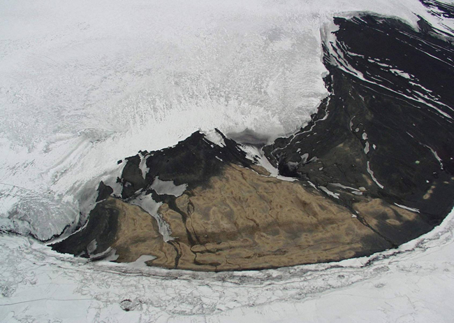
| Aerial photograph of Cape Bird Adélie colony, Ross Island |
Counting
The images are processed and printed. The colony is then marked up, the images are fitted together like a jigsaw puzzle and the areas to be counted on each image delineated. This ensures each breeding bird is included only once. The images are then counted using a semi-automated counting programme.
 |
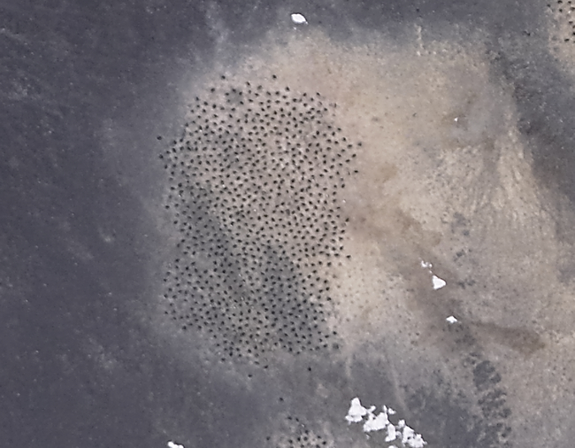
| Adélie subcolony photographed using a medium format digital camera. Each black dot represents a male penguin sitting on eggs (incubation) while his mate is at sea feeding. Both parents share care of the eggs and chicks. |
 |
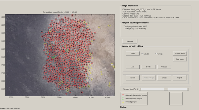
| Semi-automated penguin counting program (SAPC); each red circle represents one breeding pair automatically counted, yellow circles indicate a where a SAPC "penguin" has been manually removed from the count, green circles represent where a penguin has been manually added to the count. |
