Māori land visualisation tool
Manaaki Whenua is looking to further develop a tool that allows Māori land owners and managers to look at their land and access information to help them better understand the resources and potential.
The prototype land visualisation tool was launched last year and is available to everyone who has an interest in Māori Land. It combines updated block (property and legal) data from the Ministry of Justice (Māori Land Online) with environmental and land resource data from Manaaki Whenua.
This year, with further support from Te Puni Kōkiri (Ministry of Māori Development), the options to extend the tool and develop a sustainable platform for its ongoing availability and development are being considered.
The prototype provides landowners with a “broad brush” land assessment by showing areas at national scale suitable for horticulture, cropping, pastoral farming, forestry and areas needing long-term protection. However, the aim of new research is to improve the level of information available and enable the tool to be used as the basis for land use decision-making and development of the Māori economy.
The work will include engagement of Māori Land owners and organisations to build a picture of the information that will help them – individually or collectively – to determine the best land-use options for their land.
The technical development that enables the apparently simple delivery of multiple underlying layers of complex information calls on the skill of the Informatics science team at Manaaki Whenua. They essentially translate GIS layers into a visual format similar to Google Earth – this makes it intuitive for end-users, who do not need special software or skills to be able to access and explore the land information of interest to them. The future in this type of information delivery is exciting and Manaaki Whenua is adding this accessibility to a range of the online products and services it provides that are used to help understand, monitor and manage New Zealand’s land resources.
The prototype tool remains available at http://whenuaviz.landcareresearch.co.nz and here users can already:
- create a customised report of the environmental characteristics for any Māori Land block, with land located by using either an interactive map or by searching for a block name or place name
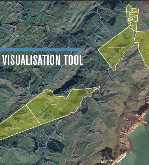
- generate a series of resource maps, statistics, and descriptive information detailing land resources and it presents this information to the user as an interactive webpage. The data is displayed over topographic maps, satellite imagery and aerial photographs.
“There has been huge interest in the tool when we have demonstrated it at conferences and workshops around the country, especially from owners of Māori Land and Māori organisations such as trusts and incorporations, and many government departments,” says Garth Harmsworth of the Manaaki Whenua development team.