Issue 8, March 2013
In this issue:
|
Editorial
Evidence & Policy
I see that the relationship between evidence and policy is one of the most prominent topics of conversation between the Prime Minister’s Chief Science Advisor, Professor Sir Peter Gluckman and his counterparts around the world.
In a recent speech to IPANZ members, Sir Peter talked of the increasing recognition that many global, regional and local risks have a major scientific and or technological component to either their origin or solution, and the problems that citizens want their politicians to solve are increasingly complex.
He notes that policy decisions are based on trade-offs across values domains such as affordability, public opinion, and political ideology. “However, effective policy formation must also incorporate the use of objective evidence. Without such, the options and the implications of various policy initiatives cannot be measured against fact and when this happens judgment can only be on the basis of anecdote, dogma and belief.
And an interesting observation: “Scientists tend to overestimate the utility of what they know and policy makers underestimate what they do not know.”
At Landcare Research we are continually looking to improve the way we develop and provide evidence to support your policy decision making. So I’m delighted to advise that Justine Daw – who many of you will know from her prominent roles in environmental and science management with MfE, FRST, MSI and MBIE – has joined our senior leadership team as General Manager Science and Policy.
Justine brings to the position a wealth of skills and experience at a time when, As Sir Peter noted, those abilities are most required.
Some examples of our recent research work that supports policy decision making are highlighted in this edition of our newsletter. With a growing appreciation of the value of ecosystem services, we have undertaken an assessment of grass land that would be suitable for native forest restoration in an ecosystem services market. And as we need to prepare for a changing climate we have identified the parts of the country that will be most susceptible to erosion.
I hope you find this edition interesting. As always, I would welcome your feedback.
Dr Richard Gordon
Chief Executive
Biosecurity
 New key to aid plant identification
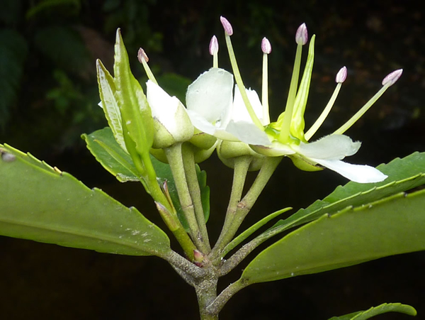
A new online tool will help biosecurity staff quickly determine the genus of any flowering plant they are trying to identify.
While it won’t formally be completed for another couple of months, the key to Flowering Plant Genera of New Zealand is available online now and Allan Herbarium research leader Dr Peter Heenan says the initial feedback has been very positive.
“A lot of people who need to identify plants are not flora experts,” says Peter. “We have created this easy-to-use key that is free of technical jargon where possible, and there is a guide on how to use it.
Dr David Glenny, who built the key, says a user can click on any of 61 visible characteristics of a plant to determine the genus. “By choosing just a few characteristics – if it has hairy leaves and yellow flowers, for example – you quickly narrow down the search results,” says David.
There are over 1,000 genera of plants wild or naturalised in New Zealand. Peter says quickly identifying the genus of a plant is the importantfirst step in determining its bio-status.
“The key is certainly a quicker and more user-friendly way of identifying a genus than wading through a technical flora,” he says, picking up a 1300-page volume of Flora of New Zealand.
Three years’ work, funded by the Terrestrial and Freshwater Biodiversity Information System (TFBIS) Programme, has gone into the development of the key.
Landcare Research is also completing a key for identifying New Zealand’s 124 native orchids. This species-level key adds to existing online resources for the identification of nationally important weeds, Coprosma species, grasses and native plants of schools and marae.
For more information: David Glenny
Sustainable Development
LUMAN - informing regional policy development
A Landcare Research initiative could assist government agencies, business and community organisations to improve land use policy development, management strategies and communication with stakeholders.
The Land Use Modelling and Analysis Network (LUMAN) aims to consolidate the research efforts of three organisations with complementary land-use modelling and analysis expertise: University College Dublin (UCD) in Ireland (www.ucd.ie), the Flemish Institute of Technological Research in Belgium (www.vito.be), and Landcare Research in New Zealand.
Landcare Research LUMAN project co-leader Dr Daniel Rutledge says the four-year programme is exciting because of the potential to develop innovative tools that government agencies could apply to a wide range of problems, particularly in resource management and spatial planning.
“The trend for this sort of information is propelled by the growing understanding that policy-making should be based on integrated and evidence-based approaches,” says Daniel. “Technological growth also allows more sophisticated approaches.”
“Models of land-use and land-use change provide an organising framework for characterising interactions between the various physical, socio-economic and climatological processes. Defining the key elements in the system and how they interact is a reflexive learning experience and brings about greater understanding of how the system works.”
He says advances in systems theory and computing power offer real potential, particularly in spatial modelling. “A key challenge we are working on is how to effectively link models and ensure they retain their integrity. Other challenges are the complexity of the issues, differences in language and communication, and in problem perceptions.”
“The increasingly complex ‘wicked’ problems posed by sustainable development demand better approaches. The emergence and possible convergence of complexity science, enhanced data acquisition from improved remote sensing techniques and enhanced regional monitoring networks including real-time sensor networks, and evolving approaches in informatics such as semantics offer the possibility to overcome these hurdles.”
A recent Statistics New Zealand survey of planning and policy organisations showed land-use information was very important to their core business.
“Land-use and land-use change information supports a number of critical functions including: state of environment reporting, monitoring impacts of land-use trends on the environment, assessing implications of different land uses for resource management, providing a basis for modelling scenarios of future land-use change, and demonstrating the urban and rural characteristics of land-use change.”
The LUMAN project will help support the ability of central and regional government and research organisations by:
- increasing capability in the critical area of land-use and land-use change characterisation, modelling, and analysis
- improving the range of tools and datasets available to end-users for use in policy development, planning and resource management, and monitoring and reporting
- fostering uptake and application of advanced decision support tools through sharing of knowledge, and developing new, innovative approaches and decision support tools in collaboration with European counterparts.
Likely applications of improved decision support tools and knowledge by New Zealand organisations could include:
- forecasting national trends for key resources (e.g., carbon emissions, ecosystem services)
- supporting formulation of regional policy to insure the integrated, sustainable use of natural resources
- evaluating options for the optimal use of land to meet multiple cultural, economic, environmental and social outcomes
Further information: Daniel Rutledge
Land Environments
Future erosion hot spots identified
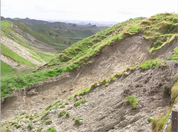 The parts of the country most susceptible to increased erosion as our climate changes have been identified by a Landcare Research-led team.
“The worst affected areas are likely to be the soft rock hill country of Taranaki, southern Waikato, Manawatu-Wanganui west of the Ruahine Range, Otago, South Canterbury and inland Marlborough,” says research leader Dr Les Basher.
“However as rainfall and river flows increase, river bank erosion could become increasingly severe in many parts of the country.”
With climate change, annual rainfall is predicted to increase in the west and south of the country, and decrease in the east and north. Heavier and/or more frequent extreme rainfalls are likely, especially in areas where annual rainfall is predicted to increase.
By 2080-2099, most places are projected to experience nearly twice as many 24-hour extreme rainfall events with a 100-year return period as occur at present. Increased windiness and incidence of drought are predicted, particularly in the east of the country.
“Storm rainfalls are an important influence on the rate of most erosion processes,” says Les. “Projected increases in extreme rainfalls will play a critical role in determining the effect of climate change.”
The team also considered erosion control options. “Expansion of plantation forests onto erodible hill country will be an effective means for countering increased storminess and erosion, with generally improved growth under elevated CO2 concentrations. Although climate change will increase wind damage to forests and increase fire risk, particularly in eastern areas.”
The review of climate change impacts on erosion processes and control methods was undertaken by a team comprising experts from Landcare Research, NIWA, GNS Science, AgResearch, Plant & Food Research and Scion. The work is part of the Ministry of Primary Industries’ Sustainable Land Management and Climate Change (SKMCC) research programme.
Further information: Les Basher
‘Plenty of opportunities’ for indigenous forest restoration
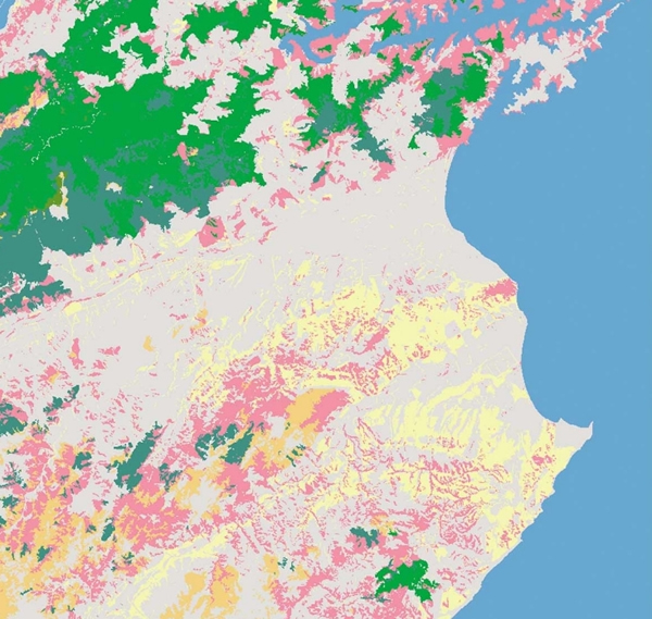 Two million hectares of marginal grassland suitable for restoration as indigenous forest through an ecosystem services market have been identified by Landcare Research scientists.
“If we were to restore indigenous forest to achieve ecosystem service benefits, then the most suitable land has the lowest productive value and the highest potential ecosystem services value,” says lead researcher, Dr John Dymond.
Combining a map of basic ecosystems at 2008 with national datasets of agricultural production, the team undertook a nationwide assessment of all grassland. “With 2 mha of land suitable for conversion, there are plenty of opportunities for restoration,” says John.
“If/when an ecosystem services market is/was established, this is where landowners would be most likely to choose to change land use. It is here that the revenue from enhancing ecosystem services is most likely to offset the loss of revenue from farm production.”
John says it’s not widely known that about 51,000 ha of indigenous forest was cleared in New Zealand between 1990 and 2008, primarily on private land.
“So the extent of our indigenous forest area is still undergoing change. We currently have over 1 mha of shrub-lands, much of which is reverting back to indigenous forest.
“We need to continue to monitor the extent and condition of indigenous forests on a national basis to ensure our management is achieving its desired goals.”
Further information: John Dymond
Reference: Opportunities for restoring indigenous forest in New Zealand
An innovative, low-cost method for assessing soil carbon in paddocks
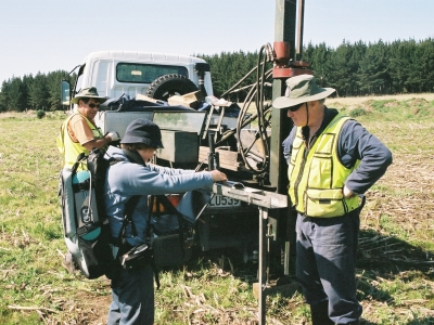 Landcare Research scientists have developed a cost-effective alternative to the traditional approach to assessing soil carbon through laboratory analysis.
Palmerston North-based scientists Pierre Roudier, Carolyn Hedley and Craig Ross studied the accuracy of two ‘proximal sensing’ technologies.
Proximal sensing is the term for techniques that are used close to the ground – typically one millimetre to one metre – as opposed to remote sensing, which involves aircraft or satellite sensing platforms.
The trio used ‘on-the-go’ proximal sensing (usually attached to or towed by a tractor or quad bike) and static ‘on-site’ proximal sensing technologies. Both are suitable for characterising soil variability at a very fine scale.
“Soil carbon stocks can vary significantly across a paddock so we wanted to see if the two technologies could enable us to refine methods of assessment,” says Pierre.
Two comparative mapping strategies were then undertaken on a 68 ha arable field. The first method used conventional laboratory analysis of soil organic carbon for 100 samples collected across the field. These point data were combined with on-the-go electromagnetic (EM) survey data that included elevation data used to create a 5m resolution elevation model of the field.
The second strategy used visible near infra-red spectroscopy (VNIR) to estimate carbon stocks across the same field. Soil organic carbon has specific spectral ‘signatures’ in the near infra-red range of the light spectrum. Spectroscopy is a non-destructive technique and potentially very cost-efficient if fewer laboratory analyses are required. The soil cores, collected to 30 cm depth, were scanned in the field at 1 cm intervals before being taken away for laboratory analysis.
To estimate the number of physical samples needed to accurately calibrate the VNIR spectra, the model’s performance was assessed repetitively using 10 different-sized sets of the soil analyses, ranging from 10% of the soil sample through to all the soil samples.
Pierre and his colleagues found that VNIR could accurately predict the spatial variability of soil organic carbon using only 40% of the soil samples as a calibration set, and hence significantly improve the efficiency of digital soil mapping.
Additionally, the core scanning procedure provides a direct measurement of soil carbon at 1-cm intervals, improving depth resolution, and detecting subtle but important changes that may occur at each centimetre of soil profile.
“In order to keep the number of lab analyses to a minimum and improve the prediction performance, we are developing a national spectral library, based on the National Soil Archive in Palmerston North, dedicated to soil attributes prediction from cores,” says Pierre.
Further information: Pierre Roudier
NLRC Update
National Land Resource Centre Director Dr Alison Collins provides a brief update including the work with 16 agencies in creating a National Science Challenge submission, and a recent survey of capability within the sector.
 Video -
Further information: Alison Collins
Biodiversity
Seven rules for successful mammal pest eradication
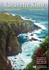 As the concept of a predator-free New Zealand (PFNZ) gains momentum, Landcare Research scientists Andrea Byrom and John Parkes have come up with the ‘Seven Rules’ for eradication of mammals at any scale.
The rules are outlined in an article in the latest edition of Kararehe Kino, Landcare Research’s Vertebrate Pest Research newsletter, which focuses on how science can contribute to PFNZ.
In a nutshell the seven rules are:
Rule 1: All animals must be put at risk.
Rule 2: Pest species must be killed at rates faster than their rate of increase.
Rule 3: The risk of recolonisation must be zero.
Rule 4: Social and economic conditions must be conducive to meeting the critical rules.
Rule 5: Where the benefits of management can be achieved without eradication, discounted future benefits should favour the one-off costs of eradication.
Rule 6: Animals surviving the campaign should be detectable and dealt with before numbers can increase.
Rule 7: There must be no net adverse effects.
For more on the Seven Rules, see the latest edition of Kararehe Kino or contact Andrea Byrom, the Managing Invasive Weeds Pests and Diseases Portfolio Leader.
For those based in Wellington, Andrea will be speaking about PFNZ in a free public lecture, ‘Pesty Science: Is Predator-Free NZ a reasonable reality or an impossible dream?’ at Victoria University, this Thursday, 21 March 5:30-6:30pm. To reserve a seat, phone 04 472 1000 or email rsvp@vuw.ac.nz with “Predator-Free NZ” in the subject line.
On the same day in Wellington, Landcare Research scientist Dr Bruce Warburton will explain a novel way of conveying the complexities of pest management at a Landcare Research Link seminar being held at the DOC Level 4 Conference Room, from noon to 1pm. Contact Christine Harper for more information.
Landcare Research scientist on international biodiversity platform
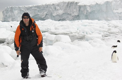 Landcare Research ecologist Dr Phil Lyver is one of just 25 scientists from around the world to be elected to the Intergovernmental Platform on Biodiversity and Ecosystem Services (IPBES).
The platform, which will assess the state of the planet's biodiversity and ecosystems, has been modelled on the Intergovernmental Panel on Climate Change (IPCC).
Terrestrial, marine, coastal, and inland water biodiversity provides the basis for ecosystems and services that underpin human well-being. However, biodiversity and ecosystem services are declining at an unprecedented rate and the Millennium Development Goal (MDG) target of a significant reduction in the rate of biodiversity loss around the world by 2010 was missed.
In response to this crisis, more than 90 governments, including New Zealand’s, met in Panama City in April 2012 and agreed to establish the Intergovernmental Platform on Biodiversity and Ecosystem Services (IPBES).
IPBES is expected to be a leading global body providing scientifically sound and relevant information to support more informed decisions on how biodiversity and ecosystem services are conserved and used around the world.
Phil is best known for his research on seabird populations in New Zealand and Antarctica, and for his work integrating western science and traditional knowledge.
Further information: Phil Lyver
Allan Herbarium upgrade
Landcare Research’s Allan Herbarium, the largest of its type in New Zealand with 620,000 specimens, has undergone a $1.2 million upgrade.
The herbarium is an essential resource in the support of biodiversity and biosecurity decision making, and is equally valued by researchers and members of the public.
 Video - Allan Herbarium upgrade
Further information: Ines Schoenberger
Please note:The newsletters are to keep MfE and EPA informed about current research projects. The news items may include interim results that have not been peer reviewed. They should not be disseminated or quoted without first contacting the person mentioned at the end of each item.