Unleashing the full potential of S-map Online through practical training courses

Sharn Hainsworth explaining aspects of S-map online in a hands-on session.
S-map Online is a national soils database that aims to provide fast, simple access to New Zealand soil data. Earlier soil databases were patchy in scale, age, and quality and many maps did not adequately describe the underlying properties of the soil types they represented. In partnership with funders such as regional councils, existing reports and digital information are being integrated and soil maps updated where existing data are of low quality. New areas of coverage are being added as they are completed, with the aim of achieving nationwide coverage at a 1:50,000 scale by 2020. A recent update added data for an additional 7,000 ha in Canterbury, 351,000 ha in Hawke’s Bay, and 376,000 ha in the Waikato.
The data provided by S-map Online allow users to explore interactive soil maps, view detailed information about soil classes or attributes, create custom PDF soil maps for printing, and download soil factsheets for specific locations. However, confident end-users are required for the data to be utilised to their full potential, and a recent survey revealed significant demand for more education about S-map, what it can be used for, and how it can be applied.
In response, Landcare Research teamed up with Hawke’s Bay Regional Council to run two half-day pilot workshops in early August 2016. The Envirolink-funded workshops focused on building understanding of soils and general awareness of the value of Landcare Research’s soil information.
After an introduction from Dr Alison Collins (Director, National Land Resource Centre) and Dr Barry Lynch (Team Leader, Land Science, Hawke’s Bay Regional Council), Dr Malcolm McLeod began by presenting a journey through the NZ Soil Classification, with a subsequent session diving into S-map Online. This was followed by practical breakout sessions where participants had the opportunity to use S-map Online and probe the minds of Landcare Research S-map experts.
More than 60 participants from regional and district councils, industry groups (e.g. Fonterra, Heinz Watties, Balance Agri-Nutrients, Irricon Resource Solutions, McCain Foods, HB Wine Growers, AgFirst, Abron) and local iwi (Ngāti Kahungunu) participated. Post-workshop feedback was overwhelmingly positive and many participants indicated their desire for other training (such as in SedNet NZ, Land Use Capability Classification, and understanding soils in the field). The workshops provided a great opportunity to build capacity in using S-map and gain feedback on how it could be improved, which will ultimately ensure S-map is used to create impact. Other regional councils have subsequently indicated their interest in hosting similar workshops, and Landcare Research is investigating the option of providing accredited training.
If you are interested in hosting or attending a workshop, have a request for other science-based training or want to incorporate training within your organisation’s accreditation schemes, please contact Alison Collins or Daina Grant for more information.
ALISON COLLINS AND DAINA GRANT – LANDCARE RESEARCH
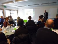
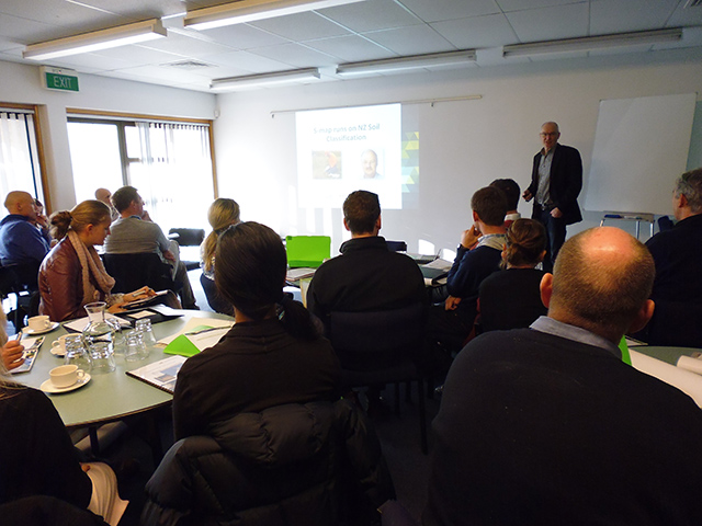
Dr Malcolm McLeod presenting to a packed room.
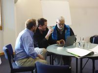
Sharn Hainsworth explaining aspects of S-map online in a hands-on session.