Land Use - Delivery and Visualisation
Within the IDA programme, a set of infographics and geovisualisation tools has been created that help users better understand land resource data and explore spatio-temporal changes for land resource data at a variety of scales and soil data uncertainty. These visualisation products are viewable online at http://vizdemo.landcareresearch.co.nz/.
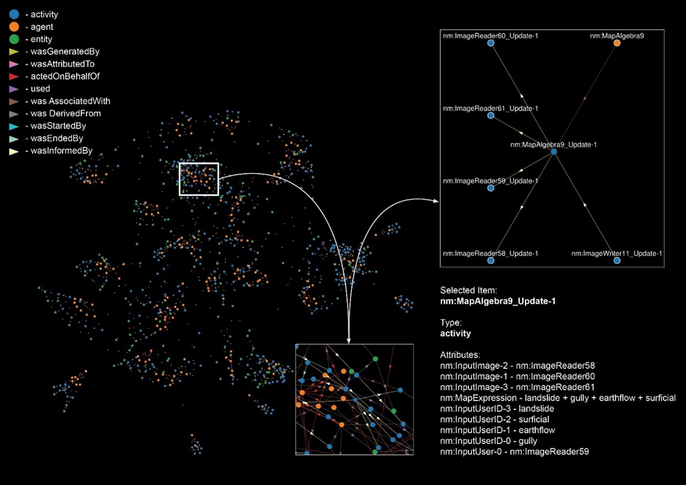
Two interactive visualization tools were designed and implemented to help visualise data provenance data created by pyluc and LUMASS. ‘Provis’, a web-based tool utilising the ‘D3’ JavaScript library, is capable of visualising very data large provenance files in a way that makes them easier for modellers and researchers to understand.

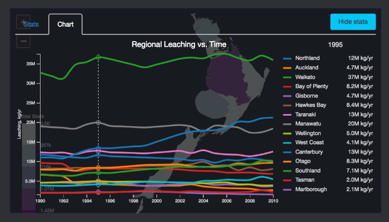
Visualising nitrate leaching change over time with cartograms and choropleth maps, using summarised nitrate leaching data at Regional Council and Territorial Authority levels. This visualisation uses bivariate data, in that the cartogram shape displays one variable (nitrate leaching), while the colours displays another (total stock).

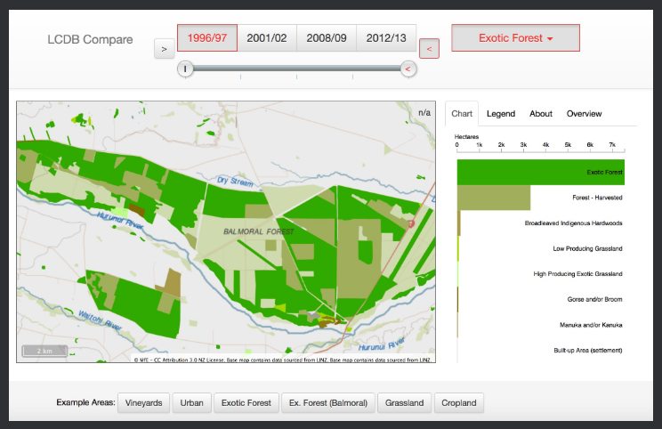
Visualising localised landcover change over time, using LCDB data, with linked bar chart displaying landcover area per class. The visualisation make use of vector tiles, packets of geographic data, packaged into pre-defined roughly-square shaped 'tiles' for transfer over the web.
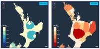
Visualising landcover change over time with cartograms and choropleth maps, using summarised LCDB data at Regional Council and Territorial Authority levels. The tool illustrates two ways for visualising regional summaries over time.
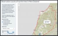
Visualising myrtle tree occurrence data in New Zealand to help mitigate biosecurity threats.
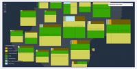
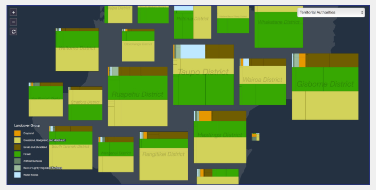
Treemaps of summarised LCDB data at Regional Council and Territorial Authority levels. Treemaps display hierarchical (tree-structured) data, in this case landcover, as a set of nested rectangles.
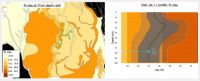
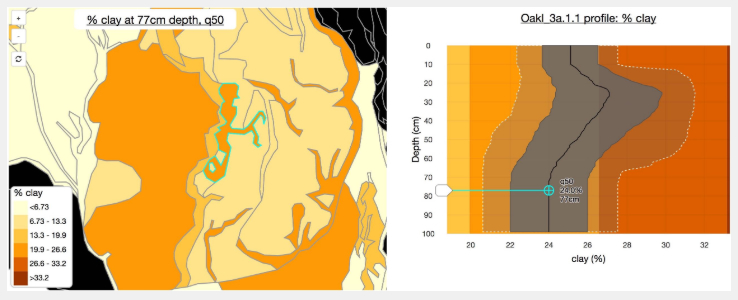
Visualising uncertainty and variability within S-map data, using a choropleth map linked to interactive charts.
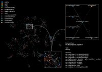
Representation of SedNetNZ data provenance using interactive visualization tool - force-based view