Land Use - Modelling for Indicators
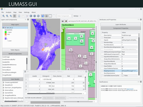
Manaaki Whenua -- Landcare Research, and the IDA team in particular, is leading the research on ecosystem services mapping and modelling and has contributed to international initiatives such as the Intergovernmental Platform on Biodiversity and Ecosystem Services (IPBES) that reviewed the state and trends of biodiversity and ecosystem services across the Asia and the Pacific (IPBES 2018; Ning et al. 2018). We developed models to map ecosystem services at the national scale in a previous MBIE programme. These models were transferred into LUMASS (the Land Use Management Support System) software and updated LUMASS to use the latest land use map developed by Manderson et al. (2018). LUMASS is a software developed at Manaaki Whenua for spatial dynamic modelling.

Land use and land cover information is fundamental to understand pressure and state of our environment. We used our knowledge on land use to update a new set of ecosystem services spatial layers, including data for greenhouse gas emission, nitrate leaching, water yield, sediment lost, and sediment retained. These datasets are available through the LRIS portal. These indicators are essential to inform environmental reporting purposes (Ausseil & Manderson 2018; Ministry for the Environment 2018; Rutledge et al. 2015), or nutrient budgeting (Singh R 2018). More work is still required to refine concepts of land use intensity and how intensity impacts on our soil and water (Manderson 2018).
References
IPBES 2018. Summary for policymakers of the regional assessment report on biodiversity and ecosystem services for Asia and the Pacific of the Intergovernmental Science-Policy Platform on Biodiversity and Ecosystem Services. Bonn, Germany.
Manderson AK 2018. Land use intensity workshop: Summary of key findings. Manaaki Whenua Landcare Research contract report for the Ministry for the Environment.
Manderson A, Lilburne L, Hewitt A, Pollacco J, Carrick S 2017. Recommendations and interim soils data to support the development of a national freshwater reporting model. Landcare Research Contract Report LC2380 for the Ministry for the Environment.
Ning W, Wang C, Ausseil A, Alhafedh Y, Broadhurst L, Lin H, Axmacher J, Okubo S, Turney C, Onuma A, Chaturvedi R, Kohli P, Apadodharan S, Abhilash P, Settele J, Claudet J, Yumoto T, Zhang Y 2018. Asia-Pacific: Chapter 4. Direct and indirect drivers of change in biodiversity and nature’s contributions to people.
Rutledge DT, Price R, Hart G 2015. National guidelines for monitoring and reporting effects of land fragmentation. Landcare Research Contract Report LC2144 for Regional Council Land Monitoring Forum.
