Sustainable land environments
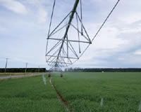
Irrigation. Image – Cissy Pan.
Vision: By 2012 regional councils and other relevant groups adopt strategies that focus on integrated management of ecosystem services for a full range of environmental, social, cultural, and economic co–benefi ts.
An estimated 17% of New Zealand’s Gross Domestic Product depends upon the health of the top 15 cm of soil. This supports most of our country’s primary sector production, the landscapes on which our tourism depends, and the quality and supply of our water in many places. It also provides a sink or buffer for many of the pollutants we put into the environment, and it stores more carbon than above–ground vegetation does.
Yet the land environment is a fragile resource. Pressures on land environments from urbanisation, forestry, lifestyle blocks, and alternative crops are increasing the intensity of production in remaining areas. Society is starting to face fundamental choices between economic well–being from intensified primary production and retention of other environmental assets such as landscape and water values.
Our work provides understanding of the basic biophysical processes in the soil and terrestrial ecosystems and how they respond to the pressures of economic land use. We work at a range of scales from the microscopic in soil and plant structures, through to regional and national integration of land environment knowledge. Integration is a unifying theme. We take a systems approach at all scales, bringing together different disciplines (natural, social and economic sciences) and stakeholders (government, landowners and business). We seek to make the ’big picture’ clearer for all parties, revealing the connections and inherent trade–offs in that picture, and to provide tools to help groups make choices about the future.
Some examples from 2007/08:
The Creating Futures FRST programme, led by Environment Waikato, is exploring future regional scenarios in the Waikato in the form of dynamic maps of changing land use and related social, economic and environmental matters. Our role is to manage the integration of diverse information sources in a spatial model for long–term, integrated policy analysis. This means integrating the skills of eight New Zealand and overseas organisations with very different backgrounds. In 2007/08 we settled on the basic framework and likely components of the Waikato Spatial Decision Support System (SDSS). These will include a dynamic economy–environment model (input/output), climate scenarios, demography, hydrology, water quality, zoning, dairying, terrestrial biodiversity and land use change models. When complete in 2010 the SDSS will greatly assist the regional council and Waikato communities in choosing realistic, integrated goals for economic development, environmental quality and social well–being. (See www.creatingfutures.org.nz)
In 2004 floods, 20,000 hectares were lost from the Manawatu Region’s farmland causing $300m of damage. Since then, our erosion science has helped to support the Horizon Regional Council’s strategy to manage the multiple pressures and impacts of land use in an integrated way. The council intends to spend $80m bringing about land use change and implementing soil conservation throughout hill country in the region, initially following a ‘first come first served’ basis for assistance with developing and implementing farm plans. However, our modelling work showed that this approach reduced sediment yields and turbidity in the Manawatu River by less than 10%. However, prioritising 500 of the highest priority farms produced a 50% reduction. The economic value of this research could be argued to be up to $40 million (assuming the benefits accrue equally to farmers and the wider community).
The erosion work coming out of the Manawatu has been rolled out to all the North Island regional councils in the form of erosion models. MAF paid for this out of its Hill Country Erosion project so that land with high risk of erosion could be targeted in its Afforestation Grant Scheme (AGS), through which $50m will be spent to encourage new forestry by buying the associated carbon credits from landowners.
Soil science has been in a hiatus in New Zealand and maintaining a succession of skilled scientists has been challenged by uneven science funding. A critical need for land management is having good quality data about our soils, and the ability to interpret it for the multitude of scenarios confronting landowners. Investment in new models must be matched by investment in the data that will enable them to be used effectively. This year we started a process to seek multi–party funding for S–Map – a digital soil mapping initiative that combines the best of the old data with new data for a significantly upgraded national soil map and database. S–map underpins the application of new environmental and sustainable production models at landscape, regional and national scales. Increasingly complex issues such as matching land use decisions to land capability, and nutrient, pollutant, groundwater and carbon management require more sophisticated models that in turn need more sophisticated soil data.
Landcare Research is part of IRAP (Integrated Research for Aquifer Protection), which also includes Crop & Food Research, AgResearch, Dairy NZ, ESR, Lincoln Ventures, Aqualinc, Environment Canterbury, and Environment Waikato. Landcare Research has been one of the developers of AquiferSim, which simulates what happens when nitrate from various agricultural land uses leaches to groundwater. This is vital for testing the effect of different policy options for tackling the cumulative effects of intensive land use. This year we installed AquiferSim on Environment Canterbury’s network so they could begin testing it. Aspects that have impressed users are the speed of AquiferSim in processing the different land use scenarios and environmental variables, and its deceptively simple visual outputs that show where nitrate moves through the aquifer. There is considerable interest from other regions as well.
While soil quality literally underpins the sustainability of land use, pests and diseases have a huge impact on biodiversity, land use and productivity. Elimination of bovine–Tb in domestic herds is critical to market access for our exports. New Zealand’s pastoral industries have relied heavily on the use of 1080–poison to control wildlife vectors of Tb – feral pigs, ferrets and possums – with the latter being the most significant vector. With ongoing public concern about the use of 1080 we have continued our research into reduced application. Two years of trials in the Central North Island showed that effective possum control could be possible with an 80% reduction in the quantity of 1080 used – as little as a few hundred grams of bait per hectare.
Other work undertaken by Landcare Research on Molesworth Station in the South Island demonstrated that by concentrating on ‘hotspots’ with higher densities of wildlife vectors, particularly possums, the amount of 1080 needed to achieve effective disease control can be dramatically reduced. This highly targeted approach was not only effective in reducing Tb to very low levels in sentinel species (pigs), but was also considerably more cost–effective than broadacre aerial baiting and dramatically reduced the amount of 1080 in the environment. The work also unequivocally demonstrated the limited role wild pigs play in maintaining Tb, with prevalence of the disease in pigs declining quickly once effective possum control was achieved. Further research into low–sowing techniques, combined with highly targeted possum control, is taking place next year.