Research highlights
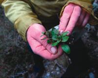
Field botany
Measurement framework for biodiversity
In June 2010, the Department of Conservation (DOC) reached a significant milestone in the development of a national biodiversity monitoring and reporting system. DOC approved the system’s general design and is now moving forward with developing detailed design and implementation options.
Over the last three years, we have worked with DOC on designing a new system that could provide a comprehensive picture of the ecological integrity of New Zealand’s native species and ecosystems. In addition, Landcare Research played a significant consultative role around the potential adoption of the system. We developed responses to a comprehensive FAQ list compiled by DOC staff, produced case studies to illustrate how the system would work, and presented a series of seminars to Wellington and regional offices. One of our Capability Fund projects developed arguments as to the utility of the new system, where the old approaches were failing, and how the new system was cost–effective because it would build on the existing LUCAS network; DOC managers commented that these arguments were ‘persuasive’.
Up until now, most of DOC’s biodiversity monitoring has been carried out at a local level to meet specific local needs; information cannot be aggregated and there are significant gaps. Implementation of the new monitoring protocols will capture information across all of the DOC estate. Regional councils and Ngā Whenua Rāhui are also looking at adopting the system. More easily shared data will result in better decisions by all managers, leading to improved conservation outcomes. And importantly, the new system will enable New Zealand to start telling a more complete story of this country’s biodiversity and meet its Biodiversity Strategy goals.
NVS Express
The National Vegetation Survey (NVS) Databank is the national repository for plot–based vegetation survey data and covers the full range of New Zealand and offshore island environments. It contains records from approximately 77,000 vegetation survey plots including over 19,000 permanent plots, with data spanning more than 50 years. The NVS Databank has a fundamental role in many national monitoring systems and underpins models of carbon sequestration.
This year, we launched ‘NVS Express’ — a purpose–built Windows tool for entering, summarising, and analysing vegetation data compatible with the NVS Databank. It accepts data collected using the NVS standard forest monitoring (i.e. permanent 20 × 20 m plots) and vegetation inventory (i.e. Recce) methods.
Features and benefi ts include built–in data validation services and a range of post–entry dataset checks that ensure data integrity. NVS Express gives users the ability to summarise data (tabulations, cross–tabulations, histograms, and summary statistics) and analyse temporal changes in permanent plot data, including growth and mortality of individually tagged trees.
Prioritising conservation management using the Vital Sites Model
We have developed an approach to modelling biodiversity and the threats to its viability in order to identify places (‘Vital Sites’) where conservation action will avert the most loss of ecological integrity. Earlier work by Landcare Research had proposed ‘ecological integrity’ as a way to measure progress towards the New Zealand Biodiversity Strategy goal of halting the decline of indigenous biodiversity.
The Vital Sites Model integrates distribution maps of native species with maps of weed and animal pest threats, and environmental and land cover information, to identify signifi cant sites and priority sites for conservation management. Outputs include maps of biodiversity significance and maps of areas of high priority for conservation action. The model can also be used to report on the conservation gains achieved by management actions. A sobering conclusion from a trial run of this model, using a limited dataset, was that New Zealand is probably investing 9 to 25 times less money than it needs to in order to halt the decline of indigenous biodiversity.
The Vital Sites Model is part of our ongoing work to support DOC’s Natural Heritage Management System (NHMS). In addition, the work has considerable application to other uses, such as the design of biodiversity offsets, and we anticipate rapid development of this model over the next few years.
Climate change and conservation in New Zealand
In another collaborative project with DOC, we examined the potential impacts of climate warming and accompanying extreme weather events on New Zealand’s biodiversity over the next few decades. We recommend conservation managers should focus on:
- Coasts, where rising sea levels will squeeze native ecosystems against developed, hardened landscapes
- Freshwater ecosystems, where dams and water abstraction have left biodiversity vulnerable to drought and high temperatures
- Alpine regions, where increased woody growth and increased pest pressure is likely to threaten a diverse, species–rich biota
- Invasive weeds and pests, which are likely to be increasingly advantaged by warmer, less–frost–prone winters.
From a practical conservation point of view, the best response to climate change is to ensure current efforts continue, or even strengthen, in order to preserve biodiversity. Increased biodiversity monitoring of vulnerable ecosystems (especially alpine and freshwater), increased surveillance of warm–temperate weeds and pests, and establishment of climate stations in high altitude and remote regions is desirable.
New Zealand Organisms Register
Surprisingly, scientists understand how many stars are in the galaxy better than how many species exist on Earth – estimates vary from 2 to 100 million, but fewer than 2 million have been named so far. A number of interlinked global projects are attempting to catalogue named biodiversity to support better information management. Work by Landcare Research underpins the New Zealand contribution of around 100,000 names of organisms of relevance to our research, conservation and biosecurity agencies.
We have been contracted by the Terrestrial and Freshwater Biodiversity Information System programme (TFBIS) to develop the informatics infrastructure for the New Zealand Organisms Register (NZOR), the fi rst national digital ‘catalogue of life´. The project is a partnership between key national data providers (initially Landcare Research, NIWA and the Museum of New Zealand Te Papa Tongarewa, and data consumers (initially MAF Biosecurity New Zealand, DOC, the Environmental Risk Management Authority (ERMA) and Environmental Bay of Plenty).
Restoring bellbirds and tūī to Hamilton City
Since 2003, we have studied tūī movements, diet and nesting success around Hamilton. Tūī were scarce, only visiting Waikato towns in winter to feed on nectar of native and exotic trees. They nested in nearby native forest remnants but with poor (c. 25%) success due to predation by ship rats and possums. With our support, Environment Waikato started rat and possum control around nesting areas in 2007, with additional control effort coming from Hamilton City Council and local conservation groups. As a consequence, unprecedented numbers of tūī visited urban and rural areas in the wider Waikato during winter 2009. This success led to a huge outpouring of public support for the project, including ongoing planting of nectar–producing species, and continued pest control.
This year, we collaborated with Waikato University, Auckland Regional Council, Environment Waikato and Hamilton City Council to translocate 200 bellbirds (the largest translocation ever attempted in New Zealand) from Tiritiri Matangi and Tawharanui to Hamilton and three Auckland sites. The release had the approval of Tainui, and the cooperation of Ngā Mana Toopu o Kirikiriroa.