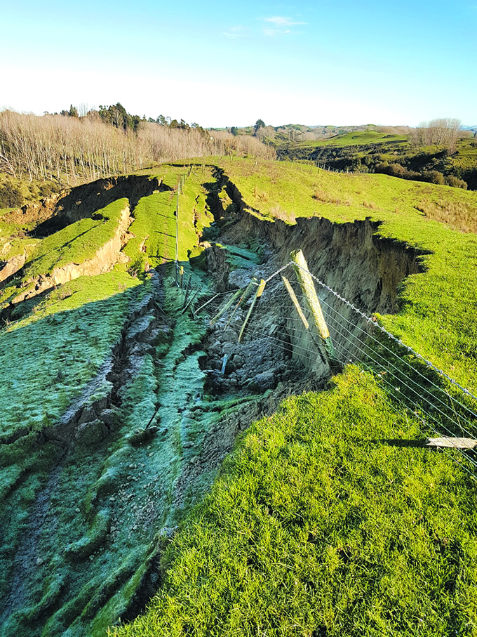
Science to manage soil erosion
New Zealand is losing 192 million tonnes of soil each year due to erosion – the equivalent of more than 7 million dump-truck loads.

According to MfE’s Environment Aotearoa 2019 report, almost half (44%) of this loss is from pastoral land. This erosion has been accelerated by the loss of native vegetation but is primarily caused by significant weather events, where heavy rain causes slips, slumps and stream-bank collapse that send massive amounts of fertile soil and sediment into waterways, streams and rivers.
This land-based erosion and transfer of sediment is a huge problem for New Zealand. It doesn’t just reduce land productivity: it also affects water quality. Too much sediment in rivers, lakes and coastal environments can smother freshwater and marine habitats. It can also hamper the growth of aquatic plants and animals, and increases the risk of flooding in towns and cities.
As significant weather events continue to increase, so does the amount of erosion, triggering the urgent need for research to understand how to best target erosion control to slow the damage and improve water quality. One of these projects is a new, collaborative, 5-year MBIE-funded programme Smarter Targeting of Erosion Control (STEC), led by Manaaki Whenua, which has the task of exploring cost-effective ways of targeting erosion control and improving water quality, discovering where erosion occurs, sediment volume, what type of sediment is produced, and by which processes.
"Year to year there is large variability in storm events," says Manaaki Whenua geomorphologist Dr Hugh Smith. ‘We have severe storm events like the one in 2004 in the Manawatū River, where huge quantities of sediment are generated and flow down the river, and there are massive impacts from landsliding and flooding. Then in other years we have extended low rainfall periods with no major storms and less sediment, but the water quality is still quite troubling.’
Current erosion modelling tools model annual average sediment loads over entire catchments, but through STEC new data will be collected and used to build new models, sampling in four river catchments across New Zealand. These are the Manawatū, for new and continuing data collection; the Whanganui, to look into impacts from the 2018 storm and legacy sediments; and the Oreti in Southland and Wairoa near Auckland, to research bank erosion and sediment fingerprinting methods in collaboration with NIWA’s Managing Mud programme.
The models will indicate how sediment, and in particular fine silt, moves through catchments, and how erosion and sediment transport can be targeted and mitigated cost-effectively to help strategically minimise erosion effects. Erosion mitigation research will also be conducted on farms to learn more about effective erosion techniques.
STEC is led by Dr Chris Phillips and Dr Hugh Smith from Manaaki Whenua, in collaboration with NIWA, Massey University, Waikato University, and an international research network. The programme partners with Whanganui iwi (Tamaupoko Community group) and Rangitāne o Manawatū.
