Kaikoura earthquake: satellite imagery
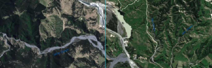
Following the Kaikoura earthqakes, Landcare Research quickly designed and released a simple tool by which users could view changes that had occurred in the landscape as a consequence of the earthquakes on 14th November 2016.
The site used pre and post-earthquake imagery taken by the Sentinel-2 satellite. After heavy use during the initial earthquake recovery period, the site was taken offline at the end of January 2017. The technology used for the site will be used in the future to present imagery on different aspects of the New Zealand landscape.
If you are interested in the technology or how we visualised the imagery, please contact David Pairman pairmand@landcareresearch.co.nz for further information.