Methods for Recording Māori Values on GIS
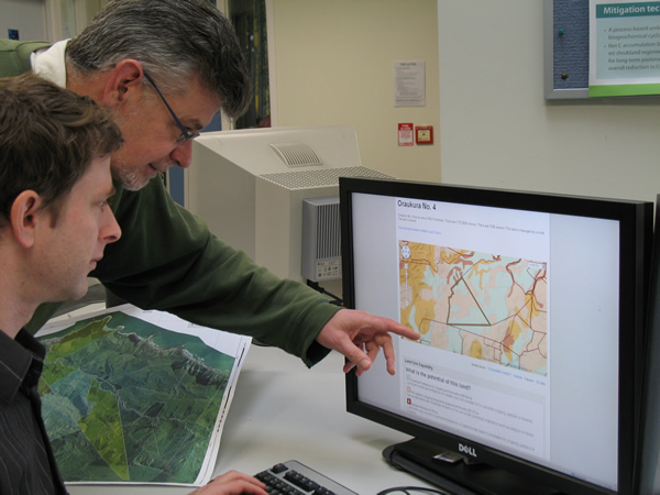
Māori Land Visualisation Tool. Image - Hayley Betts
Information Systems
The function of an information system is to improve the ability to make decisions, and can be described as a chain of operations that takes us from planning the observation and collection of data, to storage and analysis of data, to the use of derived information in some sort of decision-making process (Calkins & Tomlinson, 1977; Star & Estes 1990). For example, a map is an information system, because it is a collection of stored, checked, analysed data, and information derived from this collection is used in making decisions. However, to be useful a map must be able to convey information in a clear, unambiguous fashion to intended users (Star & Estes 1990).
Geographic Information Systems (GIS)
A Geographic Information System (GIS) can be defined as 'a system for capturing, storing, checking, manipulating, analysing, and displaying spatially referenced data' (Hearnshaw & Unwin 1994). GIS are highly suited for generating 'visual' spatial information which helps people understand relationships between information, concepts, and ideas. Both maps and graphical displays can communicate and present spatial information effectively; showing patterns (detecting change through time), quantifying features, analysing relationships, and visualising hypothetical 'what if' scenarios. 'Seeing' something graphically through pictures or maps has always been a good way to communicate and present information. GIS, if set up correctly, could allow individuals or community groups to play a more active role in planning within their environment.
Methods
Results from discussions with a number of iwi representatives indicate that Māori values information can be stored on GIS databases, provided that any system developed is done so in a culturally sensitive manner, and that cultural and intellectual property rights are taken into account in any methodology. Because much of this information is highly sensitive or confidential to each iwi or hapū, there are many factors on data acquisition and property rights to consider. It was necessary, then, first to develop a Māori values classification of all the types of information that could be recorded by iwi or hapū. Second, to develop a structured framework (see table 3), within which all information could be organised taking into account, resolution and detail, sensitivity of information, confidentiality, acknowledgement, and cultural and intellectual property rights.
A Māori values classification
Once the term Māori values was described and defined, it was possible to develop a provisional Māori values classification, including cultural, historic, spiritual, and biophysical information, which as at August 1996 is still being added to and modified in association with a number of iwi representatives. Part of the Māori values classification, sacred sites, is shown in which indicates the level of detail required at the tangata whenua level. Māori values information is first organised into one of eight main groups in the framework in. Effectively this framework matrix allows links between national, regional, iwi, and hapū level information in any database. Each piece of information is acknowledged to a source or several sources, whether it be a person (e.g. kaumātua), book, archive, or map, and references are coded appropriately for database entry.
The development of Māori value classifications and inventories are required for the development of hapū and iwi management plans.
Table 2. Part of a provisional Māori values classification for recording sacred sites
| General classification at the national and regional level | Detailed classification at the community or local level |
| Wāhi Tapu (WTP) | wāhi tapu (wtp)- sacred site, undefined
|
| Wāhi Tapu Areas (WTPA) | urupā (u) - burial ground, cemetry wāhi pakanga (wp) - battle sites ana (a) - caves rua kōiwi (rk), wheua (wh) - pit for skeletal remains wāhi horoi-a (h) - place for washing, cleansing wāhi horoi tūpāpaku (wh) - site for cleansing of corpse(s) wāhi takotoranga tūpāpaku (wtt) -site for positioning of corpse(s) tūāhu (t) - ritual place, alter, shrine, sacred place |
Cultural and intellectual property rights
Cultural and intellectual property rights
Once Māori values information has been recorded and classified, it is organised within the framework matrix shown in. Recorded information generally becomes more sensitive from top to bottom (1- 8). From left to right (a-d) the information becomes progressively more detailed and confidential, and requires greater protection using methods that conceal disclosure or give limited access. This allows different levels of protected access to be attached to specific types of information, and ensures confidentiality, for example, for different categories or degrees of wāhi tapu. In terms of property rights, each piece of information is categorised and coded from left to right as: (a) able to be stored and accessed through national or government databases, and therefore in the public domain, (b) could be stored and accessed in regional or local government databases under certain conditions specified by the iwi, hapū, or whānau, (c) only stored and accessed on specific tangata whenua databases, such as an iwi or hapū authority, and (d) confidential information that belongs to an individual or group, such as a whānau or individual kaumātua. This affects the type and form of information that can be recorded and stored at each level.
Table 2. A matrix framework for recording Māori values information | ||||
| Main groups used in Māori values classification | a. National level, central government (national databases, public domain access) | b. Regional and district databases, such as local government (conditions and criteria required for storing confidential information) | c. Māori databases such as at the iwi or hapū tribal level (secured protection of information) | d. Individual or group information - extended family (whānau) or individual (highly sensitive or personal infomation) |
| 1. vegetation | 1a. national or regional data vegetation and land use | 1b. regional or district data on vegetation and land use | 1c. local information on vegetation types | 1d. special vegetation, such as medicinal plants, plants for weaving |
| 2. animals, birds, fish, insects | 2a. national or regional data on animals, birds, etc. | 2b. regional or district data on animals, birds, fish, insects | 2c. local information on animals, birds, fish, insects | 2d. special animals, birds, fish, insects, such as special foods, cultural harvest |
| 3. land, soil | 3a. national or regional data on landforms, soils, etc. | 3b. regional or district data on landforms, soils etc. | 3c. tribal information on land features, landforms, soils, etc. | 3d. special landmarks, land features, muds for weaving, dyes |
| 4. water | 4a. national or regional data on water | 4b. regional or district data on water | 4c. tribal information on water | 4d. detailed or confidential tribal information on water |
| 5. air | 5a. national or regional data on air | 5b. regional or district data on air | 5c. tribal information on air | 5d. detailed or confidential tribal information on air |
| 6. special places | 6a. limited information on special places, cultural sites | 6b. regional and district information on special places, cultural and historic sites | 6c. tribal information on special places, cultural and historic sites (such as archaeologocal sites) | 6d. detailed family and tribal information on special places, cultural and historic sites (such as archaeological sites) |
| 7. sacred sites | 7a. no or little information at the national or regional level | 7b. regional and district information on some sacred sites | 7c. tribal information on sacred sites (such as burial grounds) | 7d. detailed family and tribal information on sacred sites (such as burial grounds) |
| 8. metaphysical | 8a. no information at the national level | 8b. no information at the regional or district level | 8c. tribal information on metaphysical (spiritual, cosmology) information | 8d. detailed family and tribal information on metaphysical (spiritual, cosmology) information |
Once organised, referenced and entered into the GIS, the information can be spatially represented as a series of GIS layers. Each layer has different levels of confidentiality and protection.
Confidential or highly sensitive information not recorded in the GIS (such as that in column d of the framework, table 3) can still to be acknowledged and linked to the GIS. It is possible to direct an enquirer by way of a directory within the GIS to a source for that knowledge, even if it requires transfer in oral or written form. This allows the development of complementary information systems, rather than ones (e.g. electronic) that replace the other (e.g. written or oral). The result is that GIS can only store, at the most, a small proportion (<10%) of the total indigenous knowledge held by kaumātua, for a particular iwi or hapū. It also allows databases to be linked between national, local authority, and iwi and hapū levels.
Information that is too sensitive to record onto a map or in a GIS database can still be linked via a database directory to an individual person to allow for greater information to be obtained from source. A number of options may be used to direct an enquirer to another information source, without the information being directly accessible from a GIS. Alternatively if the information is in a GIS database it can be given restricted access. Some options are given:
- recording the information as silent or concealed files, linked to a GIS database or a map;
- recording the information as an overlay, such as grid network, which does not identify the actual position or location of restricted or sensitive information such as wāhi tapu;
- putttting up a directory, which can direct the enquirer, via a Māori organisation such as an iwi authority, to an individual (e.g. kaumātua), for answers to particular questions, for example, enquiries about wāhi tapu or urupā.
These methods provide a link to a knowledge source for each item defined as restricted or sensitive. A label on a map, or within a GIS, can simply 'flag' a sensitive or restricted area, directing the enquirer to another information source, e.g. the Ruunanga or Trust Board offices.
Potential issues related to storage of Māori values information on GIS
Potential issues related to storage of Māori values information on GIS
If we start to store Māori values information in planning databases, such as GIS, a number of potential issues arise. These issues are as relevant between local authorities and iwi, as they are between iwi, hapū, and whaanau. They include:
- control of information;
- where the information should reside;
- ongoing maintenance and development of a database;
- intended end-use of information;
- potential for bypassing the consultative process;
- cultural and intellectual property rights and ownership rights of the information;
- potential impacts on tikanga Māori (Munn, submitted paper).