Ice
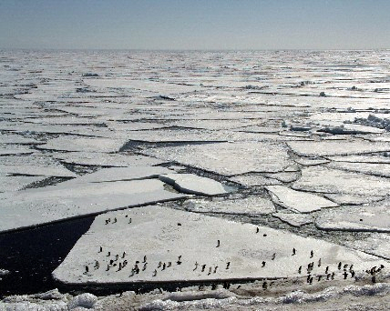
Penguins floating on pack ice. Image - Kerry Barton
Ice is the most abundant form of fresh water in the world and nearly 29 million km2 or 90% of it, is found in Antarctica.
All this ice came originally from water evaporated from the oceans. In the cold air over Antarctica, water vapour freezes around tiny dust particles. The small crystals grow larger to form snowflakes, which eventually fall to the ground. Over thousands of years the snow has been gradually compacted to form the huge icecap, (sometimes called an icesheet), of 12 million km2 which covers Antarctica.
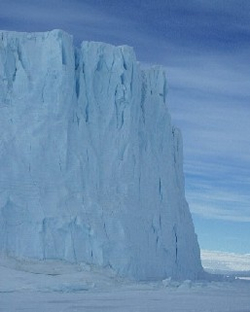
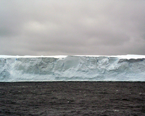
The Antarctic Icecap
The ice, which is up to 4.5 km thick in places, flows slowly downhill towards the coast under the influence of its own weight. The rate of flow varies from a few metres a year in the interior, to 200 m/yr at the margins. Glaciers can move even faster at up to 2000 m/yr!
Resulting from this coastward movement, is an annual loss of about 1500 km2 of ice, mostly in the form of icebergs that calve off glaciers and ice shelves. This loss is balanced by a build-up of fresh snow and ice. At the moment, it appears that the icecap may be slowly growing larger in size.
Glaciers
 Glaciers are slow-moving rivers of ice. Antarctica has the world's largest glacier, the Lambert, which is over 400 km long and 40 km wide.
Most glaciers flow into ice shelves or the sea. Movement is slow due to the huge amount of friction between the glacier and the rock beneath. As a result, the base of a glacier travels slower than its surface, which is forced to stretch and deform. This creates cracks and crevasses some of which can be deeper than 40 m.
By drilling deep ice cores, glaciologists can follow the course of the earth's environment and climate over the last 420 000 years. This is done by analysing bubbles of air trapped in the ice as it was formed. The ice can also contain dust particles, pollen and emissions from volcanoes.
Sea ice
 Sea ice is the frozen surface of the ocean. In late summer, the ocean around Antarctica cools to -1.8°C and ice crystals begin to form in the water. A soupy layer of ice develops, and as the temperature continues to drop, wave action coagulates the ice into cakes about 0.5 m across. As this pancake ice thickens, it gradually freezes together to form a solid layer of pack ice.
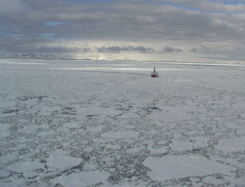
Pack ice
Although the total area and distribution of pack ice around Antarctica varies from year to year, there are usually up to 3 million km2 of ice in summer and 19 million km2 in winter (more than doubling Antarctica's total area!).
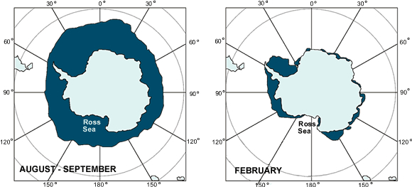 |
| The seasonal change in sea-ice extent in the Southern Ocean. |
Storm winds and waves can break sea ice up and, under the influence of ocean currents and winds, pack ice can be dispersed and just as easily pushed back together. In the past, several ships have been trapped in pack ice and some, like the Endurance in 1915, completely destroyed.
Icebergs
 These are produced wherever the ice sheet meets the ocean, at ice cliffs, glaciers or ice shelves. Wave action is mainly responsible for about 1500 km2 of icebergs calving from Antarctica each year. Icebergs vary in length from 100 m upwards. The giants that break from ice shelves can reach over 100 km in length and 300 m in thickness. Observations since the 1830s when James Clarke Ross first visited the Antarctic indicate that huge icebergs are produced every 50 to 100 years. Data from the National Ice Centre show that between 1978 and 2001, an average of 4.4 icebergs larger than 18.5 km in length calved annually from the Ross Ice Shelf.
Over 85% of an iceberg is below the surface. The average life of an iceberg is 4 years. In this time it will be carried westwards by the circumpolar current to warmer waters, possibly splitting or rolling over as it melts. Fragments of decayed icebergs smaller than 2 m across are called brash ice.
In 2000, a particularly huge iceberg, B15, broke off the Ross Ice Shelf and then itself broke into two halves. One of these, B15a, is 295 km long, 40 km wide and has a total area of about 10 000 km2.
In May 2002, another huge iceberg, C19, 200 km long broke from the Ross Ice Shelf.
Polynyas
These are regions of turbulent, well-mixed, ice-free water created by strong off-shore katabatic winds. Exposed to sunlight, polynyas teem with phytoplankton, the base of all Antarctic food chains.
- Increasing amounts of sunlight in spring allow Phaeocystis antarctica, a colonial alga, to develop dense blooms of gummy globs of cells. These, however, are not the preferred food of many herbivores.
- On the other hand, single-celled diatoms (algae, which are the base of most food chains in this area) grow well around the edges of polynyas. Consequently, a dynamic food web is to be found in these regions. For example, stocks of krill are five times more concentrated at the edges of the ice.
Polynyas can have a strong influence on weather development due to the interactions of the large exposed areas of relatively warm water in a polynya and the cold Antarctic air.