Digital soil morphometrics
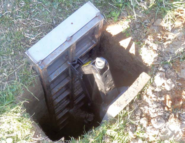
FIGURE 1 The soil monolith extraction device in place.
Bringing quantitative pedology to the soil profile
Pedologists study, examine, and classify soils in their natural environment, by investigating a vertical section of the soil, called a “soil profile”, visually and manually interpreting soil properties. Soil colour, stoniness, number of roots, and soil horizon depths can be assessed visually; and soil texture and structural stability can be assessed by feeling and touching soil particles and aggregates. This process involves digging holes, and is physically demanding, time consuming, and subjective.
Now a wide range of exciting new technologies are emerging that can assist the pedologist to examine and classify soils in their natural environment. ‘Digital soil morphometrics’ is this new discipline and it provides a framework to apply new methods and technologies to assist traditional pedological method. It quantitatively and objectively collects data, numerically analyses the data, and derives valuable information on soil profile properties.
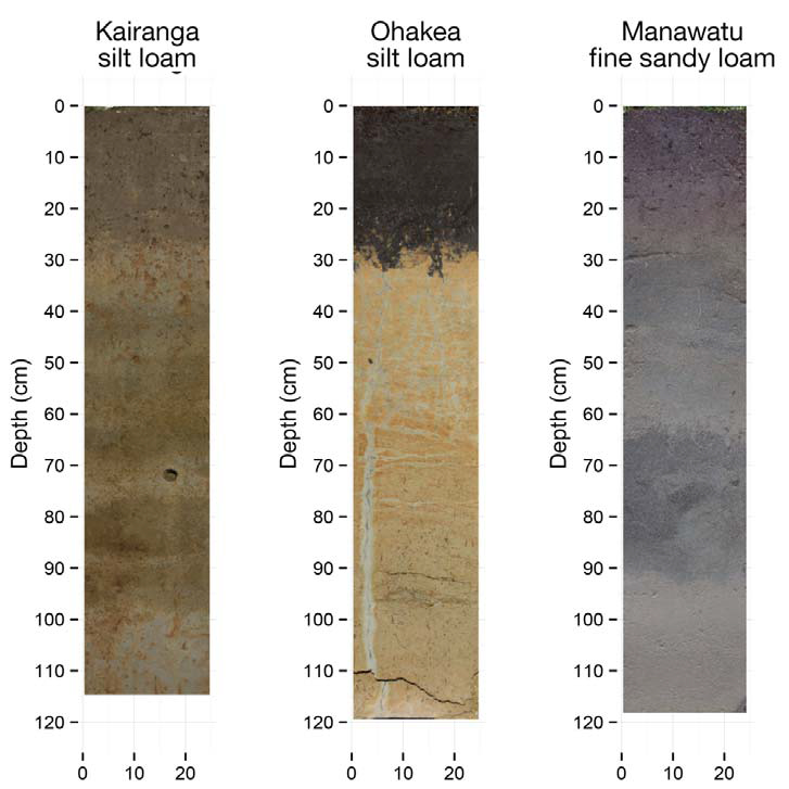
We developed a low-cost and comparatively quick soil profile extraction and surface preparation method in order to trial some of these new digital soil morphometric methods (Fig. 1). We extracted a ‘soil monolith’; a well-established method for extracting whole soil profiles for transport and subsequent preparation, examination, and measurement under controlled conditions. Next step was to collect digital images from the soil monoliths using a standard digital camera, calibrated using a set of reference colour chips, under controlled lighting conditions. These images give information on 3 colours – red, green, blue (RGB) – at an intensely high spatial resolution (1 pixel represents a 1×1-mm square on the soil profi le) (Fig. 2). The images were enhanced by combining them with data collected using a handheld Vis-NIR spectrometer. The Vis-NIR spectrometer records approximately 2150 wavebands in the visible and near-infrared parts of the light spectrum, at nanometre resolution, complementing the RGB bands obtained by the digital camera, and allowing the researcher to relate the data quantitatively to soil properties, including morphometric features, such as soil structure, horizonation, and drainage features.
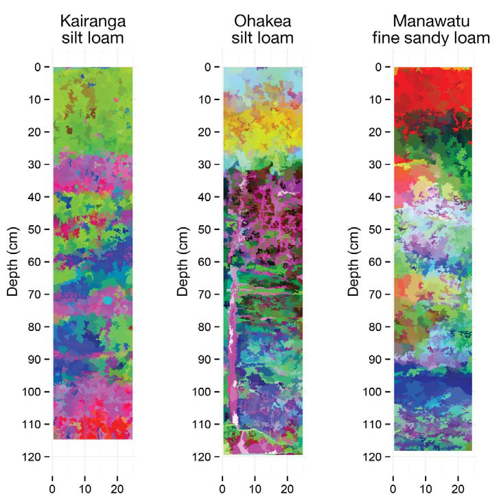
These soil profile imaging techniques with numerical analysis of the data therefore enabled a precise, objective investigation of soil characteristics including (i) horizon boundaries, and (ii) discrete areas of soil differences, for example, the grey veins observed in the Ohakea profile (Fig 3B).
Potential applications of digital soil morphometric methods include improving the estimation of soil organic carbon stocks, and understanding the flow pathways controlling the drainage and nutrient-leaching potential of individual soils.
Pierre Roudier, Andrew Manderson, Carolyn Hedley — Landcare Research

FIGURE 2 The RGB images collected using a standard digital camera on 3 soil monoliths extracted around Palmerston North. These colour photos were recorded using a standard digital single-lens refl ex camera. The colours were calibrated using a set of reference colour chips (these are used by photographers to get a correct white balance). The 3 channels of the photos (red, green, blue) record the soil colour at a very high spatial resolution (1 pixel represents a 1×1-mm square on the soil profile).

FIGURE 3 Enhanced visualisations of the same 3 soil monoliths using digital soil morphometrics techniques, combining digital camera photography with visible near-infrared spectroscopy. These enhanced soil monolith visualisations combine the spatial resolution of the digital camera (each pixel being a 1×1 mm square) with the spectral richness of the Vis-NIR spectra recorded on the soil profiles. The images show a condensed view of the variations captured using Vis-NIR spectroscopy on approximately 2150 wavebands in the visible and near-infrared parts of the light spectrum. They allow quantitative analysis of the soil profile, including the prediction of soil properties (carbon, clay) and soil morphometric features (such as soil structure, horizon boundaries and drainage features).
Autobiography and Reflection - Pierre Roudier
You could argue that I became interested in soils through the lens of a satellite. Even though I studied agronomy at university, I’ve always had a soft spot for maths and physics. As a result, I picked a specialisation that would allow me to nurture that interest, and specialised in applying a wide range of information technologies to study the environment. It was only after my PhD that I had the opportunity to apply my craft to soils, and by then the field of digital soil mapping, which aims to produce soil information from quantitative analysis of a suite of environmental data, was developing.
I find soil science to be very humbling. It’s always a wonder to realise how little we understand about soils. Despite being one of our primary resources, along with fresh water and clean air, gaps in both knowledge and information will keep the field busy for years to come. Of particular interest for me, is that we lack the spatial datasets that could reconnect soils with other fields of science.
A long time ago, in 1941, a pedologist called Hans Jenny published The Factors of Soil Formation, a seminal book in which he proposes a quantitative approach to pedology, and puts soil formation into an equation. Of course, back then, Jenny’s vision was purely theoretical as he was limited by lack of data, as well as lack of computing power. But an exciting challenge ahead of us is to bring that vision to life for New Zealand soils, and take advantage of the staggering amount of environmental data that is available to improve our soil information system.