Using aerial survey and remote sensing to assess bank and cliff erosion in Hawke’s Bay
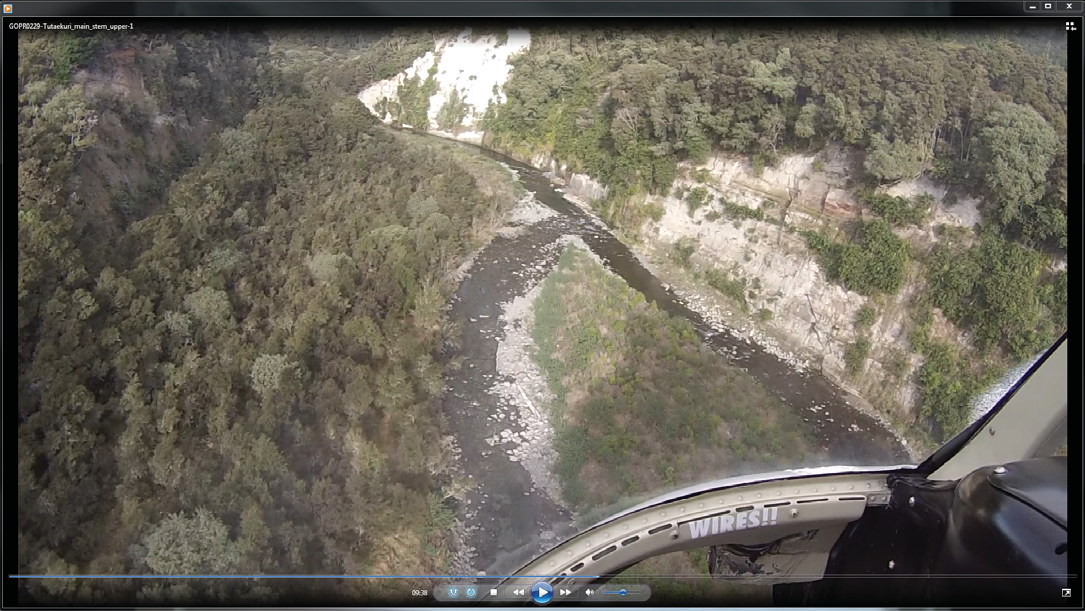
FIGURE 1 Video image of “Cliff erosion” from the upper Tutaekuri catchment.
Landcare Research scientists have been collecting video footage of bank erosion in Hawke’s Bay to help them study the stability of the landscape.
The new information will be used to improve SedNetNZ, a process-based sediment budgeting model being developed by Landcare Research (see Soil Horizons issue 21, September 2012), because the model will benefit from more detailed bank erosion data.
Bank erosion data are normally collected using ground reconnaissance, but this is time-consuming and often limited by accessibility problems (e.g. see Fig. 1).
Therefore we used a helicopter to fly hand-held, high resolution video cameras along selected river channels, covering approximately 100 kilometres of river channel in about two hours’ flying time. An example of the imagery obtained from this method is shown in Figure 1.
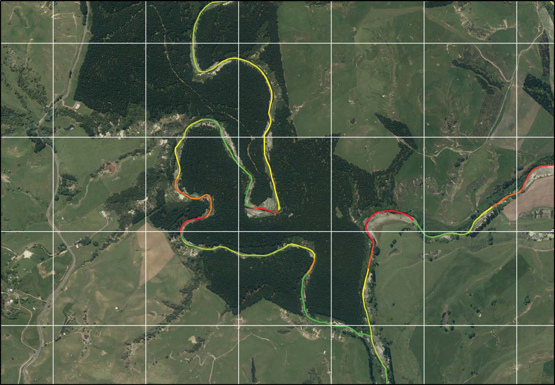
The video footage was then interpreted on-screen, in conjunction with an ortho-rectified image of the areas flown, to identify the total length of river banks and cliffs affected by different erosion types. This information was then digitised in GIS software using a river centreline subdivided by erosion category (Fig. 2), and statistics generated on the length of bank and cliff affected by erosion as a proportion of the total length of river channel.
Erosion categories identified and mapped were cliff erosion (erosion of bedrock cliffs), alluvial bank erosion, undercut slab failures, surface erosion, gullies, slumps, and shallow landslides, along with categories for those channel margins that were not eroding or were obscured.
The aerial survey approach was very successful for the following reasons:
- Continuity of coverage: High-resolution video gives a near continuous, high-quality, interpretable, qualitative record of erosion types along channel margins. Videos can be freeze-framed to yield a good-quality still photograph of any scene along the flight path. By comparison, obtaining a comparable record from the ground is not feasible.
- Ability to interpret and map from video imagery: Using a recent vertical aerial photographic survey as a base, we were able to use the video imagery objectively to map the full extent (length) of erosion along entire channels. From this we could quickly derive the total proportion of channel length affected by different erosion types, and assess their relative significance. Many of the erosion features were not clearly visible on vertical aerial imagery, further underpinning the usefulness of the video survey.
- Cost: The aerial survey, while presenting a relatively large up-front cost, yielded data that would have been more costly to acquire using traditional ground-based methods, and impossible to collect from inaccessible parts of the river bank. We intend to develop this method in future work, with the possibility of deriving three-dimensional measurements of erosion features through stereo image analysis and/or the incorporation of LiDAR data to help us better understand sediment fluxes from these sources.
NOTE: LiDAR: Light Detection and Ranging is a remote sensing method used to examine the surface of the Earth.