An international soils data interoperability experiment
First steps to a global standard for sharing soils information
The need for detailed understanding of soil distribution, function, and state has never been more important to support science and policy development, and improve productivity in a sustainable manner. Well organised and accessible soil data, made accessible in a consistent and consumable way, underpin this understanding. The importance of soil information is particularly under the spotlight this year after the United Nations General Assembly declared 2015 the International Year of Soils.
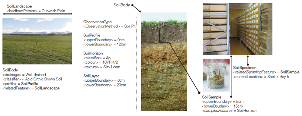
Modern digital mapping and modelling techniques are valuable for understanding soils. However, they depend on dispersed, inconsistent, and difficult to access digital data. Modern, harmonized, and interoperable information systems are required to integrate these data into a consistent set of soil data. Initiatives have started work on this by defining soil data information models. A few examples are the Australian and New Zealand ANZSoilML project, the European INSPIRE, e-SOTER and ISO SoilML, and the International GlobalSoilMap.net consortium. The UN FAO Global Soil Partnership recognises the value of these initiatives, but we still need to reconcile multiple systems that often attempt to do the same thing.
In May 2015, the International Union of Soil Sciences (IUSS) Working Group on Soil Information Standards (WG-SIS) proposed an initiative to consolidate these information models, and reconcile them into a single language for the exchange of soil data. The first step in standardization is running an Open Geospatial Consortium Interoperability Experiment. (The OGC is an international consortium of public, commercial, and academic institutions that cooperates in the development of globally accepted standards for the exchange of data.)
Landcare Research, in partnership with the Commonwealth Scientific and Industrial Research Organisation (CSIRO, Australia) and ISRIC World Soil Information Institute (Netherlands), are the lead agencies in the 6-month interoperability experiment, with Landcare Research staff taking the roles of manager and technical lead. Other international participating agencies include Agriculture and Agri-Food Canada, the US Department of Agriculture National Resources Conservation Services, the US Geological Survey, and the Research Centre for Agrobiology and Pedology (Italy).
The experiment held its initial meeting in June 2015 at the OGC Technical Committee Meeting in Boulder, Colorado. It will end in December 2015 in Sydney with presentation of a technical engineering report to an international audience of technologists, scientists, businesses, and government agencies who participate in the OGC. There will also be a demonstration of soil information systems sharing data using the draft standard. If the results of the IE are approved by the OGC, an OGC soils standards working group will be established to progress the draft to an international standard.
The development of a soils data standard would be timely, offering benefits for a number of New Zealand initiatives under development that depend on good quality soil information. These include the national science challenge ‘Our Land and Water’, and farm and land use planning, as well as central government and regional sector efforts in environmental reporting.