Impact 2.1: The status and trends of land resources and ecosystem services (including their interactions) are known and understood
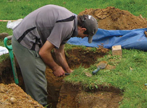
Pedologist Paul Mudge excavating a soil pit. Image - Alice Barnett
Key performance indicator: LCDB (land cover), LUDB (land use), S-map (soil) and ESDB (ecosystem services) components of LRIS (Land Resource Information System) have been enriched and are being used under the New Zealand Government Open Access Licensing framework for web-services.
We have continued to invest in developing the nationally significant soil and land databases and information systems (see: Key initiatives). Our new innovative approaches to finer-scale mapping are delivering data suitable for farm-scale nutrient budgets and environmental management plans. Collectively, these contribute to catchment and regional objectives.
2010/11 Baseline situation: Earlier versions of the land resources databases contained out-of-date information, with imcomplete coverage for end-user needs, and with some barriers to open access
Progress 2011/12: |
Progress 2012/13: |
Progress 2013/14: |
| S-map Online now provides users with detailed spatial information to help fine-tune land management and technologies. | S-map coverage has been extended to include new areas in Waikato, Canterbury, Auckland and West Coast regions. |
New areas included in S-map takes total coverage to 26% of New Zealand and 56% of Class 1–4 land; factsheets for each soil type better support farmers |
| Gisborne, Hawke’s Bay and Southland councils now have access to significantly improved S-map coverage of soil variability. | Data updates and access improvements to the Soils Portal, S map Online and the Land Resource Information System (LRIS) dramatically increased usage. | LCDB v4.0 was released in June 2014 and is widely used already. |
| An updated version of the Land Cover Database (LCDB), a thematic classification of land cover and land use (33 classes in LCDB v3.0), has been released. | LCDB has improved the accuracy of NZ’s 5-yearly National Forest Resource Assessment for submission to the FAO. | Regional councils and other users will benefi t from the development of an extended, nationally-consistent Land Use Classification (LUC) legend. |
| Where appropriate, information from our nationally significant databases is available online under an open-licensing agreement. | End-users and stakeholders worked with us to finalise the roadmap for the future of LRIS and the Land Use Classification (LUC) system. | Innovative, cost effective soil and landform mapping at 5m resolution enables farm scale environment planning, and better supports catchment and regional land use planning in Hawkes Bay. |
| Stakeholders and end-users are working with us to develop LCDB4. | ||
| Semi-automated processing of high resolution imagery is being used in large mapping projects for MfE − the Land Use Map (LUM) for carbon and the LCDB series for multiple applications. |
Highlights
S-map coverage extended
S-map coverage has been extended to include 1.5 million hectares of lowlands in Otago and Southland, as well as new areas in Canterbury, the West Coast, Wellington, Manawatu, Hawke’s Bay, Waikato and Auckland regions. In the Otago and Southland regions alone over 2000 different soil types were added to S-map.
The focus of investment in S-map has been to increase coverage of land used for primary production to better support various policy initiatives, particularly those relating to land management and farm nutrient budgets to improve water quality. S-map Online allows users to explore interactive maps of soil properties and soil variability, and download soil factsheets that provide more detailed information for each soil type. These factsheets describe the typical average properties of that soil type, and contain the wide range of soil attributes needed for Farm Environment Plans and nutrient budget models such as OVERSEER®. Over the last year there has been a lot of development and investment to support the soil component of OVERSEER and in particular being able to synchronise OVERSEER and S-map. Now, downloadable S-map factsheets include dedicated OVERSEER information, making this step much easier and more accurate for farmers.
During the year, we also worked with regional councils, industry agencies, and individual farmers to demonstrate how S-map can support farm-scale mapping, particularly how detailed field observations at farm-to-paddock scale can be linked to S-map factsheets to provide cost-effective soil information.
S-map is led by the Characterising Land Resources Portfolio, and is supported by MBIE Core funding.
Website: S-map Online
LCDB v4.0
Version 4.0 of the Land Cover Database (LCDB) was released in June 2014. It builds on earlier versions – improving line work, correcting errors, but more significantly adding a fourth time-step. The new time-step is nominally 2012 although imagery between November 2011 and February 2013 was used along with other information. Specific focus was given to improved wetland mapping from six regional councils, new urban development recorded in the LINZ cadastral database, and land use change. Around 13% of LCDB’s 480,000 polygons were substantially redrawn or had their previous classification changed. A much larger percentage of polygons were improved by more minor line-work adjustments. In the first month since release, LCDB was downloaded more than 200 times.
LCDB is a national, temporal dataset capable of helping central and regional government and the science and industry sectors answer questions on resource state, or it can be used to underpin environmental models. For example, the LCDB is used for national environmental reporting – identifying native land cover, habitats of pest species, and vulnerability to erosion or fire; assigning biodiversity priorities; and monitoring changes in land use. User feedback indicates LCDB is also being used more directly as a vegetation layer in other mapping products or mobile applications.
LCDB is managed through the Characterising Land Resources Portfolio, and is supported by MBIE Contestable funding. An extended national land use capability legend The land use capability (LUC) classification system is widely used for mapping the physical attributes of land that affect its productive use. There are 12 LUC regions across New Zealand. Mapping methods and LUC classification are independent of scale so are equally applicable at the farm, catchment, regional and national scale. However, many LUC codes refer to different types of land in different regions. Furthermore, most of these LUC regions no longer coincide with the current administration boundaries of regional councils or unitary authorities.
To develop a national extended LUC legend, we have been correlating, amalgamating and rationalising the various regional legends currently in use, whittling these down to 833 unique New Zealand-wide LUC units. Feedback from regional councils and other end-users is being used to refine this set. The national legend will facilitate consistent farm-plan LUC mapping across the whole country, and hence will be of immense benefi t to local and central government agencies responsible for developing and implementing policy and regulation, and primary industry bodies working to develop and implement good management practice on-farm.
This work is part of the Characterising Land Resources Portfolio, and is supported by MBIE Core funding.
Digital soil mapping across regions
Digital soil mapping (DSM) complements traditional onthe- ground soil mapping techniques but has the added benefi t of reducing field time and hence improving the costeffectiveness of fieldwork. While DSM is well established overseas, minimal work has occurred on New Zealand’s soft rock hill country at detailed scales. In work for Hawke’s Bay Regional Council, we developed new techniques to combine classical soil survey and digital modelling approaches to produce digital soil maps of the Papanui catchment (within the Tukituki River catchment) and a 550- km2 area from Cape Kidnappers to Blackhead. Mapping the geologically complex eroding landscapes of the coastal hill country required an understanding of the geological and soil-forming processes at work in the landscape and the development of a high resolution 5-m digital elevation model from satellite imagery to help the delineation of soil patterns.
The new maps provide more detailed spatial soil information than has previously been available. This information is readily-accessible through S-map Online, and is being used by a range of stakeholders (Ruataniwha Plains Water Storage Scheme, MPI, local government, farmers, forestry companies, consultants, exploration firms) to better understand soil limitations and environmental outcomes relating to regional planning, erosion control, land evaluation, irrigation system design and scheduling, as well as whole-farm planning and nutrient management plans. The innovative techniques developed in these Hawke’s Bay projects are applicable to mapping erosion-prone soft rock hill country and different landscapes in other areas of New Zealand.
This work is part of the Characterising Land Resources Portfolio, and is supported by Hawke’s Bay Regional Council.
Mapping landform elements across the Auckland Region
Landform elements (e.g. terraces, ridges, shoulder slopes, foot slopes, valley bottoms and channels) have previously been mapped nationally at 25-m resolution but this scale is too coarse to be effective for farm-scale land use plans or for regional planning in flatter landscapes. In a pilot study on rolling land in Karaka, South Auckland, we used LiDAR data to construct a 5-m digital elevation model of the area, which was then used to generate a map of landform elements. Fieldwork confirmed the accuracy and efficacy of our approach in this relatively low relief landscape. Following this, Auckland Council asked us to apply the technique to the entire Auckland Region. For this purpose we developed landform elements for the steeper terrain, which we combined into one continuous seamless landform-element layer.
This new work means we now have a sound method for identifying landform elements at fine scales and, more importantly, it provides a powerful source of information that can be used to test the efficacy of farm-scale digital soil mapping and its applications to S-map.
This work is part of the Characterising Land Resources Portfolio, and is supported by Auckland Council.
Cost-effective farm-scale soil information
New soil mapping techniques are being developed in the Waipa area as part of a long-term project with Waikato Regional Council to provide full S-map coverage of the Waikato Region with high accuracy and low cost. As part of the 1:50,000 S-map mapping, we are providing soil-landscape models – these ‘windows’ into the Waipa soils are representative of the greater landscape but provide detail at the farm scale. The objectives are to build understanding of soil–landscape relationships to inform digital soil mapping, and also to convey a better understanding of soils in the landscape.
The advantage is that a ‘windows’ model can be extrapolated to the wider landscape. The extrapolation can be undertaken with confi dence so long as a reoccurring pattern of soils, under the same soil-forming factors, continues across the landscape; several windows may be required to represent all soil patterns within a soil region. Work to check the accuracy of the predicted digital soil map is continuing. This work demonstrates how value can be added to S map soil information by making it available at the farm scale, whether through digital modelling or by extension of soil–landscape knowledge.
This work is part of the Characterising Land Resources Portfolio, and is supported by the Waikato Regional Council.
Ecosystem services in New Zealand
Ecosystem services are benefi ts obtained by people from the natural environment. Consideration of ecosystem services individually and collectively promotes recognition of natural resource use, and whether ecosystem services are being overdrawn or impaired. We produced New Zealand’s first-ever national assessment of conditions and trends in ecosystem services. The comprehensive book, written by some 120 authors from 26 organisations, supports natural resource management in New Zealand and the proposed National Capital Assessment, which is being led by the Natural Resources Sector.
This research was part of the Characterising Land Resources Portfolio, and was supported by MBIE Core funding.