Key initiatives
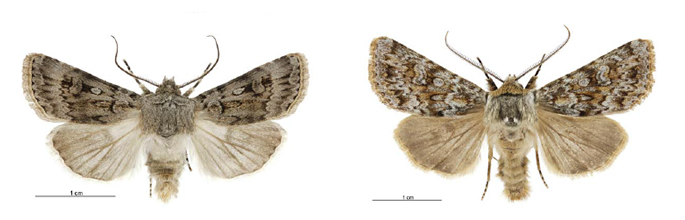
Agrotis admirationis and Aletia falsidica falsidica, nocutid moths. Image- Birgit Rhode
National e-Science Initiative (NeSI)
We are partners in the $48 million NeSI investment by a consortium of government and some universities and CRIs to build and operate three High Performance Computing facilities. NeSI enables us to carry out advanced modelling in support of all of Landcare Research’s Outcome areas. Processing time is 10–100 times faster with NeSI; datasets up to 100x larger can be analysed; and in some projects, 1000 jobs can be processed concurrently. Examples of projects made possible through the NeSI investment include:
- Analysis of the bird and pest mammal data from DOC's Tier 1 monitoring programme, a national-level broadscale inventory and monitoring programme (see: Impact 1.1)
- Weta and stick insect genome assembly (see: Impact 1.1)
- Designing a biodiversity monitoring and reporting system for Greater Wellington Regional Council
- Understanding the effects of disturbances on the functioning and biodiversity of the world's ecosystems
- Modelling options to maximise biodiversity gains
- Metagenomic analysis for pathogen discovery in wildlife diseases
- Processing remote sensing data (e.g. for LCDB v4.0, see: Impact 2.1)
- Analysis of a soil carbon stock inventory model for New Zealand (see: Impact 3.2)
- Developing the spatial and temporal models to forecast mouse plagues in Australia (see: International partnership examples)
- Environmental Domain Analysis for the Ross Sea Region of Antarctica
- Identifying change from time-series analysis of a 15-yr stack of >350 satellite images/scenes
Land and soils databases
Strong increase in usage of both the Land Resource Information Systems (LRIS) Portal and S-map Online demonstrates our land and soils data are in demand by key stakeholders. LRIS is also now being used for data archiving by our staff and external stakeholders (e.g. ECan and the National Rural Fire Authority), which demonstrates LRIS’ value well beyond its initial purpose as a public data portal. S-map Online’s connection with the S-map database and its use with OVERSEER ensure ongoing demand for this service and highlight its value to the wider agricultural and environmental community.
Land Resource Information Systems (LRIS)
LRIS provides access to the Land Resource Inventory (NZLRI), the Land Cover Database (LCDB), the National Soils Database (NSD), S-map, digital elevation models (DEMs), and more
| 2012 | 2013 | 2014 | |
|---|---|---|---|
| Visits | 12,816 | 17,258 | 21,865 |
| Page views | 128,956 | 180,245 | 198,614 |
| Total registered users | 1143 | 1956 | 2996 |
| Data downloads | 2976 | 3941 | 4909 |
S-map Online
http://smap.landcareresearch.co.nz/
Tthe national soils database that provides access to digital soil information, including maps and factsheets (2012 data cover 11 months only)
| 2012 | 2013 | 2014 | |
|---|---|---|---|
| Visits | 11,061 | 18,845 | 28,898 |
| Application loads* | 9254 | 16,129 | 32,974 |
| Soil factsheets | 10,385 | 20,437 | 32,265 |
| Point queries | 13,391 | 25,931 | 48,841 |
| Maps printed | 724 | 1541 | 2051 |
Our Environment
http://ourenvironment.scinfo.org.nz/
Provides access to a wide range of environmental data. (** 2012 data cover 7 months only)
| 2012 | 2013 | 2014 | |
|---|---|---|---|
| Visits | 4487 | 6226 | 8444 |
| Application loads* | 2633 | 2949 | 4304 |
| Point queries | 1280 | 2175 | 2165 |
| Maps printed | NA | 844 | 747 |
* Each application load equates to clicking the button on the homepage to start the mapping software
LRIS, S-map Online and Our Environment are part of the Characterising Land Resources Portfolio, and are supported by Core funding.
National Vegetation Survey Databank (NVS)
http://nvs.landcareresearch.co.nz
NVS incorporates 3770 datasets containing nearly 9.3 million records (includes tree diameters, sapling counts, species cover scores, and other plant community and ecosystem attributes). The main users are DOC, MfE, MPI, councils, CRIs, universities and consultants; 17 peer-reviewed papers (including our contribution to a significant global study published in Nature), 3 conference presentations, 6 contract reports and 3 theses were based on NVS data this financial year.
| 2012 | 20131 | 20141 | |
|---|---|---|---|
| Datasets provided on request | 1195 | 3362 | 36792 |
| Datasets added | 45 | 100 | 203 |
1 There were 15,983 page views in 2013/14.
2 48 requests involving 3679 datasets
3 20 new datasets with 1927 plots were added, most with data derived from multiple methods for each plot.
A workshop for DOC, regional councils and community end-users to improve their access to and use of the biodiversity data stored in the National Vegetation Survey Databank (NVS), a nationally significant database. The workshop included training on how to use the NVS website to discover, request and download data, as well as upload data.
NVS is managed by the Measuring Biodiversity Change Portfolio, and is supported by Core funding.
Biological collections
Specimens are loaned on request to researchers, both nationally and internationally.
These collections are part of the Defining Land Biota Portfolio, and are supported by Core funding.
| Specimens loaned or gifted1 | 2012 | 2013 | 2014 |
|---|---|---|---|
| NZ Arthropod Collection (NZAC), including nematodes – specimens | 4785 | 6693 | 537 |
| International Collection of Micro- Organisms from Plants (ICMP) – cultures | 598 | 1289 | 914 |
| NZ Fungal Herbarium (PDD) – specimens | 263 | 599 | 567 |
| Allan Herbarium (CHR) – specimens | 4063 | 3734 | 3941 |
| NZ flax & living plant collections – sets of divisions supplied | 25 | 17 | 21 |
1 Data are for outward specimens and do not include incoming loans, exchanges or additions to collections
An increasingly range of specimen data are available online through our information portals that relate to our biological collections (such as e-Flora, our systematics databases, the NZ Virtual Herbarium and the NZ Organisms Register, as well as through international portals such as the Global Biodiversity Information Facility.
Updates to Threat Classifications
DOC’s Threat Classification System is central to its conservation strategies. Our invertebrate systematics staff worked with DOC to revise the listings for key invertebrate groups – Lepidoptera (moths and butterflies), Hymenoptera (ants, bees and wasps), Hemiptera (bugs, cicadas, etc.), Phasmatodea (stick insects) and Oligochaeta (earthworms). Our mycologists are currently working on an update on the status of fungal conservation in New Zealand, and its integration with global initiatives including a concerted effort to meet IUCN's Red Listing criteria for threatened fungi. DOC also uses the rankings to prioritise future research for many ‘Data Deficient’ species requiring more understanding of their distribution and abundance.
Ngā Tipu Whakaoranga
http://maoriplantuse.landcareresearch.co.nz/
This ethnobotany database contains fully-referenced, detailed information on how Māori used plants, particularly before the arrival of Europeans.
| 2012 | 2013 | 2014 | |
|---|---|---|---|
| Page views | 22,640 | 36,529 | 53,175 |
This is part of the Defining Land Biota Portfolio, and is supported by Core funding.