About
Ortho-rectification and pan-sharpening
To make effective use of any Satellite Imagery it is usually necessary to orient the image into its correct geographic space. This process is called Rectification, as it projects the data onto a plane and makes it conform to a map projection system. This is done by collecting ground control points to assign geographic coordinates to identifiable features in the image. Ortho-rectification is a form of rectification correcting for terrain displacement, achieved by specifying a DEM (Digital Elevation Model) to the model.
Landsat ETM+ data provides multispectral imagery with a nominal 30-m sampling distance and a co-registered panchromatic band sampled at a nominal 15-m. We use the panchromatic image to identify sufficient ground control points to ensure that the ortho-rectification model is accurate to better than 10-m. A method was designed to enhance the resolution of the multispectral data using the panchromatic data. The resultant pan-sharpened multispectral data has been produced at a 15-m sampling distance, thus permitting mapping of ETM+ to 1:50 000 scale.
 |
 |
| Multi-spectral Landsat image at 30-m pixel resolution | Multi-spectral Landsat image pan-sharpened image at 15-m pixel resolution |
Standardised reflectance
Satellite images are more than just a picture of the earth. They are a calibrated measure of the amount of light leaving the surface of the earth. This amount of reflected light depends on the amount of sunlight falling on the earth, which in turn depends on the time of year and atmospheric conditions. Atmospheric models exist to calculate the amount of solar energy reaching the earth given the state of the atmosphere, and these models are used at Landcare Research to convert satellite images into reflectance measurements. Atmospheric models in general calculate atmosphere effects assuming a level earth surface, and are used to compare imagery from different dates. However, New Zealand’s topography complicates the geometry between the surface, sun and satellite.
For the computer to classify features accurately in imagery, we need the measured colour to correspond directly to a given class. This means the colours in the image will vary only with land-surface cover and not with topography. In short, we need to “flatten” satellite images. There has been a long history of research in New Zealand to understand the effects slopes have on vegetation reflectance. Scientists at Landcare Research now have a physical model able to correct for topographic effects, predicting the flat surface reflectance of a sloping pixel. Image flattening requires knowledge of the slope and aspect of each pixel in an image. This slope information is calculated using a Digital Elevation Model (DEM) produced from the 20-m contour information of the NZMS260 topographic map series. The figures below show the difference between an original satellite image and a standardised reflectance (flat) image.
 |
 |
| Original Landsat image | Standardised reflectance image |
Being able to make reflectance measurements from space that are only influenced by surface cover expands the potential of remote sensing to monitor the environment, and has led to a number of applications.
Examples of ortho-rectification, pan-sharpening and standardised reflectance
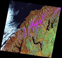
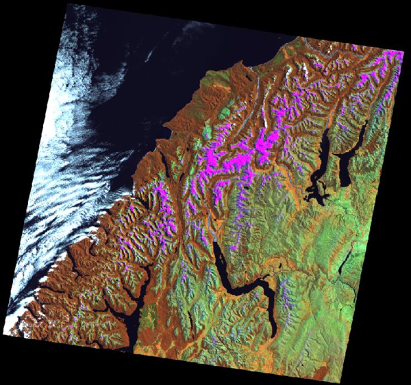
This image is a Landsat ETM+ orthorectified scene of the south-west area of the South Island
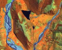
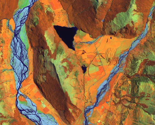
This is a zoom at full sampling of the ortho-rectified image. The area shown is Diamond Lake, just north of Lake Wakatipu

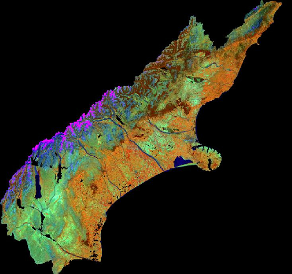
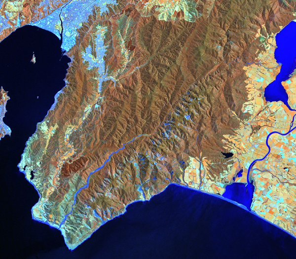
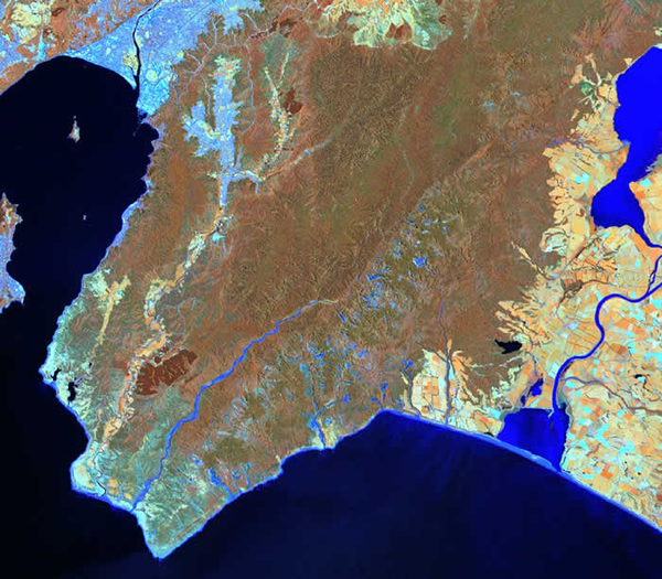
This image represents the flattened version of the Canterbury region
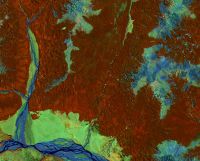
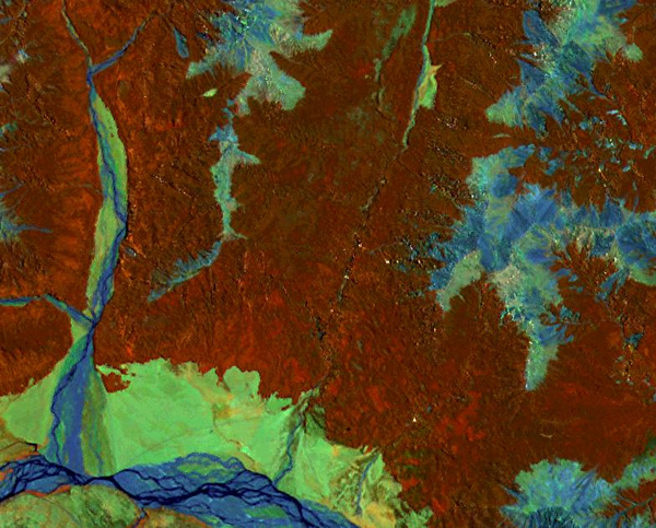
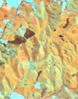
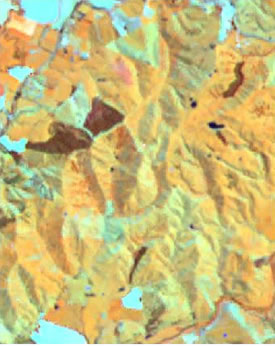
This image is the flattened version of a mountainous view close to Arthur's Pass, with the Waimakariri river at the bottom. The brown colour is indigenous forest, cyan is bare ground areas on the top of the mountains