| Key Achievements |
2014/15 (planned) |
2014/15 (actual) |
| Soil mapping and modelling – Outcome 2 |
$0.38 |
$0.79 |
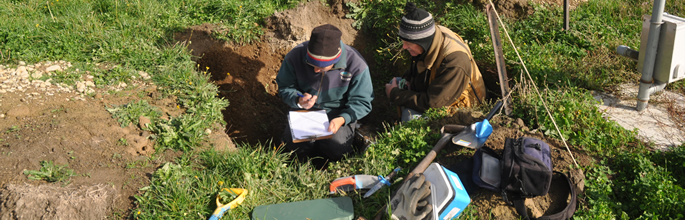
- Applied digital soil mapping (DSM) techniques to extend coverage of S map, focusing on more complex terrains such as Southern Hawke’s Bay and Southland hill country. High quality soils information is fundamental to achieving policy goals of ‘export double’ while meeting the limits for water quality set under the National Objectives Framework. Soil characteristics are the predominant determinant of leaching of nutrients and other contaminants into waterways in New Zealand. Through DSM techniques we are advancing national coverage of S map and providing a key resource for the next generation of Regional Plans, as well as a critical support for limit setting under the National Policy Statement for Freshwater Management.
- Updated and released new versions of S map Online, supported the release of the new version of Overseer (6.2) and increased data input standards. Better quality soil information will improve the calculation of nutrient budgets and allow farmers and their consultants to examine farm scale nutrient management options to optimise production and minimise losses of nutrients to the environment. This will provide essential support for setting and meeting limits under the National Policy Statement for Freshwater Management. S map Online has experienced significant and sustained growth in terms of access and use, with the Online application used to generate 927,519 map views; 60,432 queries with 40,660 soil factsheets requested/viewed and 2,574 maps created for printing.
|
| Data stewardship infoservices – Outcome 2 |
$1.71 |
$1.52 |
- Led the development of the Antarctic Environmental Portal (AEP ), which was launched at the meeting of the Antarctic Treaty System's Committee for Environmental Protection (CEP) in June. The Portal provides an important link between Antarctic science and policy, making science based information available to the CEP and all the Antarctic Treaty nations. It also enables Antarctic scientists, particularly through the Scientific Committee on Antarctic Research (SCAR), to provide independent scientific advice to the Antarctic Treaty, including bringing new or emerging issues to the attention of policy makers. The Portal underlines New Zealand's and Landcare Research's key roles in providing science and a cutting edge communication platform to the Treaty nations.
- Upgraded the National Soils Database Repository (NSDR ) into a next generation system that is capable of efficient storage and interrogation of large quantities of highly variable soil attribute data. The NSDR is a crucial system for the maintenance of soil observation data, is essential to powering S map and supports environmental reporting initiatives such as Environmental and Monitoring Reporting (EMaR).
|
| Ecosystem services state and trend – Outcome 2 |
$0.39 |
$0.80 |
- Enabled the New Zealand Government to achieve better quality land domain reporting and to be on the leading edge of terrestrial ecosystem environmental performance indicators by:
- contributing to the 2015 State of Environment report, in support of the Environmental Reporting and RMA Bills before Parliament;
- developing the LUMASS tool to run spatial scenarios of the impact of agricultural intensification on ecosystem services provision and agricultural performance under potential irrigation schemes in the Ruamahanga catchment and Wairarapa Water Use Project;
- leading participation in the United Nations Inter Governmental Panel of Biodiversity and Ecosystem Services (IPBES) and contributing to the regional assessment of biodiversity and ecosystem services for Asia and the Pacific;
- developing a hive carrying capacity model for honey bees that has attracted interest from DOC and MPI;
- drafting a manuscript on wetland extent change in Southland in partnership with DOC.
|