A soil scanner from space age science
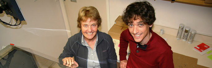
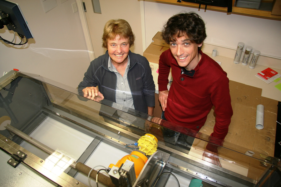
Landcare Research scientists Dr Carolyn Hedley and Dr Pierre Roudier have developed a faster, more efficient soil scanner using space age technology.
Landcare Research is using sensor technologies, similar to those used on the Mars rover, to rapidly scan soils and estimate soil organic carbon stocks. Visible near-infrared (Vis-NIR) spectroscopy is being used on a custom-made soil scanner by Landcare Research as part of a Global Research Alliance (GRA) project, led by CSIRO, Australia.
Landcare Research senior scientist Dr Carolyn Hedley explained that similar technologies are used in space exploration for remote sensing on far-off planets. "The Mars rover has sensors attached that collect information from the surface of the planet that help scientists infer what minerals Martian rocks contain. Space exploration helped to develop new technologies such as soil spectroscopy now available for soil science research closer to home."
The Wellington-based automation and electrical engineering company AFI Ltd was commissioned to build the automated soil core scanner. The sensors are mounted into a custom-made soil scanning machine. As well as the Vis-NIR spectrometer, there is a density sensor imported from Germany that uses a gamma beam to estimate soil bulk density. The Vis-NIR and density sensors automatically move along the soil core, collecting information every few centimetres and taking about 20 minutes to scan one soil core 60 cm long.
The initial dataset relates sensor estimates to conventional laboratory estimations of bulk density. The approach, commonly used industrially to assess material density in the paper and pulp industry, is a significant improvement on existing manual methods, being rapid, reproducible, auditable and cost-efficient.
Another powerful feature of the scanner is its data management system. Sensor data is stored in a custom-built database, from which it is extracted and modelled to predict, amongst other things, volumetric soil organic carbon values. The database has been built by the Landcare Research informatics team (Alistair Ritchie, Tim Hinnerk-Hueur) and is shared with CSIRO. The data model is an extension of that used to upgrade the National Soil Database (NSD) into the NSD Repository (NSDR).
The automated scanner also allows many more soil organic carbon estimates to be made for the same cost as earlier methods. An enduring problem with earlier manual methods was time and cost constraints, which meant it was not possible to collect enough values to accurately assess variability across a landscape. This is really important, because evidence from a recent Sustainable Land Management and Climate Change (SLMACC) project, 'Improved measurements of hill country soil carbon – to assist carbon change studies’, showed that soil carbon varies more than three-fold in a 2 km grid around three NSD soil carbon monitoring sites. The new automated scanning method allows enough data to be collected from a study area (e.g. 100 values) so that digital soil mapping methods can be used, to reduce the uncertainty of soil organic carbon stock estimates.
The machine replicates one initially designed by CSIRO in Australia. CSIRO provided their research and design plans to Landcare Research to enable development of the soil scanner within a Global Research Alliance Soil Carbon project. Landcare Research scientists Drs Carolyn Hedley and Pierre Roudier collaborated with the GRA Project Leader and CSIRO Principal Scientist Dr Raphael Viscarra Rossel, based in Canberra, Australia. Also involved in the project were Dr Frank Kelliher (AgResearch), Dr Craig Lobsey (CSIRO) and Dr Jeff Baldock (CSIRO Agriculture, South Australia).
Work has already begun on incorporating another sensor into the scanner. This is a standard digital camera, calibrated using a set of reference colour chips, to collect soil images at high spatial resolution. The images are combined with data from the spectrometer, which records approximately 2150 wavebands, complementing the colour bands (red, green, blue) obtained by the digital camera. The addition of the camera will allow the researchers to investigate soil profile features such as soil structure, horizonation and drainage (through mottled colours).
The scanner has potential for wider applications than assessing soil organic carbon stocks because Vis-NIR spectroscopy is a new, rapid-sensing method that collects a unique spectrum from a soil surface. This spectrum can be interpreted using a calibration dataset and statistics to predict a number of soil attributes as well as total organic carbon (e.g. carbon fractions, nitrogen, cation exchange capacity, clay content, root density). It can also be used for soil classification.
This kind of research is required because globally we need improved ways of estimating soil carbon stocks and stock changes so that land owners can be audited and rewarded for any carbon sequestered into soils due to land management changes. A key reason that soil carbon is not currently part of the Emissions Trading Scheme (ETS) is that the uncertainty of estimating soil carbon stock changes is considered to be too large. Traditional methods of field soil collection, air-drying, sieving and lab analysis for carbon content, plus the need to collect intact soil cores of known volume for estimation of bulk density, are very time-consuming and costly. The number of samples that can be practically collected is small, so that estimates of soil carbon stocks have large uncertainty. In contrast, this new sensor’s ‘survey- scan-predict’ method offers opportunities to drive down the degree of uncertainty associated with estimations of soil organic carbon stocks.
Hedley said, "There is two to three times as much carbon in the soil as the atmosphere. So even a very small increase in soil carbon globally is actually a mitigation strategy for removing carbon dioxide from the atmosphere. The problem is that it is going to be very difficult to measure the very small changes in soil carbon stocks that might occur over a period of a few years. Our research is continuing to develop ways that assess soil carbon stocks and stock changes, with reduced uncertainty."
Footnote: Carolyn Hedley (GRA Project Leader & RPA Carbon Storage in Soils and Biomass). The Landcare Research soil core scanner has been built and funded using GRA soil carbon funding (2013–2016)
NOTES ON FUNDING: The Soil Scanner research programme was funded by MBIE Strategic Funding: 2015 ($117,000); 2014 ($133,000); 2013 ($90,000).
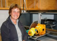
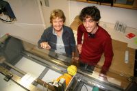
Dr Carolyn Hedley with the soil core scanner.
Landcare Research scientists Dr Carolyn Hedley and Dr Pierre Roudier have developed a faster, more efficient soil scanner using space age technology.

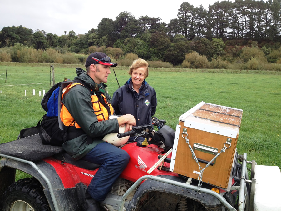
Paul Peterson and Dr Carolyn Hedley with a quad bike that has a gamma sensor mounted to the front to collect soil carbon information.