Access formats: OurEnvironment
Online interactive GIS portal
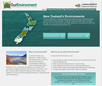
 The easiest way to explore the Threatened Environment Classification 2012 is to view it in Landcare Research’s free interactive online GIS portal classification Our Environment.
Here you can also look at many other national spatial data, and make your own maps of regions of interest.
Quick guide to showing the classification and making a pdf map in Our Environment
 Go to: Our Environment
- Click: “Create a map”
You will now see several topics which you can select to depict on your map - Scroll down towards the bottom of the page; under “About Ecosystems and habitats” tick “Which areas of indigenous vegetation are under threat?”
- Scroll back up to the top of the page, and click the large button (“Click topics and then click here”)
- Accept the conditions of use to view the map
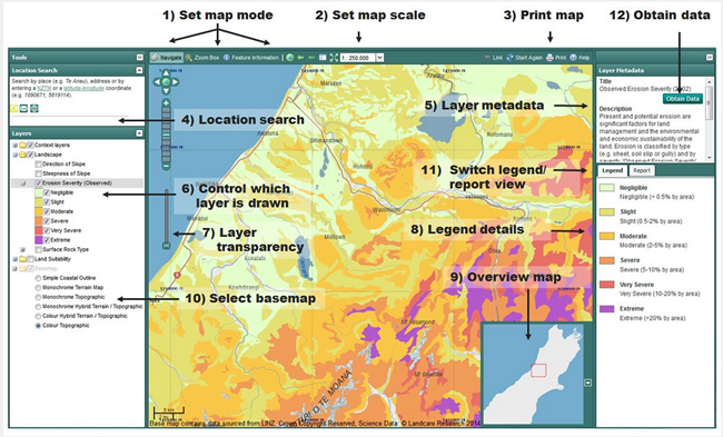
- You will now see the Threatened Environment Classification depicted on the map of New Zealand; the meta-data (5) and legend (8) are available on the right of the screen.
If you do not see the layer on the map of New Zealand, you need to tick the box “Threatened Environment Classification” in the “Layers” box on the left of the screen (6).
You can zoom in and select the area of interest using your mouse wheel or the zoom scroller or zoom box that you can find in the top left of the map window (1).
A better-looking map can be created by adding Hill-shade: click “Colour Terrain Map” and then slide the Layer Transparency slider (number (7) in the figure below) in the bottom left of the map window (for example to 30%).
To create a printable PDF map, use the Print facility (3).
- Click on the Print icon to open the print window. The extent of your map is shown by the orange box. Click on the box and drag it around to change the geographic location of your map.
- Changing the scale or paper size will affect the amount of detail or the size of the geographic area that will appear on the map.
- You can enter a title for the map.
- When you’re happy with the result, request the PDF file by clicking on 'Create PDF and download' button. Depending on how your computer is set up, you will either be able to view the PDF file directly or save it on to your computer.
Note: The time it takes to create the PDF file will vary depending upon the complexity, size and scale of the map. You may have to wait a couple of minutes for the file to be created and downloaded.
Clicking on the “obtain data” button (11) takes you to the Threatened Environment Classification website, where you can find more information and links to downloadable data.
For more information on how to make the most of the capabilities of Our Environment, see Getting Started.