Highlights
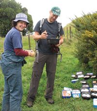
Corinne Watts and Danny Thornburrow taking a break from searching prickly gorse for giant Mahoenui weta for translocation. Image - J Neville
Impact 1: The status and trends of land resources and ecosystem services (including their interactions) are known and understood.
A biodiversity assessment system for New Zealand
We have designed the first objective biodiversity assessment system where ecological integrity can be measured consistently and without bias at national and regional scales, on both private and public lands across conservation and productive landscapes.
Ecological integrity embodies three components – indigenous dominance; species occupancy; and ecosystem representation – and for each we worked with DOC to assess vegetation structure and composition, bird communities, and introduced mammal abundance and distribution at each of 80 indigenous forest sampling points, using an 8-km grid. These sampling points were a subset of the 1177 sites used for determining national-scale carbon stocks for MfE and for Montreal Process reporting by MPI; and hence is a cost-effective whole-ofgovernment approach. As the DOC programme expands to all 1177 sites and beyond, we will be working with them to assess the effects of DOC management on ecological integrity. For example, vegetation structure results so far show widespread regeneration of palatable trees that have been eaten by deer and goats. An important implication is that deer and goat control can be targeted on the relatively few sites where regeneration is deficient and so recommendations from the New Zealand Game Council could be consistent with conservation outcomes.
The Regional Council Biodiversity Forum has now adopted the same objective biodiversity assessment framework. The framework is also attracting increasing attention from private sector groups, e.g. Future Forests Research, for reporting environmental performance and meeting product certification requirements.
More information »
This research was supported by Core funding, DOC, Envirolink, and regional councils.
Conservation status of native species
The New Zealand Threat Classification System, sponsored by DOC, is used to assess the threat status of New Zealand taxa (species, subspecies, varieties and forma), with the status of each group reviewed triennially to help guide conservation efforts. We contribute systematics knowledge of fungi, plants and invertebrates, including authoritative up-to-date names of threatened and at-risk species, and information on their distribution, abundance and biology.
‘Threatened’ and ‘at risk’ species are the basis of the DOC Species Optimisation project designed to maximise the value gained from resources committed to protecting threatened species. The Threat Classification System is also used by other agencies, e.g. MfE for state-of-the nation biodiversity indicators.
The 2012 review of vascular plants added about 40 taxa to the ‘nationally threatened’ category (total now about 220 taxa). This significant change is largely due to the decline in ephemeral wetlands and partly due to identification of new species that have been designated ‘nationally threatened’. A large number of invertebrate species have also had their threat rankings changed, again partly due to newly discovered species. Thanks to targeted research, we have moved 112 fungal taxa from the ‘data deficient’ lists.
More information »
This research was supported by Core funding, DOC and TFBIS.
Status of Naturally Uncommon Ecosystems
The International Union for Conservation of Nature (IUCN) has proposed a quantitative approach to ecosystem-risk assessment based on changes in extent of ecosystems and reductions in ecosystem services. By applying the IUCN’s ecosystem Red List criteria to New Zealand’s 72 naturally uncommon ecosystems, we identified 18 ‘critically-endangered’, 17 ‘endangered’ and 10 ‘vulnerable’ ecosystem types. Naturally uncommon ecosystems contain 145 (85%) of mainland New Zealand’s taxonomically-distinct ‘nationally critical’, ‘nationally endangered, and ‘nationally vulnerable’ plant species, 66 (46%) of which were endemic to naturally uncommon ecosystems.
The results of this work have been used as evidence for Environment Court hearings on the Mt William North and Escarpment Mine coal mining proposals; to inform the development of the Regional Council Terrestrial Biodiversity Monitoring Framework; and in regional councils’ environmental management plans and risk assessments.
International recognition of our research led to our involvement in the IUCN working group that is developing an Ecosystems Red List similar to the IUCN Species Red List.
This work was supported by OBI funding (now Core funding).
New Zealand Organisms Register (NZOR)
The NZOR project commenced in 2009 to create an accurate, authoritative, comprehensive and continuously updated catalogue of taxonomic names of all New Zealand biota and other taxa of importance to New Zealand. It was formally launched in August 2012 by the Minister for Primary Industries.
The knowledge of what organisms we have in New Zealand (and what we don’t have) is fundamental to monitoring, reporting and critical decision-making in biosecurity, conservation and biodiversity research. We have led the development of the multi-agency, collaborative web-based framework to aggregate, integrate, share and continually update data from a range of authoritative sources. Sources include the plant, fungi, bacteria and invertebrate names databases associated with the Nationally Significant Collections that we manage, and data from the recently completed New Zealand Inventory of Biodiversity with contributions from NIWA, Te Papa, DOC, universities and a global team of 237 specialists.
NZOR currently collates basic data on 70 000 species present in New Zealand, and another 15 000 of importance. It is the most complete digital catalogue of any country, and the NZOR infrastructure is unique. It represents a significant national contribution to global efforts, led by the Global Biodiversity Information Facility (GBIF) and Group on Earth Observations Biodiversity Observation Network (GEO BON), to support evidence-based reporting of the status and trend of biodiversity globally.
NZOR is also part of an emerging standards-based biodiversity informatics infrastructure for data sharing and is the first regional dataset to be incorporated into the Global Catalogue of Life.
www.nzor.org.nz
NZOR is supported by TFBIS, and uses data in Core-funded Nationally Significant Collections and Databases.
New Zealand Virtual Herbarium (NZVH)
We led the development of the NZVH, launched August 2011. It provides free Internet access to over 700 000 records held in 11 botanical collections from Auckland to Dunedin. The records relate to over 1.4 million specimens of mosses, lichens, liverworts, ferns, algae and seed plants that have been collected in New Zealand from 1769 (Captain Cook's first voyage ) to the present day; and cover all regions of the New Zealand mainland, as well as the offshore islands. These records can now be searched simultaneously across the participating herbaria and results viewed as distribution maps or for download. This will benefit conservation and biosecurity users of herbaria, including DOC, MPI, regional councils and researchers.
www.virtualherbarium.org.nz
The work was supported by TFBIS, and uses data in our Core-funded Nationally Significant Collections and Databases.
Impact 2: The most threatened ecosystems, habitats and species can be managed to reduce the risk of decline in native biodiversity.
Understanding species extinction processes
Estimating rates of extinction associated with habitat loss is one of the most pressing tasks facing conservation scientists in the 21st century. In collaboration with a postdoctoral researcher at York University (Toronto, Canada), we have developed a new framework linking extinction to changes in species’ distributions and changes in species’ populations in time and space. They show for the .rst time how different disciplines in conservation science (genetics, population ecology, and fragmentation) can be united to provide more precise and context-specific estimates of extinction.
This work was supported by Core funding.
Dryland biodiversity
The spread of land-use intensification across the Mackenzie Basin floor in the last decade probably represents the most rapid rate of indigenous ecosystem loss and landscape transformation within any single ecological region in New Zealand in recent times. The basin is biogeographically distinctive, containing extensive and intact sequences of naturally rare terrestrial ecosystems that are strongholds for several of New Zealand’s most endangered plant species. It also supports endemic and highly threatened invertebrate and freshwater fish fauna, and internationally important populations of threatened migratory wading birds, gulls and terns. Current protected land areas, which cover only 6% of the basin floor, are inadequate to maintain the viability of these ecosystems.
Our recent research includes measurement of land use changes and the remonitoring of the ~1000-ha Tekapo Scienti.c Reserve, which is the only sizeable area where stock have been absent and rabbits and wilding pines controlled to low levels for nearly 20 years. There is an astonishing resurgence of tussocks and other palatable native species in the absence of grazing across a variety of land forms and habitats. Dozens of tiny cryptic native plants, including several rare and uncommon species, are showing similar resilience. This research has been presented at public meetings, deliberations, and hearings surrounding intensive agricultural development in the basin. Most recently, our research was used by the Upper Waitaki Shared Vision Forum of landowners, businesses and public-interest groups to reach an agreement to ask Government for funding for a substantial area (100 000 ha) of new ‘protective management’ in the Upper Waitaki (Mackenzie) Basin.
Funding has been provided by The Miss E.L. Hellaby Indigenous Grasslands Research Trust, Core funding and DOC.
Wetland restoration: adding value to land & water
New Zealand wetlands sustain indigenous biota, maintain water quality, sequester carbon and thus provide large economic, social and cultural benefits. Ecosystem services from wetlands have been valued at NZ$34,184 per hectare per year. In spite of this, more than 90% of pre-settlement wetlands have been lost. Wetlands are complex systems driven by many interacting physical, chemical and biological processes, and this complexity has hampered restoration efforts in the past.
We worked with NIWA, DOC and the University of Waikato to produce a user-friendly manual of guidelines, techniques and tools to improve the management and restoration of wetlands. The manual is supported by extensive research including experiments in wetlands that have been drained, burned, mined, invaded by weeds, or otherwise modified. We developed a strategy to successfully restore a type of rare and threatened bog (Sporadanthus) at a site being mined for horticultural peat. Our patch restoration approach improved nutrient balances leading to better growth rates, better decomposition patterns and increased storage of carbon. Under our guidance, populations of Sporadanthus and rare invertebrates have been reintroduced to three privately-owned wetlands in the Waikato where the bog type once occurred. These wetlands are being showcased for visitors and educational purposes; and one is the site for the National Wetland Trust’s proposed national wetland centre.
More information »
This research was supported by MBIE contestable funding, DOC, Envirolink, regional councils and other stakeholders.
Invasive species management
Invasive species management helps conserve localised populations and ecosystems, but rarely has its potential benefits been explored at the landscape scale. We have been investigating this in a series of related projects. The latest project involves DOC, Hawke’s Bay Regional Council, community groups and the Robertson Foundation Aotearoa. Boundary Stream Mainland Island has had pest control for 15 years. It is surrounded by other reserves and many smaller privately-owned blocks of native habitat. However, these all sit within a ‘sea’ of unprotected agricultural land. We have begun applying ‘metapopulation’ management across thousands of hectares to determine if predator control in the pastoral landscape is suf.cient to boost native species, using the network of native forest remnants. Models of connectivity between patches will help managers and community groups with limited budgets decide where and when to carry out landscape-scale pest control.
More information »
This research was supported by Core funding, DOC, Envirolink, Hawkes Bay Regional Council and the Robertson Foundation.
Choosing the ‘best’ weeds for biocontrol
Biocontrol can provide permanent cost-effective weed control. But worldwide only around one-third of programmes achieve effective control and one in six fails to have any impact. We have developed a three-factor framework to evaluate the potential cost and feasibility of biocontrol to help ensure projects are adequately resourced and agency expectations are appropriate.
First, all DOC conservancies and 14 regional, district and city councils ranked their top 10 environmental weeds according to perceived impacts and dif.culty to control. We then used a database of the quantitative impacts of biocontrol against 80 weed species worldwide to assess traits that in.uence biocontrol success. These traits include whether or not a weed is also a major weed in its native range; mode of reproduction (sexual or asexual); and ecosystem type (aquatic/wetland or terrestrial). Targeting weeds that have already been successfully controlled by overseas agencies greatly reduces development costs. Impact, feasibility and cost rankings were combined to give an overall ‘priority for biocontrol’ score for the 50 worst New Zealand environmental weeds. Tradescantia was top of the list – it had a high feasibility score, and is currently a biocontrol target in New Zealand, as is Japanese honeysuckle, second overall. However, within the top 20 weeds, eight species (40%), including the Chilean flame creeper and African club moss (ranked third and fourth), are not current biocontrol targets in this country.
Rankings should also be regularly reviewed. Some pragmatic decision-making will always be needed, particularly when deciding the right balance between weed importance and the feasibility of biocontrol.
The National Biocontrol Collective used the prioritisation system to help decide which projects to fund in 2012/13. We have also used the system to rank weed biocontrol targets in the Pacific region, and CABI have used it for weeds of Brazil and China. Weeds that affect the productive sector may also be included in the future.
More information »
This research was supported by Core funding, and builds on a Land & Water Australia pilot study.