Land resources
Outcome 2: Sustainable use of land resources and the ecosystem services across catchments and sectors
Rationale
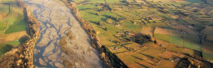
Land resources include the soil’s dynamic physical, chemical and biological ‘systems’, and the land cover, topography and hydrology in which the soil is situated. Land is a vital natural asset that supports a wide variety of resource use and which provides a wide range of ecosystem services, e.g. clean water, fertile soils, and aesthetic, cultural and spiritual benefits upon which New Zealand’s economy, identity and brand are based. Our soil resources alone are estimated to underpin 25% of New Zealand’s GDP.
Protecting our land assets does not automatically imply limiting resource use; rather it focuses on how resources are allocated and managed for primary production, clean water, urban development, conservation, tourism and cultural values. Our land assets also underpin New Zealand’s contributions to global issues (e.g. biodiversity loss, climate change). Effective management requires improved knowledge of their variability and change over time and across catchments and landscapes (natural, managed and urban), the impact of human activities, and potential environmental limits.
Achieving appropriate sustainable management of our land and water resources is a major economic development opportunity for New Zealand.
Impact 1 : The status and trends of land resources and ecosystem services (including their interactions) are known and understood.
|
KP1 |
Progress |
| LCDB (land cover), LUDB (land use), S-map (soil) and ESDB (ecosystem services) components of LRIS (Land Resource Information System) have been enriched and are being used under the New Zealand Government Open Access Licensing framework for web-services. |
|
Impact 2 : Opportunities and threats to land resources are recognised and balanced to maintain or enhance the provision ofecosystem services.
|
KPI 2 |
Progress |
| Regional councils and the irrigation, pastoral, horticultural and arable sectors are using knowledge of soil variability to improve the match between land-use practices and land capability. |
|