Impact 1 - Trends
Measuring GHG emissions
Terrestrial greenhouse gas emissions and removals are understood and quantified so that changes in relation to management strategies, land-use policies and global change can be predicted.
Reassessing Global Warming Potentials
All greenhouse gases contribute to global warming, but they absorb infrared radiation to different degrees and have different longevities in the atmosphere. The relative Global Warming Potentials (GWPs) of different gases are currently calculated in a fairly simplistic way by calculating the radiation absorption of each gas over a specified time horizon, most typically 100 years, but are not explicitly linked to an assessment of ultimate climate-change impacts.
We have developed a new metric, the Climate Change Impact Potential (CCIP) that derives a quantitative assessment of the importance of each gas according to its impact related directly to temperature increases, which related to the rate of warming, and to cumulative warming.
In principle, CCIPs are a better metric than GWPs in accounting for the climate-change impact of different greenhouse gases and the effect of their release or uptake at different times. Compared with GWPs, calculated CCIPs would shift the emphasis from short lived methane (CH4) to long-lived nitrous oxide (N2O). It would have only a small effect on New Zealand’s overall greenhouse gas emissions, just shifting the relative emphasis from CH4 to N2O.
The new approach was well-received when presented at a recent International Energy Agency meeting in Vienna, with participants interested in obtaining details of the methodology and its implications. Improved understanding and metrics for greenhouse gases will provide better estimates of the impact resulting from greenhouse gas emissions, enabling governments to better target mitigation efforts at those gases that would have the greatest effect in reducing ultimate climate change impacts.
This research is part of the Measuring Greenhouse Gases and Carbon Storage portfolio, and is supported by Core funding.
More accurate emission factors
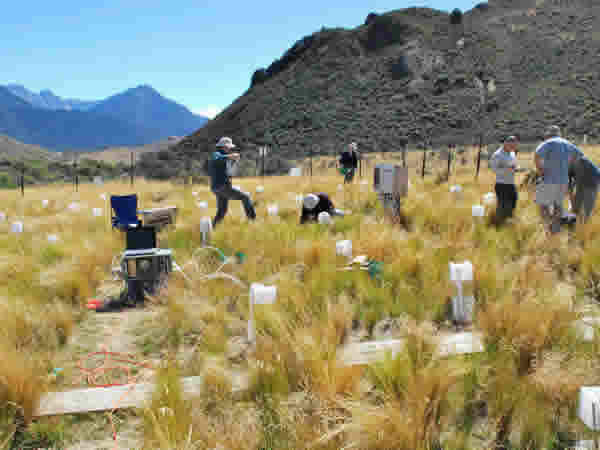
We developed emission factor (EF) look-up tables for calculating the direct nitrous oxide (N2O) emissions from grazed pasture soils in New Zealand. Look-up tables of long-term average direct EFs (and their associated uncertainties) were generated using multiple simulations of a new model over a representative range of major soil, climate and management conditions occurring in New Zealand, using 20 years of climate data. These EFs were then combined with national activity data maps to estimate direct N2O emissions from grazed pasture in New Zealand. This information will be used for modeling the impacts of land use changes and for refining the New Zealand Greenhouse Gas Inventory to be more regionally specific.
Our NZ-DNDC model has been also able to simulate N2O reductions from nitrification inhibitor-treated grazed pasture, showing that the model is able to account for the mitigation technology.
Excreta from livestock are another significant source of N2O emissions. Our previous research in collaboration with AgResearch indicated the currently-used EF could be lowered. Recently we showed that applying this lower EF to beef, deer and sheep farming on rolling and steep slopes could result in ~37% lower N2O emissions than indicated by the current inventory values. If the lower EFs for sheep urine and dung on lower slopes are also included, emissions for hill country could be up to 61% lower than the emissions currently reported in New Zealand’s Greenhouse Gas Inventory.
Ammonia (NH3) volatilisation represents a significant loss of nitrogen from agricultural systems and is a precursor for N2O formation; hence NH3 included in national inventories. In research commissioned by MPI, field measurements of NH3 emissions from cattle excreta in-situ confirmed the New Zealand specific EF (used since 2008) is indeed appropriate.
All these areas of research contribute to improving the accuracy of reporting N2O emissions in the National Inventory and support MPI with policy decisions and international obligations.
This research is part of the Measuring Greenhouse Gases and Carbon Storage portfolio, and was supported by Core funding. MPI and a MPI subcontract through AgResearch, and Ballance Agri-Nutrients.
Land Use and Carbon Analysis System (LUCAS)
We performed the first New Zealand national-scale assessment of the uncertainty associated with plot-based estimates of forest carbon (e.g. error associated with measuring tree heights, diameters, and the models used to scale these individual tree measurements into plot and then national-scale carbon estimates). Above-ground carbon stock estimates were 1.7% higher with error propagation than without, and had 2.7% greater uncertainty. Carbon change estimates were more sensitive to measurement and model uncertainty, with a 39% increase in uncertainty. Our findings show that national-scale plot-based estimates of carbon stock and carbon change are relatively robust to measurement error and model uncertainty but that carbon stock change between two measurement periods needs to be larger than we previously thought in order to detect it.
MfE has commissioned us to run our uncertainty estimation alongside the national calculations of Kyoto Protocol Commitment Period 1 carbon stock change for natural forests.
This meets the recommendations of the UNFCCC Good Practice Guidance and will be the first time this type of uncertainty has been provided in New Zealand reports to the UNFCCC. MfE can have increased confidence that the carbon estimates from the existing LUCAS (Land Use and Carbon Analysis System) plot network have relatively little bias and they know the size of stock change they can confidently detect.
This research is part of both the Measuring Greenhouse Gases and Carbon Storage and Measuring Biodiversity Change portfolios, and was supported by Core funding and MfE.
Innovative new approach to assessing soil carbon
We refined traditional methods of assessing organic carbon stocks in soil and how they vary across a landscape. The project compared two digital soil mapping strategies for a large arable field. The first method used conventional laboratory analysis of soil samples collected from across the field. These point data were combined with electromagnetic survey data to model the field. The second strategy used visible near infra-red spectroscopy (VNIR) to estimate carbon stocks across the same field. VNIR Spectroscopy proved to be very accurate and is potentially a much more cost-efficient approach to mapping the spatial variability of soil carbon as fewer laboratory analyses are required.
This research was part of the Characterising Land Resources portfolio, and was supported by Core funding.
Impact of erosion on soil carbon
Research into the effects of landslide, gully and earthflow erosion on soil carbon stocks found that, while gully erosion has a very minor impact, both landslides and earthflows have significant effects. The loss of carbon due to erosion is large (30 tonnes C/ha) compared with the changes in soil carbon stocks associated with land use change.
This work could benefit the Soil Carbon Monitoring System (CMS), which currently does not account for erosion. Our results highlight the importance of erosion − at least for baseline 1990 soil carbon stocks for New Zealand. It remains to be established whether erosion is significant to post-1990 soil C stock changes.
This research is part of the Realising Land’s Potential portfolio, and was supported by MPI funding.