Database & collections usage
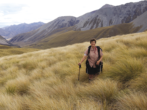
Kerry Ford (author of a Guide to Grasses of New Zealand) in tussock grassland. Image - Ilse Breitwieser
Land and soils databases
These are part of the Characterising Land portfolio, and are supported by Core funding.
Land Resource Information Systems (LRIS)
Provides access to the Land Resource Inventory (NZLRI), the national Soils Database (NSD), S-map, digital elevation models (DEMs)
http://lris.scinfo.org.nz
| 2012 | 2013 | % change | |
| Visits | 12,816 | 17,258 | +35% |
| Page views | 128,956 | 180,245 | +40% |
| Total registered users | 1143 | 1956 | +71% |
| Data downloads | 2976 | 3941 | +32% |
Strong increase in usage for both the Land Resource Information Systems (LRIS) Portal and S-map Online reflect a good match to target audience requirements. LRIS is now being used for data archiving internally by staff and externally by stakeholders (ECan and National Rural Fire Authority), which demonstrates LRIS’ value well beyond its initial purpose as a public data download site.
S-map Online
The new national soils database that provides access to digital soil information, including maps and fact sheets (2012 data covers 11 months only)
http://smap.landcareresearch.co.nz/
| 2012 | 2013 | % change | |
| Visits | 11,061 | 18,845 | +70% |
| Application loads1 | 9254 | 16,129 | +74% |
| Soil factsheets | 10,385 | 20,437 | +97% |
| Point queries | 13,391 | 25,931 | +94% |
| Maps printed | 724 | 1541 | +113% |
1 Each application load equates to clicking the button on the home page to start the mapping software.
Major updates to the functionality of S-map include the way that profile-available-water (PAW) is calculated, and the ability to feed soil data directly into the Farm Dairy Effluent Storage Calculator (an AgResearch product) that depends on soil properties. All S-map factsheets have been updated to include hyperlinks to an extended glossary, which helps users understand the data.
We upgraded the Soils Portal website ensuring users have increased access to soil data assets that are not accessible through S-map Online. Maps and data can be viewed and requested for the New Zealand Soil Classification, the Fundamental Soils Layers, the National Soils database (NSD) sites and Ross Sea Region soil sites. Novel data-visualisation features (e.g. layer transparency, also used in S-map Online) assist map users. The upgrade is an important step in consolidating access to all our soil data assets.
Our Environment
Provides access to a wide range of environmental data.
http://ourenvironment.scinfo.org.nz/
| 2012 | 2013 | 2 | |
| Visits | 4487 | 6226 | 2 |
| Application loads1 | 2633 | 2949 | 2 |
| Point queries | 1280 | 2175 | 2 |
| Maps printed | NA | 844 | 2 |
1 Each application load equates to clicking the button on the home page to start the mapping software.
2 2012 data covers 7 months only so no increase/decrease calculated)
New and updated maps available through Our Environment include the Basic Ecosystems (2008) dataset and National Wetlands (current and historical) dataset.
National Vegetation Survey Databank (NVS)
Includes plot records, maps and photos spanning 50 years
http://nvs.landcareresearch.co.nz
| 2012 | 2013 | % change | |
| Datasets provided on request1 | 1195 | 33622 | + 181% |
1 There were 11,200 page views.
2 38 requests involving 3362 datasets Excludes datasets available online through NVS Express.
In addition, 22 peer-reviewed paper, 8 conference presentations, 3 contract reports and 1 thesis were based on NVS data.
The NVS website was completely redeveloped this year. As well as a fresh new look, several new features have been introduced, such as improved search, new location maps, and the capability to approve data requests and download data online.
Planned strategic investment to digitise paper records (as per the SCI 2012–17) was deferred.
Biological collections and databases
These are part of the Defining Land Biota portfolio, and are supported by Core funding.
Specimens loaned or gifted from Nationally Significant Biological Collections1
| 2012 | 2013 | % change from 2012 | |
| NZ Arthropod Collection (NZAC), including nematodes – specimens | 4785 | 6693 | +40% |
| International Collection of Micro-Organisms from Plants (ICMP) – cultures | 598 | 1289 | +115% |
| NZ Fungal Herbarium (PDD) – specimens | 263 | 599 | +128% |
| Associated database (for PDD and ICMP) – page views | 140,658 | 496,3662 | +253% |
| Allan Herbarium (CHR) – specimens | 4063 | 3734 | -8% |
| Associated databases – page views | 206,812 | 196,855 | -5% |
| NZ flax & living plant collections | 25 | 17 | -32% |
| Ngā Tipu Whakaoranga Ethnobotany Database – page views | 22,640 | 36,529 | +61% |
1 Data are for outward specimens and do not include incoming loans, exchanges or additions to collections.
2 Includes NZFungi and NZFungi2. This huge upsurge reflects the launch of the new NZFungi2 website in April 2012 to increase access to the PDD and ICMP databases; NZFungi2 has significantly increased functionality compared to the old NZFungi pages.
Specimen data are available online through our systematics databases (http://scd.landcareresearch.co.nz/ ), the NZ Virtual Herbarium (www.virtualherbarium.org.nz ), the NZ Organisms Register (www.nzor.org.nz), and the Global Biodiversity Information Facility (www.GBIF.org).
This year, we made some significant additions to the open-access e-Flora web portal (www.nzflora.info), an important resource covering native and naturalised marine and terrestrial plants in New Zealand. The new information includes three genera that are ranked in DOC’s Threatened Plant Classification. New descriptions and distributions of weed species such as Azolla, Equisetum, Marsilea and Salvinia will also be of value to conservation and biosecurity managers. A revision of coastal cresses (Lepidium) recognised 11 new native species; all have high conservation values and are actively managed by DOC.
We also launched two new online interactive botanical keys for the identification of native orchids (a family with probably the highest conservation values of any in New Zealand) and flowering plant genera (the first such key), and an update of the grasses of New Zealand (a difficult group for non-specialists to identify). The keys link to Ngā Tipu o Aotearoa, Landcare Research’s plant names database.
The collections continued to provide identification and information services on request, e.g. the Allan Herbarium provided 1042 identifications and 93 sets of information to DOC, MPI, regional councils, nurseries, researchers and the general public.
Recent developments in invertebrate systematics included progress towards a revision of Noctuidae moths (many native species are threatened or associated with threatened ecosystems; many exotic species are high-risk pests); and new coverage of Carabidae (often used as biological indicators, with about 60% of New Zealand ground beetles being endemic). We also published the first ever identification guide to Ichneumonid parasitoid wasps (one of the largest families of invertebrates in New Zealand). These groups of insects are economically and ecologically important.
NZOR
Landcare Research is custodian of and curates seven ‘Nationally Significant’ biological, soil and natural resource databases and collections – the largest holding for any of the CRIs, and larger than equivalent collections held by museums in New Zealand. The New Zealand Organisms Register (NZOR) is an excellent example of how our informatics capability has significantly increased access to taxonomic data associated with our biological collections plus equivalent data managed by NIWA and Te Papa Tongarewa. NZOR creates one dynamic, freely-available virtual national resource. Data can be directly integrated into biodiversity and biosecurity systems used by central government ministries, departments, and agencies, local government, research institutes, NGOs and the wider community. NZOR aligns with Open Government policies and fits within emerging e-Government initiatives.NZOR is the most complete digital species catalogue of any country, and represents a significant national contribution to global efforts such as the Catalogue of Life, the Global Biodiversity Information Facility (GBIF) and Group on Earth Observations Biodiversity Observation Network (GEO BON), to support evidence-based reporting of the status and trend of biodiversity globally.
NZOR is part of the Defining Land Biota portfolio. Development of NZOR was funded through TFBIS.