S-map data use expanding rapidly
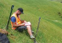
Scott Fraser assessing soils (David Palmer).
Increasing productivity of rural land is a national priority – as is reducing the adverse impacts on freshwater of intensive land use and large-scale irrigation schemes.
Fine-tuning land management to meet both goals requires accurate soil information from S-Map, the digital soil map and information system for New Zealand.
S-map data is delivered via S-map Online, the free access website used by regional councils, farmers and industry consultants. Over the last three years, the number of unique visitors to S-Map Online has increased by 52% p.a.; visits by 77% p.a.; and 100,000 soil fact sheets have been downloaded.
A major development has seen S-map factsheets now include dedicated information for the OVERSEERR Nutrient Budgets tool. A new web data service was launched where data is delivered directly into OVERSEER and other third party systems rather than relying on manual transfer of data from S-map. Computers can now ‘talk’ directly with each other over the web in a common soils-computer language. This initiative is supported by the Regional Council Land Monitoring Forum.