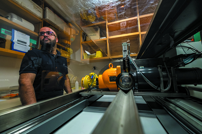
Soil core scanning, national inventory and monitoring
Globally, soil scientists have turned their attention to soil carbon research to investigate how much carbon is contained in soils and how best to retain or increase soil carbon stocks. Any increase is a direct offset to greenhouse gas emissions to the atmosphere and could be accounted for in national accounting and emission trading schemes.

Decreasing soil carbon stocks indicates loss of structural resilience and nutrient retention. Researchers estimate that a 0.4% increase in soil carbon per year would halt the increase in carbon dioxide concentrations in the atmosphere related to human activities. This largely aspirational ‘4 per mille’ (4 per thousand) goal announced at the climate change meeting COP 21, in France in 2015, is incentivising researchers to think widely about methods to increase soil carbon stocks in our managed soils, together with methods to monitor any soil carbon stock changes over time.
Soil carbon stocks can be highly variable from place to place in the landscape, and so their accurate estimation for a target area (e.g. a farm or a country) must take account of this spatial variability to be statistically robust.
Our approach has been to spatially optimise sampling positions, and then use a rapid soil spectral analysis method to measure soil carbon at these sampling positions and provide a mean soil carbon stock estimate. Repeated soil sampling campaigns enable stocks to be monitored over time.
Soil spectrometers have advanced considerably over recent decades. They are now portable, and rapidly collect reflected light at nanometre resolution from a soil surface over a wide range of wavelengths (visible, near infrared, mid infrared), converting it to digital output.
Advanced software packages, with calibration data and algorithms, rapidly convert the digital data from the simple scan of the soil surface to soil carbon content. We have integrated one of these visible near infrared spectrometers with an active gamma attenuation sensor onto an automated platform for soil core scanning. The active gamma attenuation sensor measures the bulk density of the soil, and the spectral data are used with this to estimate volumetric soil carbon content for that soil core.
We are also developing digital soil mapping methods that integrate the soil carbon estimates for each soil core with high-resolution environmental data layers (e.g. elevation, slope, climate, soil), selected because they influence the distribution of soil carbon stocks across landscapes.
Data mining approaches are used to develop a spatial model that best predicts the soil core data at the positions from which it was collected. Once the spatial model has been optimised, it is used to predict a soil carbon map.
Our research team is continuing to develop spectral and spatial prediction models to reduce the uncertainty related to soil carbon stock estimates so that small changes in soil carbon stocks can be verified over future decades.
