Distribution modelling for managing sambar deer in Victoria
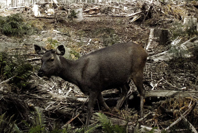
A female sambar deer at a camera-trap during a presence/absence field survey. Image - Department of Sustainability and Environment, Victoria.
Sambar deer were released in the 1860s in Victoria, Australia, and have subsequently spread across much of the State. Such expansion is of concern because of the potentially negative impacts the deer may have on native biodiversity and agriculture. Cost-effective management of sambar deer, as for any exotic species, requires knowledge of their current and potential distributions (i.e. areas of suitable habitat both occupied and unoccupied).
The time and cost to conduct comprehensive surveys of wildlife across large areas such as Victoria (237,629 km2), can be prohibitive. And even if it could be done, how would anyone know if an area was suitable habitat if a species had not yet had a chance to colonise there?
Fortunately, there is a method to predict future population distributions: predictive distribution modelling. The idea is based on the assumption that a species has its own environmental niche, i.e. it will live in areas that meet a certain range of environmental conditions related to biophysical variables such as temperature, rainfall, type of vegetation, and distance to water.
The approach involves developing a statistical model that describes the relationship between site occupancy (the presence or absence of a species at a small number of sampled sites relative to the total possible number of sites) and the biophysical variables at those sites. If these so-called ‘predictor’ variables are available for all sites, then the statistical model can be used to predict the habitat suitability of sites that are not surveyed.
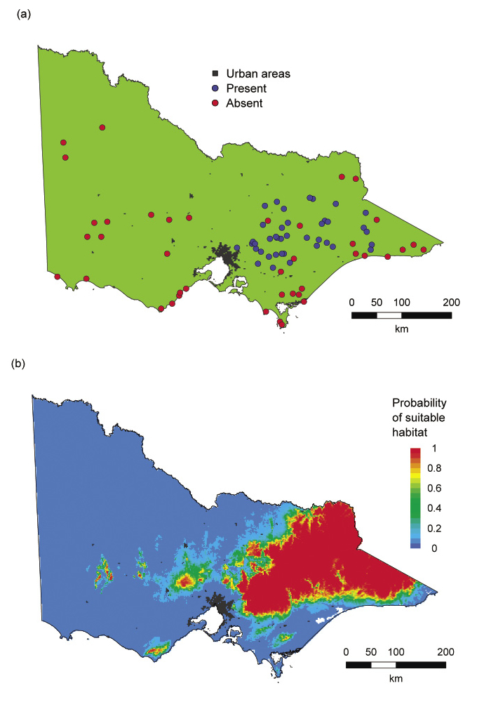
Andrew Gormley, working with Dave Forsyth and others at the Arthur Rylah Institute, Department of Sustainability and Environment (DSE), in Victoria, used this approach to determine the current and potential distributions of sambar deer in the State. For the purpose of their field sampling and modelling, Victoria was divided into a grid of cells of 2×2 km, resulting in 56,764 cells. Fieldwork in 80 cells detected sambar deer in half of them (Fig. 1a). However, although sambar deer are clearly common and widespread in Victoria, they are typically nocturnal and live in dense forest, making them hard to detect. To minimise the chance of missing sambar deer during each survey, three different detection methods were used in each cell:
- Faecal pellet counts (x3) along randomly placed 150-m survey lines
- Sign surveys (x1) involving searches for sambar, their wallows, tree-rubs and tracks, along a 400-m trail or watercourse
- Heat-in-motion remote cameras (x2) left out for 3 weeks at the start and end of the sign-survey trail
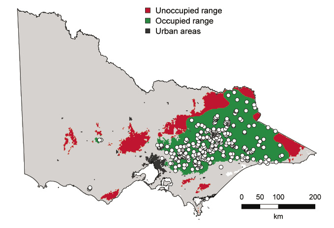
Twelve biophysical variables were potentially useful predictors of sambar deer occupancy. The Victorian State Government’s Geospatial Database Library was used to calculate ‘spatial layers’ for each biophysical variable and hence the variable’s value at every cell across Victoria. Next, statistical modelling determined the relationship between sambar deer and the biophysical variables, and this relationship was ‘projected’ onto every cell to produce a map of habitat suitability for sambar deer in Victoria (Fig. 1b). Finally, the map was partitioned into areas of suitable and unsuitable habitat, with the suitable habitat further divided into occupied and unoccupied range (Fig. 2). The occupied range was estimated as the utilisation distribution calculated from all recorded sightings of sambar deer that have been entered into DSE’s Atlas of Victorian Wildlife. The results indicate that sambar deer presently occupy about 74% of their potential range in Victoria.
The analysis identified several discrete areas of suitable habitat that are currently unoccupied (Fig. 2). Establishing surveillance monitoring in such areas may enable new populations to be quickly detected and appropriate management actions to be implemented.
Predictive distribution modelling is a tool that managers can use to estimate current and potential distributions of invasive species, and can be applied to any plant or animal taxon. It can also be used to better target control and/or containment actions in occupied range and establish surveillance monitoring to detect incursions into unoccupied range. It is inevitable that some areas of unsuitable habitat will be incorrectly deemed as suitable and vice versa. The method attempts to minimise these errors and at the same time provide a practical method for estimating habitat suitability at large spatial scales.
This study was funded by the Department of Sustainability and Environment, Victoria (Land Management Branch), the Department of Primary Industries, Victoria (Invasive Plants and Animals Branch) and Parks Victoria.
Andrew Gormley
Dave Forsyth, Michael Lindeman, David Ramsey, Michael Scroggie and Luke Woodford (Arthur Rylah Institute for Environmental Research, Australia)
Peter Griffioen (Peter Griffioen Consulting, Australia)

Fig. 1. Maps of Victoria (a) showing field-site location, with sambar deer presence (blue) and absence (red) indicated, and (b) habitat suitability for sambar deer.
Fig. 2. Sambar deer range in Victoria: areas deemed to be unsuitable sambar deer habitat are grey, unoccupied range is red, and occupied range is green with circles showing sambar deer locations recorded from the Atlas of Victorian Wildlife.