Detection
Ship detection |
||
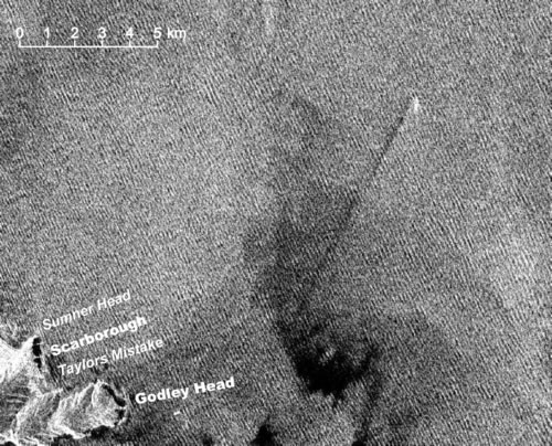 |
Using synthetic aperture radar data (which is available wet or fine, day or night), ship presence, ship size, direction of travel, and an estimate of speed can be made. |
|
Edge detection |
||
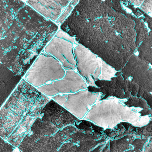 |
Automated detection and extraction of edges, or boundaries, in an image can make map-updating faster and more cost effective. Here, clearfell areas are mapped for exotic forest inventory. |
|
Change detection |
||
 |
 |
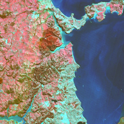
With time-sequential digital imagery, changes in land cover and some land uses are easily detected and quantified. In these two images, construction of the northern extension of the Auckland Motorway is a major feature in the 1999 imagery. So too is urban sprawl. Each image is 20 x 20 km. |
| ©CNES 1988 | ©CNES 1999 | |