Fusing Data to Add Value and Information
Topographic suppression |
||
 |
 |
With the combined inputs of a satellite image and a digital elevation model, an algorithm developed at Landcare Research reduces the effects of the topography, especially slope, aspect, and shadowing. This technique improves the accuracy of land cover classifications. |
| Topographic suppression | SPOT- 4 data © CNES 1996 |
|
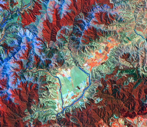
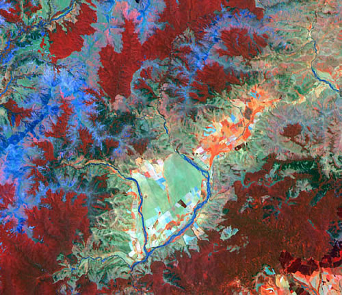
Multitemporal SAR |
||

Radarsat data |
Three Radarsat-1 images of an area in Western Australia taken in July 1998, October 1998 and January 1999 have been carefully aligned with one another. These images, therefore, represent the radar response from the early, middle, and late growing season. The various colours in the image correspond to different agricultural crops in the image. Each crop grows at a different rate to the others and exhibits a different growth pattern. Radar, which responds to the size, orientation, and physical arrangement of a target, is highly sensitive to these changes. Imagery such as this, correctly processed, can be used to classify the image into different crop types. This can be done regardless of the weather or cloud cover, since radar is unaffected by these factors. |
|
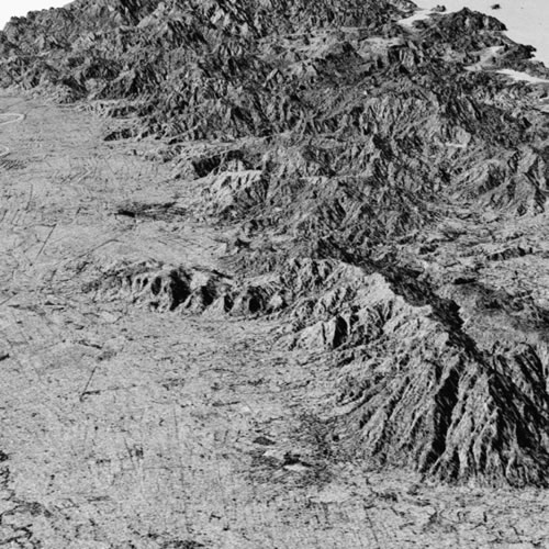
Perspective views |
||
|
JERS-1 SAR. NASDA/MITI retains copyright of data. |
Making a digital elevation model from contours or from a satellite stereopair, draping satellite imagery over this model, and then viewing the resultant image from a specified angle creates a perspective view. These are useful for landscape planning and visualisation. JERS-1 L-band synthetic aperture radar image draped over 20m contours. The view is of southern Coromandel Peninsula looking to the North, with Paeroa and Waihi in the foreground, Whangamata in the background. |
|