Land cover and land use
Land cover databases
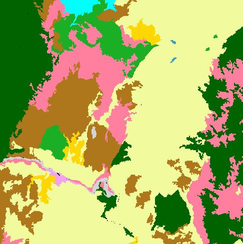
Digital land cover maps of New Zealand are derived from satellite imagery every 5 years. The first land cover database was in 1996-1997; and was followed by LCDB-2 in 2001-2002. Landcare Research is contracted by Ministry for Primary Industries (MPI) to create the next 2 LCDB maps in the series: LCDB-3, derived from SPOT-5 imagery of 2007-2008, was released in 2012, and LCDB-4, derived from SPOT-5 imagery taken in 2012, is due to be released mid-2014.
LUCAS: Land Use and Carbon Analysis System
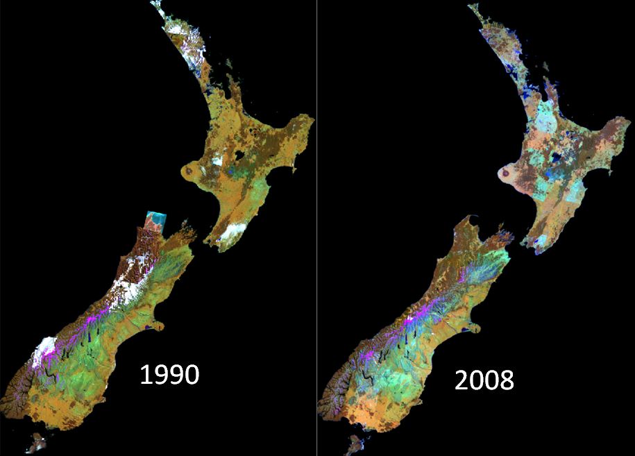
LUCAS is an inventory derived from satellite images used primarily to estimate our greenhouse gas emissions and removals that are attributable to land uses. Landcare Research prepares the LUCAS layers for a Government consortium led by Ministry for the Environment. The key years are 1990 (baseline), 2008, and 2012.
Crop types and timing
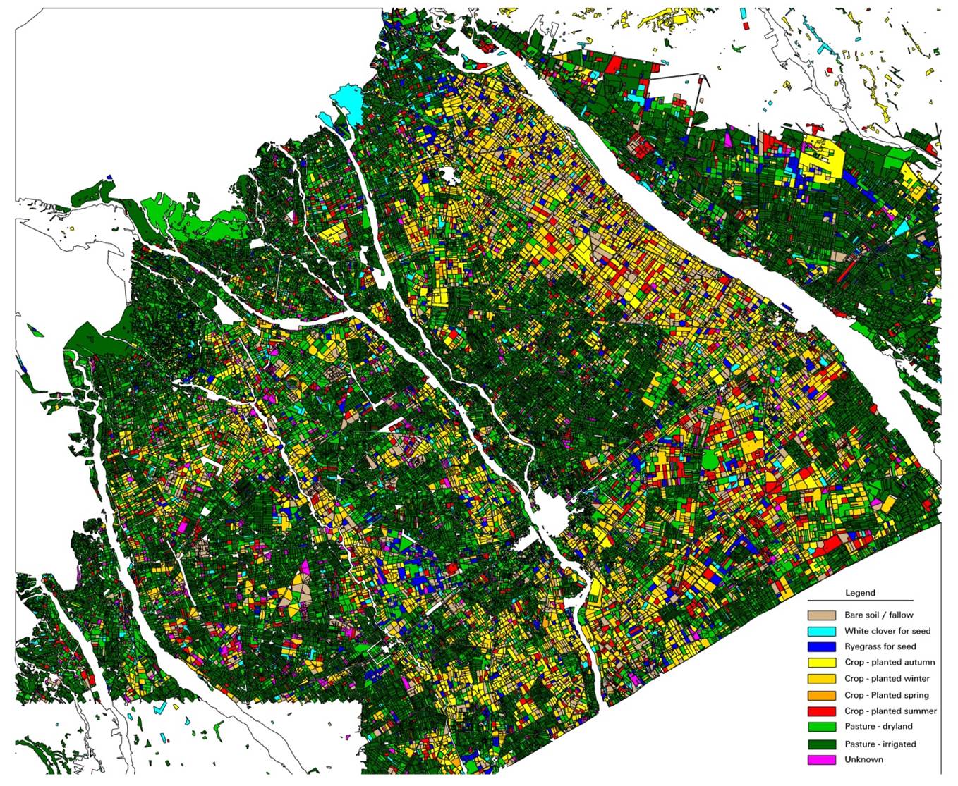 Using time sequences of medium resolution satellite images, Landcare Research can provide land use and crop information on a regional scale. An automated paddock boundary mapping methodology, combined with a series of crop spectral profiles, enables the production of high accuracy information with minimal field work (ground control).