Soil information underpinning critical decision making
The value of accurate and accessible soil information has heightened as the need to manage the impacts of intensive land use on freshwater has become a national priority.
Soils have natural abilities to buffer and filter contaminants. These processes are currently modelled and incorporated within decision support tools such as Overseer, which calculates nutrients flows within a farm.
Landcare Research has continued the development of S-map, our online soils database, to integrate with Overseer, as the latter’s effectiveness is dependent on the quality of soil input data.
S-map is now delivering detailed data on soil variability to support improved use of Overseer by land managers and consultants, and regional councils. We are also working to enable S-map data to stream from an identified area directly into Overseer for analysis.
We are continuing research into the development of new and improved S-map information products to support farm and regional-scale decision-making. We have added soil vulnerability assessments for nitrate and phosphorous contamination and improved prediction of key soil physical properties, including important soil water storage attributes, derived from the National Soils Database.
Smart use of spatial soil information has been previously shown to have a 1:6 cost benefit ratio after the first year, when using the soil map to target mitigation to the high nitrogen-leaching soils of a catchment.
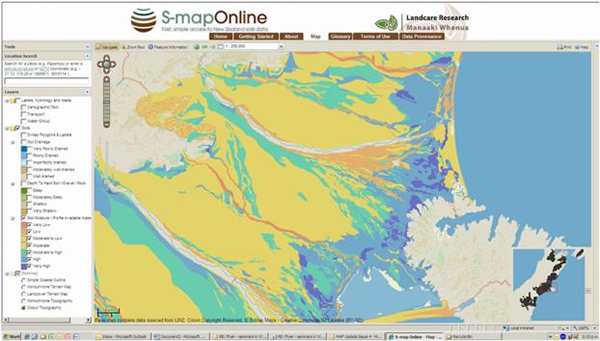
In July 2013 we extended coverage of S-map data in new areas of Gisborne, Waikato, Canterbury, Auckland and West Coast, and this work is continuing. In Hawkes Bay, hill country soil mapping is being based on a 12.5m high resolution digital elevation model built from our analysis of satellite imagery. In the Waikato, an approach is being trialled where soil types and their detailed spatial variability are being captured within detailed ‘windows’ that are representative of land systems. This will provide a reference area for those needing soil data for high resolution soil mapping.
S-map use by land managers and consultants, regional and central government, and scientists is increasing. The S-map Online web service experienced a peak of 2028 visits in the month of April 2013.
Like the users, S-map’s impact is also widely ranging. Amongst the major stakeholders ECan is an exemplar. Their extensive use is due to S-map’s wide coverage in the Canterbury lowlands. For example, the nutrient load zone committees are using S-map data in calculations of estimated nitrogen load in a zone under different Land use scenarios.
“S-map is a vital piece of the puzzle,” says ECan Land Resources Scientist, Zach Hill. “It plays a key role in our efforts to understand the interactions between water, land use, and soil in Canterbury.”
Going forward, with Central Government now investing up to $400M over the next 5 years to help develop new regional irrigation schemes (with a projected return of $4 billion dollars by 2026) enhanced spatial soil knowledge is likely to be in even greater demand.
Key soil properties such as water holding capacity will be critical in driving productivity gains, greater water-use efficiency, as well as reducing nutrient leaching. The value of soil knowledge to New Zealand, even if it drives 10% productivity gains through smart application, could be as significant as $400m per year.