Detecting changes in soil carbon and nitrogen under pastoral land use in New Zealand
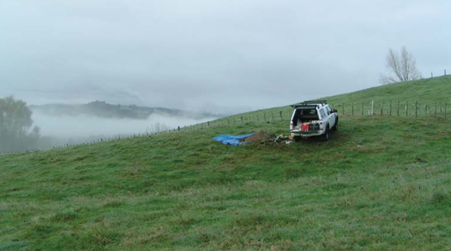
Resampling the National Soils Database (NSD) sites.
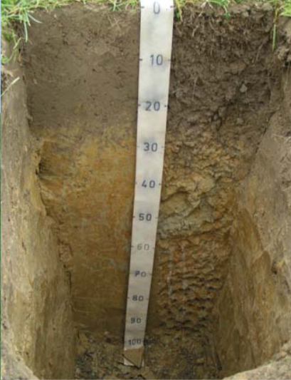
We have revisited and resampled the National Soils Database (NSD) sites to compare changes in soil carbon, nitrogen, phosphorus, and pH since archived samples were collected (dating back to 1960s).
This current MAF funded SLMACC project complements a previous project where 83 profiles were revisited, and is collaborative with the University of Waikato. It is planned to have re-sampled 200+ sites by June 2012. Forty sites between Southland and the Waikato were visited in the last 12 months, which adds to 83 sites re-sampled in the previous 8 years. All sites were originally under pastoral land use and were also under pastoral land use when re-sampled. As it was not always possible to ascertain that the land use had been continuously pastoral, and for the majority of sites, it was assumed that some cultivation had occurred over the 20–30 years between sampling. Sites that showed evidence of cultivation in the previous 12 months were not sampled.
 Sampling of 119 sites provides evidence that soil C and N stocks had changed over an average 28-year time period between sampling, and that there were land-use effects. Flat dairy land lost significant C and N, flat dry stock land remained unchanged, and hill country dry stock land (with no landslides) gained significant C and N (Table 1). There are a number of hypotheses as to the mechanisms of stock changes, but understanding the role that various land management practices play in loss of C from the soil system is likely to be important in managing and enhancing soil storage. The implications that increasing land-use intensity has on C and N stocks and fluxes are fundamental to managing and enhancing soil C and N, but, as land use intensity is not quantitatively defined, it is not possible to assess loss of C directly against land-use intensity. However, environmental data are being collected to help understand land-use activity and, thereby, intensity. Fertiliser and lime use, stock type, grazing management, farm size, history of tenure, and general farm observations such as pasture species and condition, and the relative location of sites on farm are noted where this information is available.
Table 1. Average change in C and N in t/ha/y for 0–30 cm soil; sem in parentheses.
| Land form | Land use | C | N | |
|---|---|---|---|---|
| n | Average | Average | ||
| Flat | Drystock | 54 | –0.04 (0.09) | 0.002 (0.008) |
| Flat | Dairy | 37 | –0.53 (0.14)*** | –0.037 (0.014)* |
| Hill (mid-slope) | Drystock | 16 | 0.48 (0.17)* | 0.062 (0.017)** |
| South Island tussock | Drystock | 12 | 0.00 (0.13) | 0.004 (0.009) |
| ( *, **, and *** - significantly different from 0 at P<0.05, P<0.01, and P<0.001 respectively) | ||||
Data collected in 2010 have continued to support previous findings, although changes under dairy farms are not as large. With 200 points of data representing 11 NZSC Soil Orders (Allophanic, Brown, Gley, Granular, Melanic, Oxidic, Pallic, Pumice, Recent, Semiarid, Ultic) and pastoral land uses ranging from extensively grazed upland tussock to intensively grazed lowland dairy, it is hoped to gain understanding of the factors leading to losses of profile C and N. This will help focus future research into mechanisms that control stocks and fluxes, and may help explain why dairy soils have lost significant C and N over the last 20–30 years.
Scott Fraser & Roger Parfitt