S-map Online: an interactive mapping and query application for New Zealand soils data
S-map is a new digital soil spatial information system for New Zealand created as part of the government-funded SpInfo (Spatial Information) programme run by Landcare Research.
S-map is designed to provide consistent and comprehensive national soil data layers to support applications at local and regional to national scales. It builds on previous soil mapping by filling gaps with new mapping and upgrading the associated soil property information to meet a new national standard. In time S-map will have national coverage and contain predominantly new digital data at a scale that resolves soil variation on hill slopes (nominally 1:50 000 scale). The rate of progress will depend on funding.
S-map Online
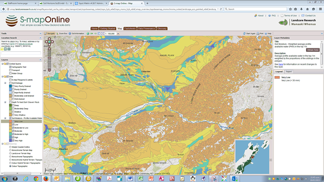
Although S-map coverage is not yet complete, there is sufficient cover that the Informatics team at Landcare Research has developed S-map Online, a web browser service to provide easy access to information on the soils likely to be found at a location of interest (in those areas with available S-map data).
The new S-map Online service has adopted the user-friendly and now familiar “Google Earth” style navigation to make it easy to search, view, and query the S-map data. Using S-map online you can:
- explore interactive soil maps of soil properties such as soil drainage and available water
- learn about the soil in your backyard or paddock
- view detailed information about a soil class or attribute
- create custom PDF soil maps for printing
- for specific locations, download soil factsheets that provide more detailed knowledge of soil properties and information relevant to a variety of potential uses.
Access to the factsheet generator by searching on the regional soil name is still available.
The S-map Online web service has excellent, high-quality base maps, including maps based on LINZ topographic data. These allow you not only to locate an area of interest with a high degree of accuracy but also to provide a geographic context for the soils data.
The Future
S-map is currently being extended in the following areas:
- Environment Waikato territorial area
- Environment Canterbury territorial area
- Soft-rock hill country in the central North Island
- Small windows in Northland, Gisborne, Hawke’s Bay, Manawatu, Wairarapa, Golden Bay, West Coast
There are also plans to develop the S-map Online glossary and factsheets further into a more fully featured knowledge delivery system to explain soils terminology and soil properties so users can develop their soil knowledge and ultimately make better informed and more reliable land-use decisions.
Alongside S-map Online, the Informatics team is launching Our Environment, which will replace the old Geospatial Data integration Portal and give more general browse, map view, and query access to a selection of Landcare Research’s databases. Both S-map Online and Our Environment are built using a new geospatial-portal-software platform for visualising geospatial data and for querying attributes of datasets. Designed and written by the Informatics team and based on open standards and open source software (including PostGIS, MapServer, Geo Tools and Open Layers), the platform will be used to roll out other web applications with rich data visualisations capabilities over the next few years.
James Barringer, David Medyckyj-Scott, Allan Hewitt & Linda Lilburne