Mapping Antarctic soils
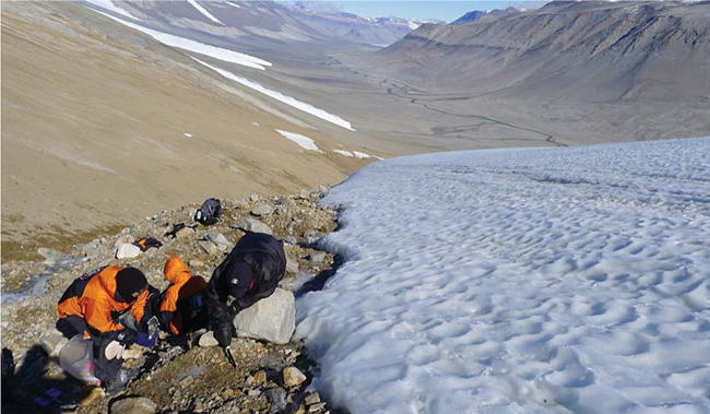
Figure 1. View westwards along Wright Valley from Goodspeed alpine glacier on Christmas Day 2010. Note alpine glaciers on the south wall of the valley and the inland flowing Onyx River in the valley bottom.
The Antarctic environment and its soils are protected by international treaty that gives freedom for scientific investigation and sets stringent standards of environmental protection. This provides a framework for Landcare Research’s involvement in a number of projects, which include our current emphasis on producing soil maps so that any future decisions are well informed.
The total ice-free area of Antarctica is less than 0.4% of the continent, and soils can develop in 90% of these ice-free regions, which occur mainly on the coast, particularly on the Antarctic Peninsula and in the McMurdo Dry Valleys in the Ross Sea Region. An example of a dry valley, the Wright Valley, is shown in Figure 1.
Soil data are deposited in our Antarctic soils database, which is part of the New Zealand National Soils Database (NSD) – a nationally significant database – managed by Landcare Research. The database contains historic data collected by Drs Iain Campbell and Graeme Claridge from the 1950s to the 1990s plus more recent data. Descriptions of over 1000 soil pits are included in the database. For each soil pit, site and soil horizons are described in detail. Site descriptions include observations of the surrounding geological, topographic and climatic contexts, and local surface features, site moisture, parent material, and biology.
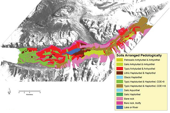
We have been mapping soils in the Ross Sea region using soil landscape models, with fieldwork for validation. Information used includes: soil descriptions; high resolution electronic Light Detection and Ranging (LIDAR) data; high resolution satellite images and stereo air photo pairs to give detailed 3D images of the landscape.Our soil map of the Wright Valley (Figure 2) shows the patterns of soil development.
Our Antarctic soils maps have many applications, including:
- providing a spatial framework for environmental management including impact assessment and reporting
- rating soil vulnerability to human impacts (e.g., foot traffic or hydrocarbon spills)
- aiding selection of sites for experimental work
- assisting with planning for campsites and fieldwork sites that minimise impacts
- defining sites that require further protection.
This research is being conducted collaboratively with Professor James Bockheim (University of Wisconsin, Madison, WI, USA) and Dr Megan Balks (Waikato University).
Malcolm Mcleod