S-map: delivering free online soil map information
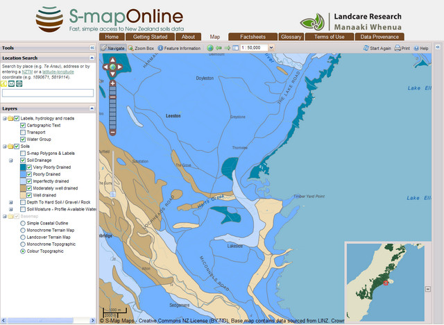
S-Map screenshot
What is the problem?
Soils are inherently variable but existing soil databases are patchy in scale, age and quality. Better knowledge of soil variability is needed to fine-tune management approaches and technologies that maximise plant growth potential, improve water-use efficiency and minimise loss of potential contaminants.
How did we approach resolving the problem?
We created S-map: seamless digital soil map coverage for New Zealand. S-map is designed to be applied at any scale, from farm to region to nation.
S-map helps soil scientists recognise the soil variability that is most significant for water storage, leaching of nutrients, and support of crops, and to express this in the form of a map. S-map is also innovative in its ability to take the raw soil data collected in soil mapping and transform it into the information products needed for land management.
Who has adopted our innovation?
Users of S-map range from farmers and their consultants right through to government agencies responsible for setting water quality targets. S-map provides critical information to enable them to run nutrient management tools such as Overseer, specialist crop calculators such as the wheat calculator and potato calculator, irrigation calculators and the dairy effluent storage calculator.
Accurate soil data inputs provide more accurate management outputs. The S-map database has been developed to deliver soil knowledge in the digital age, with the flexibility to deliver soil information to a multitude of users who have different needs and use a variety of tools.
What impact has this innovation had on adopters?
The dividends of tuning management to soil variability are widely spread. A catchment-scale case study in the Mataura Valley estimated the economic value of tuning nitrogen mitigation practices to stony soils that are a hotspot for leaching nitrogen into groundwater. It showed a cost–benefit ratio of 1:6 in the first year where mitigation practices can be targeted to stony soils under dairy land use. For each kilogram of nitrogen applied, there was a $17 benefit in savings to the farmer, and $25 benefit to the community in reduced leaching of nitrogen to the groundwater.
Knowledge of soil variability is also underpinning the rapid growth in precision irrigation. Understanding the soil variability under a centre pivot irrigator means water can be applied according to the specific soil-water requirements of each soil type. Our case studies show a current return on investment for the farmer of 1–5 years.
Soil information is delivered direct to users’ geographic information systems, or is available on the Web through the user-friendly portal ‘S-map Online’. Future developments will focus on building capability to directly deliver site-specific soil information into users’ models and tools.