New land cover database – how is our landscape changing?

New Zealand’s landscape is changing but understanding exactly how that change is occurring and the intricacies involved are complex.
Land managers need to understand that change to better manage for the future and, in many cases, to meet legal and international requirements.
From satellite images to a digital map…
 We have developed an authoritative record of the state of land changes in New Zealand through development of the Land Cover Database (LCDB), a digital map of the land surface of the country.
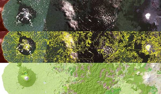
The LCDB is created by grouping together similar classes which can be identified in satellite images and, being digital, it can be used to make a number of different maps. As a map, it can be combined with other geographic information to reveal new information on patterns and trends of land use and land cover. The third version of the Land Cover Database, released in 2013, contains snapshots of land cover at 1996-97 and 2001-02 and 2009 incorporated into the data layer.
LCDB provides the basis for better resource management decisions, more effective use of natural resources and improved environmental management.
The third version was compiled from about 160 satellite images of New Zealand that were captured in the summer of 2008/9.
The database is extensively used by policy makers and land managers in central and regional government for uses such as state of environment monitoring, forest and shrubland inventory, biodiversity assessment, trend analysis and infrastructure planning.
Users can download the database from Landcare Research’s data portal (http://lris.scinfo.org.nz/) and use a GIS (Geographical Information System) to manipulate the data and produce the information they require.
Building on the first two LCDB versions, produced in 2000 and 2004, LCDB v3.0 makes use of improvements in the resolution of satellite imagery, as well as Landcare Research’s advances in image processing technology to provide an accurate record of New Zealand’s land cover at 2008/09.
With just under 450,000 polygons, or delineated areas, the database classifies all land cover under 33 classes at three time steps (the summers of 1996/97, 2000/01 and 2008/09).
Around 65,000 polygons were manually modified in LCDB v3.0 with about 36% of these being real change in land cover between 2000/01 and 2008/09, and the remainder being corrections to previous mapping. A further 200,000+ polygons or polygon parts were modified to smooth boundaries or correct their location.
In addition to the new time period and corrections to the earlier periods, this version has smoothed out the line work from early satellite image classifications and enforced compatibility with the coastline used in New Zealand’s Topo50 map series.
In July 2014 LCDB was further improved with the release of version four (LCDB v4.0).
Key asset for land managers
LCDB is proving to be a popular and valuable asset for land managers throughout New Zealand.
“With the advent of LCDB3, we have adopted LCDB as our primary landcover source. This has worked out very well for us,” says Tim Baigent, formerly with Geographx, a Wellington-based cartography and mapping design company.
“We've been very impressed by the quality of the new data. The attention that has obviously gone into the delineation of classes in a consistent, standard manner across the whole country makes it ideally suited to cartographic presentation among many other purposes.”
Kati Doehring, from the Cawthron Institute has mostly used the LCDB to calculate stream catchment land cover with the main focus on agricultural, urban and native vegetation land use. In particular, she uses it to assess land use modifications along river margins and their entire catchments.
“The projects I use the LCDB for are both research (MBIE) and consulting type based. It is a great resource to have and we greatly value the fact that it is freely available in an easy to use and understand format.”