High country condition
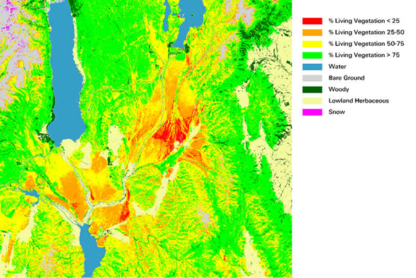
Preliminary map of percentage of living vegetation in the high country areas of the Mackenzie Basin
Being able to make reflectance measurements from space that are only influenced by surface cover expands the potential of remote sensing to monitor the environment. One example is the Fraction of Photosynthetically Active Radiation (FPAR), the amount of energy available for photosynthesis that is absorbed by a vegetated surface. As the Landsat sensor has 3 spectral bands in the photosynthetically active region, it is ideal for measuring the proportion of light reflected (and therefore absorbed) in this region. In general, healthy mature ecosystems evolve to absorb most of the available useful energy, and appear bright in an FPAR image. Urban areas and clouds appear dark, as they reflect a large amount of light. Differences between forested and urban areas illustrate the way in which regular FPAR measurements can be a useful indicator for monitoring ecosystems.