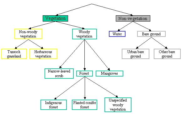
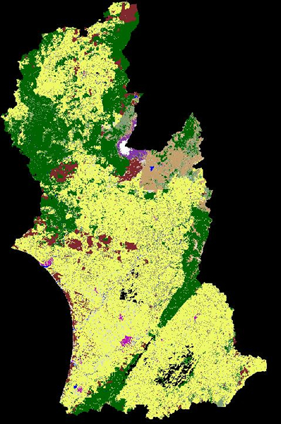
Land cover mapping
Land cover is relatively easy to map automatically from standardised reflectance. This is because standardised reflectance is a property of the land cover alone – the effects of atmosphere, viewing and illumination geometry, and topography have been removed. The old remote sensing concept, that spectral signatures are unique to different land covers, therefore becomes a useful approximation. However, not only are spectral signatures unique, but they may also be defined objectively through spectral reflectance rules. The basic land cover product is based on a hierarchy of binary split rules. Each split is defined by an objective reflectance rule (for example, the rule for water is that the difference in reflectance between bands 2 and 5 is less than 0.02, and the band 5 reflectance is less than 0.12). The resulting map is consequently consistent throughout the region. The map is produced through an automatic process, with the minimum mapping unit equal to the pixel size, i.e. 15 m. This produces a map with sufficient spatial detail to be useful for regional applications.